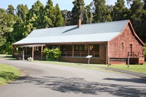
NPS Photo Crater Rim Historic District is an approximately 5,000-acre historic district in and around Kīlauea Caldera in Hawaiʻi Volcanoes National Park. The district is significant for its association with early park planning at Hawaiʻi National Park (HNP), for its association with the Civilian Conservation Corps (CCC) program, and for its distinctive design style, which exemplifies the "Park Service Rustic" style and naturalistic landscape architecture perpetuated by the NPS in the period between the First and Second World Wars. The period of significance spans the years 1916 to 1942, covering the period of primary park development and CCC involvement. Cultural Landscape Inventory Report for the Crater Rim Historic District The Cultural Landscape Inventory report for the Crater Rim Historic District documents the area that encompasses Crater Rim Drive, a 10.6-mile scenic loop road that takes visitors around the caldera rim and onto the caldera floor. The district also includes the road's associated features, parking lots, and overlooks; the buildings and developed areas on the caldera rim, including the Volcano House, Jaggar Museum, and Thurston Lava Tube; and the scenic trails that lie within the district. Crater Rim Drive begins on the high bluff in the northeast corner of the caldera in the headquarters area. The most developed part of the caldera rim, the headquarters area includes the Volcano House hotel, Visitor Center, the Volcano Arts Center housed in the 1877 Volcano House structure, and park offices, residences, and maintenance facilities. From here, the road follows the north bluff of Kīlauea Caldera, past Kīlauea Military Camp and the Jaggar Museum and Volcano Observatory on Uwēkahuna Bluff. The road then descends the bluff through the fractured Southwest Rift Zone onto the floor of the caldera. Here, visitors are given the opportunity to park and view Halemaʻumaʻu, the large crater within the Kīlauea caldera that, up until the 1930s, was quite active. From the Halemaʻumaʻu parking lot, Crater Rim Drive climbs back out of the caldera and past the smaller craters of Keanakākoʻi and Kīlauea Iki, through the tree fern forest, and past Thurston Lava Tube. The loop road rejoins itself in the headquarters area. Along its route, Crater Rim Drive passes through a variety of contrasting natural settings, exhibiting for visitors lush forests of ohia lehua trees and hapuʻu tree ferns, high scrub desert, and barren, smoking lava fields. The sheer cliffs of the caldera and the open vegetation of much of the district offer spectacular views of the volcanic landscape. The boundary of the Crater Rim Historic District includes the caldera and its rim, following the roads, trails, and park boundary that encompass the contributing features. Within this district boundary are at least two other separate and distinct historic districts: the Kīlauea Administration and Employee Housing Historic District and Kīlauea Military Camp. These are individual districts in their own right and are not component landscapes of the Crater Rim Historic District. |
Last updated: November 25, 2019
