Experience the Diversity of the Great Basin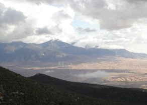
NPS PHOTO Check out the Self Guided Auto Tour "Great Basin Life Zones" on the official NPS app for a journey through the unique ecosystems you'll encounter on the road to 10,000 feet! Driving into the CloudsStarting at the Park boundary on Nevada Highway 488, the Wheeler Peak Scenic Drive takes you on a paved 12 mile, out and back road to an elevation exceeding 10,000 feet above sea level, to the face of Wheeler Peak. Along this 12 mile road, you will gain over 4,000 feet in elevation, and cross through numerous ecological zones, the equivalent of driving from Baker, Nevada, to the frozen Yukon, thousands of miles to the north. As you leave the Great Basin Desert, you will be amazed as to the diversity of life that lives just feet above the barren desert beneath. It is not uncommon to see mule deer, marmots, coyotes, and jackrabbits as you climb along the road.Sagebrush OceansStarting the drive by the Lehman Caves Visitor Center, you are already at an elevation of 7,000 feet above sea level. Here you are driving through a typical Great Basin eco-region that is dominated by the low-lying sagebrush. Look closely, and you will see that it is not one, but multiple different species of sagebrush that cover the flats, all competing for valuable water and nutrients. If you are lucky enough to catch a summer rain shower, you will smell the sage filling the air. 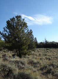
NPS PHOTO Stands of Pinyon PineAs you leave the sagebrush, you will notice some drastic changes as the low shrubs are replaced by taller and taller pine trees. By 8,000 feet, you are passing through a prime example of a pristine Pinyon/Juniper woodland ecological zone. Look closely, and you will see subtle differences between these two common trees. Pinyon pines have sharp, round needles emerging singly from the tree stem, while juniper needles are very short and lay close together, giving the appearance of scales.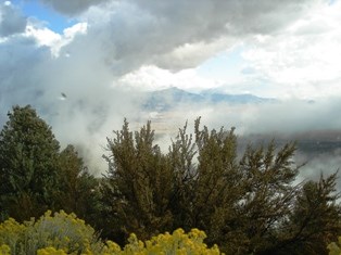
NPS PHOTO Mountain Mahogany WildernessAscending out of the pinyon/juniper ecological zone at around 8,500 feet above sea level, one begins to encounter some scrappy, rough looking trees, known as the Curleaf Mountain Mahogany. Look closely at their leaves, and you will discover small, waxy leaves that curl down at the edges, just as the name suggests. In late summer, you might see branches covered with delicate, fuzzy spirals as the trees prepare to release their seeds. The sign of human impact is noticeable in these parts, as large stands of mountain mahogany were cleared to support the early miners of the area. 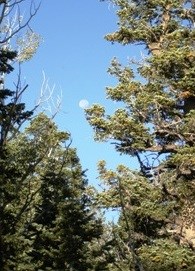
NPS PHOTO Collections of ConifersBy 9,000 feet, you have left the mountain mahogany , and entered a forest of mixed conifers. As you examine the forest, you will see groves of white fir, Douglas fir, and ponderosa pine. Telling these trees apart is as easy as looking at their needles. White fir has flat needles that arch upwards, Douglas fir has drooping branches with three terminal buds at the end, while ponderosa pine is the large tree with reddish bark and long needles. Stick your nose in the cracks in the bark of the ponderosa pine. You will smell a distinct smell that reminds some of vanilla, and others of butterscotch- you decide for yourself!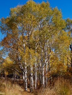
NPS PHOTO Families of AspensBy the 11th mile, you have reached an altitude of 10,000 feet above sea level. Ecologically, you have entered a region more characteristic of a Rocky Mountain alpine forest than that of the Nevada desert. This sub-alpine forest is dominated by the white-barked aspen tree. Surprisingly, each aspen grove you see can be a single, living organism. Aspens reproduce through cloning by sending runners out underground that become new trees. Because of this, it is common that entire hillsides of aspens are all a single, genetically identical tree. By the time you reach the Summit Trailhead, you have completed your journey from the harsh sagebrush flats to the surprisingly lush and diverse sub-alpine forests of the Snake Range. In just 12 miles, you have traveled through the same eco-regions that you would have encountered as if you drove from Baker, Nevada to the frozen Yukon, thousands of miles north. Gateway to the ParkAs you travel along the road, take the time to stop at the many pullouts along the way. These paved parking areas highlight some of the important geological and historical highlights of the Great Basin region. Pullouts provide excellent viewing and photography opportunities for Mount Moriah, Lehman Creek, Wheeler Peak, Doso Doyabi Peak, and the Snake Valley below. Use the Wheeler Peak Scenic drive to access the popular hiking trails to the Alpine Lakes, the bristlecone pine interpretive trail, the Osceola Ditch, and the Wheeler Peak Summit Trailhead. For Your SafetyPlease use caution while driving the Wheeler Peak Scenic Drive. The narrowness of the road, and the danger of wildlife crossings, limits driving speeds to 35 mph. This speed limit is strictly enforced for your safety, the safety of others, and the safety of the wildlife. When descending, use lower gears to avoid excessive wearing of brakes in an effort to maintain a safe speed. Due to the winding nature of the road, it is illegal to pass traffic along the entire road.For your safety, please stop only at pullouts. Vehicles and trailers over 24 feet in length are not permitted beyond the Upper Lehman Creek Campground (mile marker 3). During the winter, this road is impassible, and is closed to vehicle traffic at the Upper Lehman Campground. The road is usually open by Memorial Day weekend. Please refer to Current Conditions for updates. |
Last updated: July 12, 2023
