|
You are viewing ARCHIVED content published online before January 20, 2025.
Please note that this content is NOT UPDATED, and links may not work. For current information,
visit https://www.nps.gov/aboutus/news/index.htm.

NPS Photo
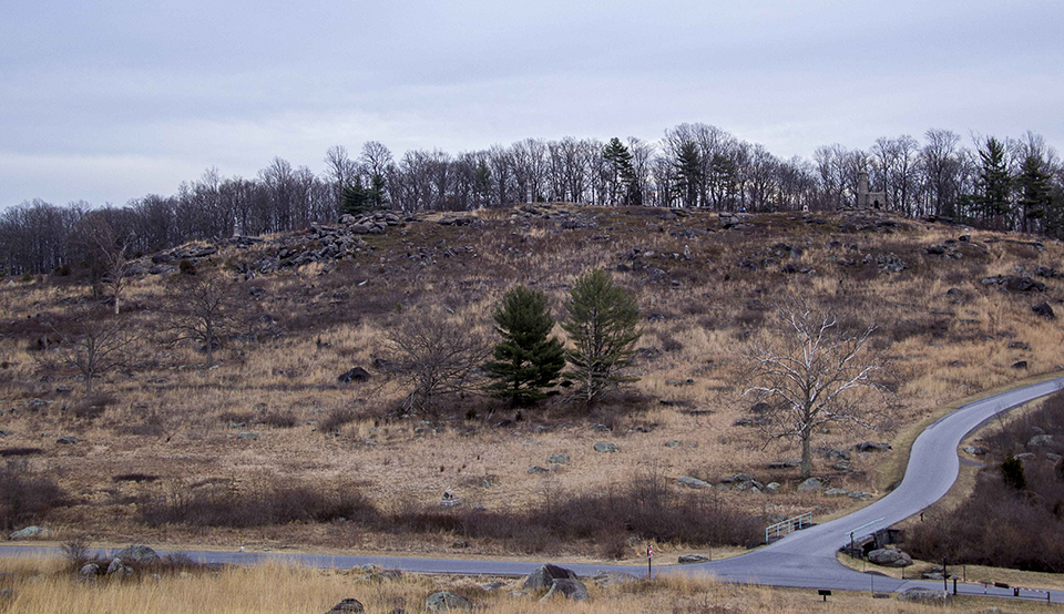
Contact: Katie Lawhon, 717-338-4402 Gettysburg National Military Park is planning a prescribed burn on the 52 acres on the west slope of Little Round Top this spring. National Park Service (NPS) regional fire management specialists will assist the park with the prescribed fire, whose purpose is to help maintain the open fields and meadows of the Gettysburg battlefield by reducing woody vegetation without the use of chemical or labor-intensive mowing or mechanical hand trimming. It will be the park’s fifth prescribed fire since 2013. The actual date of the fire will be announced in a news release but will likely be in April.Before the prescribed fire takes place NPS Archeologist Joel Dukes will be conducting an investigation of the Little Round Top slope. The archeology work will proceed over the next week. The intent of the archeological investigation is to build on previous studies from the western states where the effects of fire on battlefields have been studied. Dukes will use the data that he gathers to provide the park with specific information to identify potential archeological resources that may need to be protected from the impacts from fire. To accomplish the research Dukes has pulled together a small group of experts in battlefield archeology who have volunteered for the battlefield metal detection survey. Many in the research group have been involved in previous NPS battlefield studies that have helped improve understanding--and in some cases have helped rewrite--what we know about those events. For battlefield sites it has been proven that metal detecting is a superior and cost effective method for locating and defining evidence for military action. This is a limited group of selected volunteers. Please note: the public is not permitted to use metal detectors within Gettysburg National Military Park. The NPS team will dutifully catalog and identify each item. Location is critical, so when an item is uncovered it is placed in a protective bag, assigned a unique catalog number, and a small flag is placed where it was located. This process ensures that the artifact's location can be later verified. After the survey, the artifact locations are entered into Geographic Information System (GIS), and a map of the survey site is created. Location is the critical element of battlefield archaeology that enables us to expand our understanding of a battle. When the project is complete and the map is compiled, the distribution of artifacts can show fields of fire, areas of engagement, and unit positions. All artifacts recovered during the project will be analyzed in a lab and returned to Gettysburg National Military Park. Little Round Top is the location of some of the most famous fighting of the Battle of Gettysburg. Rising 164 feet above the Plum Run Valley to the west, Little Round Top became the anchor of the Union’s left flank and a focal point of Confederate attacks on the afternoon of July 2 1863. In addition to the project at Little Round Top, the NPS team will be conducting archeological investigations at George Spangler Farm where the Gettysburg Foundation is planning to re-establish an historic orchard. Spangler Farm was the site of hospital during the battle and the study will ensure that important archeological features are not disturbed by the tree planting. Gettysburg National Military Park preserves, protects and interprets for this and future generations the resources associated with the 1863 Battle of Gettysburg, during the American Civil War, the Soldiers' National Cemetery, and their commemorations. |
Last updated: February 22, 2017
