Walter C. Mendenhall 
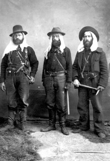
USGS Photo Library During the 1880s and 1890s, the expeditions of the Navy and the Revenue Marine Service, as well as the observations of wandering prospectors, helped to chart the twists and turns of river systems in the Brooks Range. Between the rivers, however, the maps were either largely blank or highly speculative. In 1898, the federal government announced a systematic topographic and geologic survey of Alaska that would include renewed exploration of the Brooks Range. Alfred Hulse Brooks, the new head of the Alaskan branch of the United States Geological Survey (USGS), called the project "far more important than any previously done," due in large part because it "furnished the first clue to the geography and geology of the part of Alaska north of the Yukon Basin." Between 1899 and 1911, six major reconnaissance expeditions traversed the mountain range, mapping its topography and geology and defining the patterns of economic geology so important to prospectors and miners. 
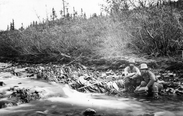
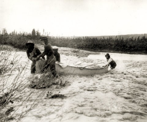
USGS Photo Library The first of these USGS expeditions took place in 1899 when Frank Schrader and Thomas Gerdine led a team of four other geologists up the Chandalar River in canoes, portaged fifteen miles to the Bettles River watershed, and floated the Middle Fork of the Koyukuk. Two years later Schrader and seven others advanced up the John River to Anaktuvuk Pass, crossed through to the North Slope and ran the Anaktuvuk and Colville rivers to the Arctic Coast. Also in 1901, a party led by Walter Mendenhall surveyed the Alatna and Kobuk rivers, portaging their canoes over the long-used Koyukon-Inupiat route from Helpmejack Creek to the upper Kobuk and down to Kotzebue Sound in the Chukchi Sea. And this was just the beginning. After a hiatus of about eight years, the USGS investigators again began crisscrossing the Brooks Range, producing some of the most thorough documentation of the region ever produced. The USGS Bulletins contain accounts of interactions with miners and wonderfully detailed descriptions of mining operations and mineral prospects. It appears the surveyors got on well with the prospectors and miners because the surveyors demonstrated that they could travel light and tough with dog teams, pack horses, and canoes - often for months, through the whole round of seasons. The geologists also shared their scientific observations and maps with the miners, who typically relied on only their personal experiences and hearsay. 
USGS Photo Library By summarizing their knowledge of travel routes and mining prospects in Alaska, the USGS investigators were able to counter some of the inaccurate and crassly promotional gold rush literature that was luring stampeders to disappointment and disaster. In the process, they accomplished truly amazing feats of endurance, poling their canoes up swift rivers and across endless stretches of soft, wet country, hauling bulky survey and photographic gear, enduring mosquitoes and foul weather, and all the while creating detailed maps and finely wrought drawings of geological sections. Their survey network eventually extended from the Yukon River north to the Arctic Ocean, and from the Chandalar River west to Kotzebue Sound. |
Last updated: July 14, 2025
