|
You are viewing ARCHIVED content published online before January 20, 2025.
Please note that this content is NOT UPDATED, and links may not work. For current information,
visit https://www.nps.gov/aboutus/news/index.htm.
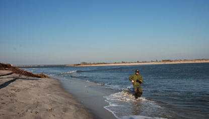
Contact: Paula Valentine, Public Affairs, 631-687-4759 Patchogue, NY - Fire Island National Seashore issued a statement on Saturday regarding the status of the breach on Fire Island at Old Inlet, where water has flowed freely between the ocean and the bay since October 29, 2012 as a result of Hurricane Sandy. "The National Park Service will support the decision of the Breach Contingency Team," stated Superintendent Christopher Soller, "and issue the required permit for filling the breach at Old Inlet, if the breach does not close naturally or if the team determines that mechanical closure is necessary to prevent adverse impacts to communities or resources along the Great South Bay." If the breach appears to be closing on its own, the Seashore will not seek intervention. This is one of three breaches that occurred on the south shore of Long Island during the storm. Within 48 hours of landfall, a 1997 U. S. Army Corps of Engineers (USACE) Breach Contingency Plan (BCP) was put into action to provide quick and coordinated federal and state response to cuts through the island. Environmental compliance for Fire Island National Seashore's portion of this plan had been completed and approved in 1996. Two breaches (one in Cupsogue County Park and one in Smith Point County Park) were mechanically closed soon after the storm, in accordance with the BCP. Because the breach at Old Inlet is located within the federally designated Otis Pike Fire Island High Dune Wilderness, the BCP calls for it to be monitored by a multi-agency team for 45-60 days, to determine if the breach will close naturally or should be filled mechanically. If there is evidence of an increase in tidal ranges within the Great South Bay that can potentially flood communities on the south shore of Long Island or Fire Island, the BCP calls for the breach to be filled. National Park Service staff have been tracking the position of the breach, by walking its east and west shorelines at low tide on at least a weekly basis. Using mapping-grade GPS equipment, we are able to determine the width and length of the channel, and its location. Other federal agencies and cooperators have been measuring the breach's depth, shape and velocity, and the water quality and quantity in the Great South Bay. Based on monitoring results at the end of December 2012, the team decided to continue the monitoring process. Water levels had returned to normal in the vicinity of the breach, the breach channel was fairly stable although somewhat dynamic, its depth was 8 feet or less, and it appeared to be filling by natural processes. Between January and mid-March 2013, when a series of winter storms affected the island, the new inlet migrated to the west and its channel deepened. "While the Old Inlet breach has been in a very dynamic state during the winter," stated Soller, "our scientists expect it to narrow or close over the course of this summer, when Fire Island's beach normally builds up by the seasonal accretion of sand." There is no guarantee that it will close on its own, however, and the only provision of the existing BCP is that any breaches on the south shore of Long Island will be closed. On March 14, 2013, New York State Department of Environmental Conservation (DEC) announced that the State is taking preliminary steps to prepare for the implementation of a closure of the breach. (See: www.dec.ny.gov/press/89723.html) "If the State makes the request to the Army Corps of Engineers to proceed with the process to close the breach," stated Soller, "the NPS will support that decision by issuing the required permit to conduct work on federal land." Barrier islands, like Fire Island, are by nature very dynamic landforms, and storms and breaches are a part of the natural process which helps sustain coastal barrier islands. Addressing the issues and impacts of the breach at Old Inlet is a delicate balancing act. The park is offering a variety of interpretive programs that include walks to the breach and talks about the effects of the storm. |
Last updated: November 20, 2018