NPS Photo This park is more than a vast expanse of sagebrush mesas. A variety of life zones exist throughout the recreation area - from the Gunnison River to the vertical walls of the Upper Black Canyon. Semi-arid ShrublandSome visitors to Curecanti often describe the area as a high mountain desert. With the annual precipitation averaging 12 inches per year, the most accurate classification is semi-arid shrubland. The dominant plant species throughout Curecanti is big sagebrush (Artemisia tridentata), often mixed with a greener shrub called rabbitbrush (Chrysothamnus viscidiflorus). However, a slight difference in elevation, moisture, or soil structure can result in a noticeable difference in the vegetation. Invasive cheatgrass (Bromus tectorum) is overtaking native sagebrush habitat, threatening vulnerable species like the Gunnison Sage-grouse (Centrocercus minimus). 
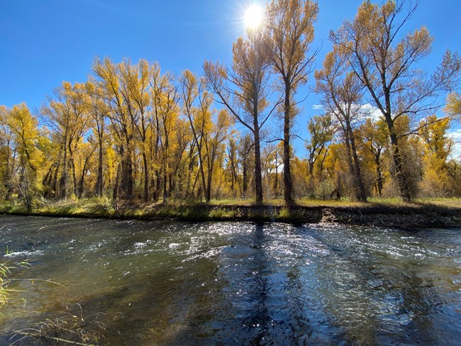
NPS Photo Riparian ZonesIn this moisture rich riparian zone, the narrowleaf cottonwood (Populus angustifolia) plays an important role. Its deep roots help stabilize the riverbank, and its dense canopy provides shade where many other plants can grow. Neversink, located along the Gunnsion River, is a popular place to walk and enjoy the riverside environment. Mule deer (Odocoileus hemionus), great blue heron (Ardea Herodias), and northern river otter (Lontra canadensis) can be seen here. 
NPS Photo/Troy Hunt Canyon WallsBlack Canyon of the Gunnison begins in Curecanti below Blue Mesa Dam. Several overlooks from CO Highway 92 provide views into the canyon. Upon a closer look, some may notice a difference between the canyon walls. The south-facing wall is very steep and sparsely vegetated with sagebrush and juniper trees. The north-facing wall is often thick with Douglas fir (Pseudotsuga menziesii), mountain maple (Acer spicatum), and a dense undergrowth. This difference is due to the amount of sunlight that hits each wall. The combination of increased freeze-thaw erosion and the amount of soil created by it makes for a more hospitable environment on the north-facing wall.
NPS Photo ForestsHeading north towards the West Elk Mountains, the vegetation changes with an increase in elevation. Ponderosa pine (Pinus ponderosa), Douglas fir (Pseudotsuga menziesii), and blue spruce (Picea pungens) trees are present at higher elevations. Intermittent pockets of quaking aspen (Populus tremuloides) can also been seen along CO Highway 92.Although requiring more precipitation than sagebrush, a ponderosa pine forest signifies a dry environment. These trees usually grow in places that receive less than 25 inches (63.5 cm) of precipitation per year. |
Last updated: November 4, 2024
