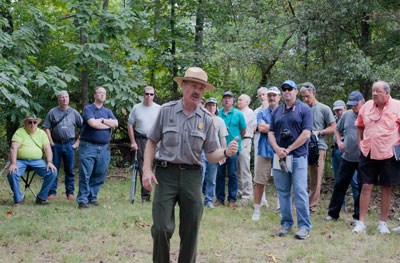
NPS On September 14-15 and 19-20, Park Historian Jim Ogden will lead in-depth hikes and tours examining, in detail, specific actions and locations during the Battle of Chickamauga. These tours typically last approximately 90 minutes and usually involve a mile or more of walking through uneven terrain and across unmowed fields. Please dress appropriately, bring a water bottle, and wear sunscreen and insect repellant. Some visitors bring lightweight folding chairs, but be prepared to carry them for long distances. Saturday, September 14This day's hikes will focus on the events of September 19, 1863. 8 am - Going After a Brigade of the Enemy
John Croxton’s Indianans, Kentuckians, and Ohioans had marched all night. After a short opportunity to make coffee, they march out after a cut off Confederate Brigade. In this 90-minute, mile and a half walk learn how Croxton’s Brigade helped change the course of the battle.
Reports and a quick reconnaissance suggested to Confederate Generals William Walker and St. John Liddell that it was the Federals who had become the aggressors instead of the Confederates. This 90-minute, mile and a half walk will examine Liddell’s effort to fulfill Walker’s order to “retard, if possible, the farther progress of the enemy.”
In late morning, Cheatham’s Division marched north to join a very different battle. The experience of the division’s center brigade, Preston Smith’s, will be the focus of this 90-minute, mile and a half walk.
While the battle rolled southwestward, fighting erupted again in an area that was littered with the carnage of war from some of first fighting of the day. This 90-minute, mile and a half walk will address Liddell’s Division’s afternoon fighting with Baldwin’s and Willich’s Brigades in the Winfrey Field area. 7 pm - The Night Fight’s Right
As sunset passed on September 19, Patrick Cleburne’s fresh Confederate division was sent forward to drive back the enemy’s left wing. This 90-minute twilight into night mile and a half walk will look at the right of the action that participants found to be visually some of the most spectacular of the increasingly bloody battle. Sunday, September 15This day’s hikes will focus on events of September 20, 1863. 8 am - Thomas & Rosecrans Position the Left
While seemingly some of Bragg’s subordinates did not know that the Confederates were trying to turn Union left, Union Generals William Rosecrans and George Thomas did! This 90-minute, mile and a half walk will examine Rosecrans’ and Thomas’ efforts to, as Thomas said, “strengthen the left.”
This 90-minute, mile and a half walk will focus on the experience of the right half of the left brigade of Breckinridge’s Division, Ben Hardin Helm’s Kentucky “Orphan” Brigade.
Marching left to support Reynolds he’s then told to march right to support Brannan. Those seemingly contradictory directives brought Charles Harker and his brigade to fight in the north end of Dyer Field, the subject of this 90-minute, mile and a half walk.
They seemingly point in odd directions but those cannon behind the Visitor Center represent a usually overlooked latter, even near final, stage of the battle. This 90-minute, one mile walk will examine the fifth engagement in the battle of a Confederate division, Liddell’s, that had helped open the battle two days before. Thursday, September 19Follow the “Historian Hike” signs from the Chickamauga Battlefield Visitor Center to the designated starting point for that hike. 8 am - Forrest Develops the Enemy
A brief pre-dawn skirmish in the woods over which Forrest had swept the afternoon before, and Forrest’s own nature, helped dramatically shift events then beginning to unfold in the valley of the River of Death. This 90-minute, mile and a half walk will examine the directive to Forrest on the morning of September 19 to “develop the enemy.”
As sunset passed on September 19, Patrick Cleburne’s fresh Confederate division was sent forward to drive back the enemy’s left wing. This 90-minute twilight into night mile and a half walk will look at the left of the action that participants found to be visually some of the most spectacular of the increasingly bloody battle. Friday, September 20Follow the “Historian Hike” signs from the Chickamauga Battlefield Visitor Center to the designated starting point for that hike. 3:30 pm - Harker’s Fight on the Open Spur
Forced to withdraw from his fight in Dyer Field, Charles Harker retired his brigade “by battalions, to the crest of a hill” and resumed the fight. This 90-minute, mile and a half walk will examine the fight of Harker’s Ohioans and Kentuckians on the open spur east of the Snodgrass farmstead. |
Last updated: August 10, 2024
