|
National park lands are not free. Protecting our natural and cultural heritage and providing a safe, enjoyable, and educational place to visit requires substantial funding. Although your taxes help offset the costs of operating parks like Chattahoochee River National Recreation Area, they do not cover all of the costs. As expenses to maintain and staff the parks rise each year, government funding is unable to keep up. The Recreational Fee Demonstration Program (Fee Demo) was instituted in 1997 and ended on December 31 2004. This “demonstration” program authorized 100% of the revenue generated by charging fees to be returned to the National Park Service, with 80% remaining at the site where it is collected and 20% to be used Servicewide at the Director's discretion. In 2005 the Federal Lands Recreation Enhancement Act replaced the Fee Demo program and is the Congressional authority that is currently used by the National Park Service to collect fees. As a part of the Fee Demo program Chattahoochee River National Recreation Area collected a daily or annual parking fee from visitors. In 2005, with the new Act, the park changed to collecting an entrance fee instead of a parking fee. This change allowed visitors to use their "America the Beautiful" pass. This change also allows all fees collected in the park to be spent in the park. The funds are used to accomplish projects that the park has been unable to fund through yearly Congressional allocations. 
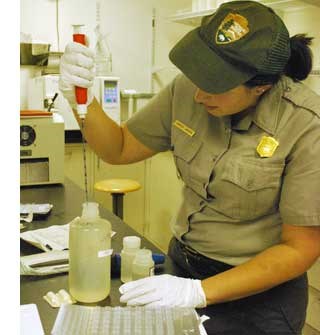
NPS BacteriAlert ProgramToday many visitors rely on a convenient web-based reporting system to check bacteria levels in the Chattahoochee River before they go on the river. This system, called "BacteriAlert," came from your fees. The BacteriAlert monitoring program is a partnership between the National Park Service, the United States Geological Survey, the Chattahoochee Riverkeeper, the Cobb County-Marietta Water Authority, and the Cobb County Water System. The program continues to be partially funded with dollars from the Chattahoochee River National Recreation Area fee program. This program now provides real-time estimates of harmful bacteria such as e. coli in the Chattahoochee River and posts results to the internet at https://ga2.er.usgs.gov/bacteria/. The program also provides actual bacteria colony counts once a week. 
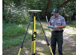
NPS Boundary SurveyingIn 1978, the National Park Service acquired 48 miles of the Chattahoochee River, along with about 6,000 acres of land including such areas as the Palisades, Cochran Shoals, and Bowman's Island. The boundaries of this newly acquired property were approximately 200 miles long. Although they were described in the park's organic act, they were not surveyed on the ground. CRNRA uses fee money to pay a professionally certified surveyor and a team of engineering students to to out and survey the park's boundaries on an everyday basis. This work is critical for protecting the park's natural and historic resources from encroachment and damage by neighboring land owners. In addition to surveying the park's 200-mile perimeter boundary, the survey team is also locating the boundaries of several large easements that pass through park property, such as the large Colonial Pipeline easement on the Cochran Shoals fitness loop trail. 
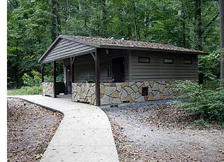
Restroom ReplacementDateline: Chattahoochee River, October 4, 2007 Thanks to your entrance fees, that old restroom facility at the middle of the fitness loop trail at the Cochran Shoals unit has now been replaced by two new facilities, one at the Interstate North parking lot and the other at the Columns Drive parking lot. The new units were built after the flood of 2009. The park has five other restrooms at various units such as Jones Bridge and Akers Mill (Sandy Point) starting to show their age. Rehabilitating these existing facilities will be done using fee money. Fee money will also pay for installing long-overdue restrooms at parking areas that have never had them, such as Sope Creek. 
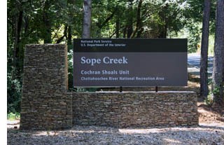
NPS Sign ReplacementToday as you drive down Paper Mill Road you see a new sign sitting atop a stone base with a NPS arrowhead. You may recognize the design from parks you visited last summer on your tour of the national parks out west. Thanks to your entrance fees, we are now able to install new entrance signs. These are perhaps the most important of all park signs. They welcome you as you arrive, providing a gateway that marks the beginning of your park experience. They tell you that you are now in a special place. The consistent appearance of entrance signs throughout the national park system ensures that you understand that CRNRA is one of over 400 places managed by the National Park Service. Once you enter the park, the traffic signs look just like the ones you see in your normal driving routine. However, all other park regulatory and informational signs have a distinctive brown background. Park Entrance SignsMany of the Park Entrance signs were in poor shape due to graffiti, outdated information, faded paint, or delamination. Some were just missing. With the issuance of new NPS sign standards, it was decided to use entrance fee monies to purchase and install new entrance signs at all park entrances. Park Roadway SignsJust like the entrance signs, the signs along the park roads showed their age. In 2013 the park began a program of replacing signs in the park with your entrance fee monies. The regulatory and warning signs were replaced following new Federal Highway Administration (FHA) guidelines. All signs in the park will now incorporate reflective materials to provide for a safer visit. Informational signs with the distinctive brown background were replaced, and in some instances signs were installed in new locations. |
Last updated: September 22, 2022
