



News Release
News Release Date: February 24, 2026
Contact:
National Wildfire PIO, 239-673-2746
Smoke from the National Wildfire is currently impacting several major roadways, including:
- Interstate 75 (Alligator Alley)
- State Road 29
- U.S. Route 41 (Tamiami Trail)
Public Safety Advisory
Motorists traveling through the area are urged to:
- Exercise extreme caution.
- Reduce speed and use low-beam headlights in smoky conditions.
- Allow extra travel time.
- Be alert for emergency personnel and equipment operating along roadways.
- Monitor local traffic updates and emergency alerts.
Firefighting Operations
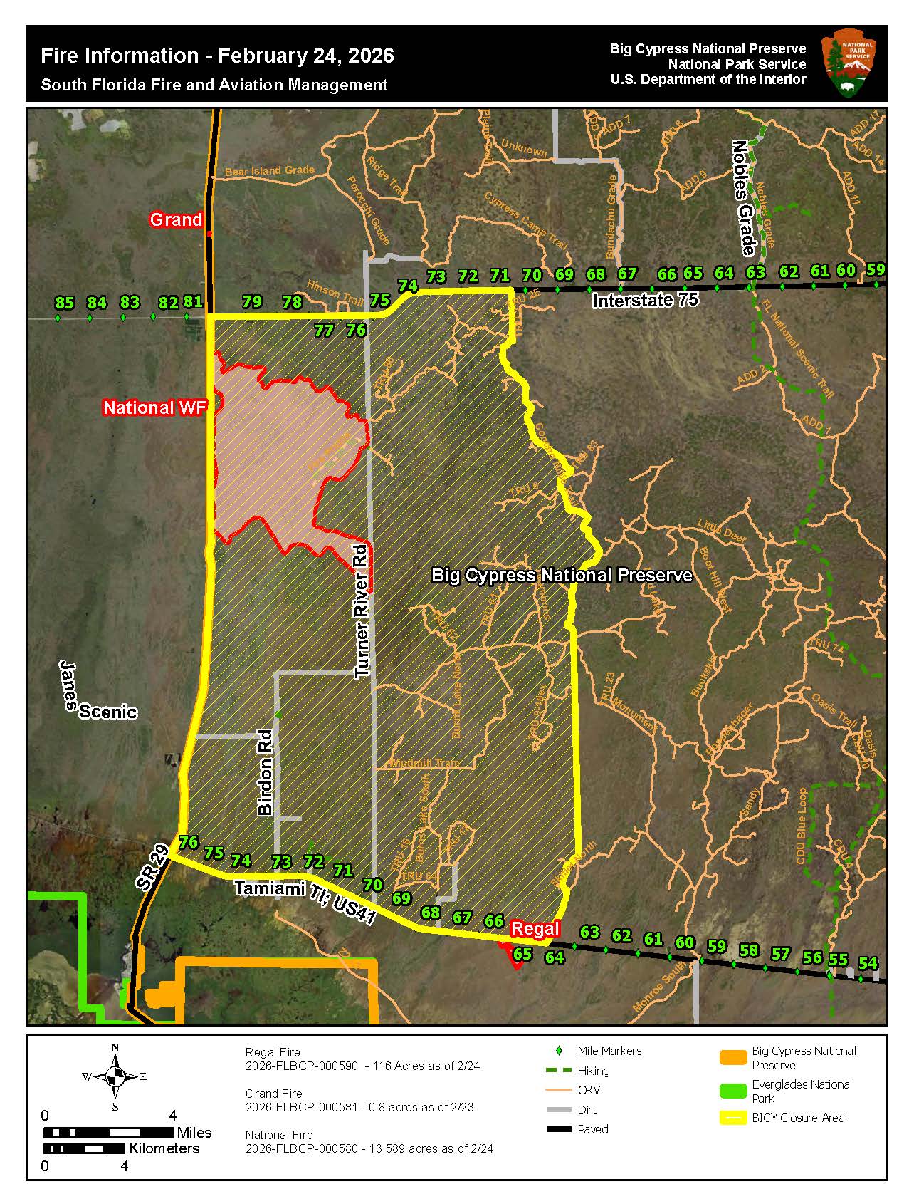
Firefighters on the National Wildfire have continued suppression efforts throughout the day and are actively working to establish and reinforce a containment perimeter defined by:
- South of I-75
- East of SR 29
- North of Lower and Upper Wagon Wheel
- West of Turner River Road
Fire crews remain engaged in coordinated suppression and containment efforts and will continue monitoring conditions closely, especially in anticipation of shifting winds.
The National Fire is approximately 15,000 acres and 0% contained.
Stay Informed
Area closures are in place to ensure firefighter and public safety. Monitor updates via Big Cypress National Preserve web alerts at Alerts & Conditions - Big Cypress National Preserve (U.S. National Park Service) - and local media.
Last updated: February 24, 2026