



News Release
News Release Date: February 26, 2026
Contact:
National Fire Information, 239-673-2746
During a wildfire, area closures may become necessary due to active fire behavior, shifting winds, and reduced visibility from heavy smoke, all of which can create hazardous and rapidly changing conditions. As fire intensity increases, burning debris, falling trees, and limited escape routes pose significant risks to visitors and firefighters alike. Temporary closures allow crews to conduct suppression operations—including defensive firing and aviation support—without interference, while also ensuring public safety. These measures are implemented only when needed and help reduce the likelihood of injuries, vehicle accidents, and additional fire starts in already impacted areas.
As conditions improve, and when fire managers deem areas safe for reentry, the closure may be reduced or terminated.
For the most up to date information please visit:Alerts & Conditions - Big Cypress National Preserve (U.S. National Park Service)
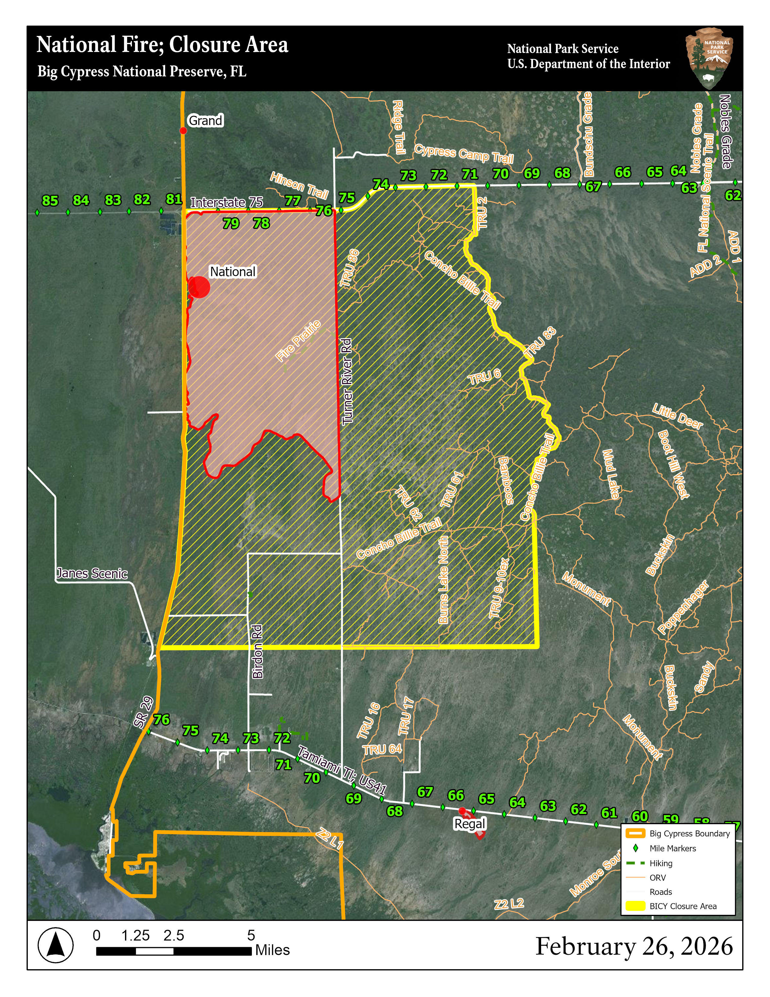
Please refer to the provided map and area description below, temporary closures include the following areas:
- All areas within the perimeter of the closure and perimeter trails within the preserve (*see map)
- South of Interstate 75 (Alligator Alley)
- East of State Road 29
- North of Windmill Tram Road (*see map)
- Private lands in the designated area; residents should use caution and notify the Fire Duty Officer of entry by calling 561-923-5228.
Last updated: February 26, 2026