Article

Wayfinding at Telaquana Corridor
Wayfinding is defined as signs, maps and other graphic or audible methods used to convey location and directions to travelers.

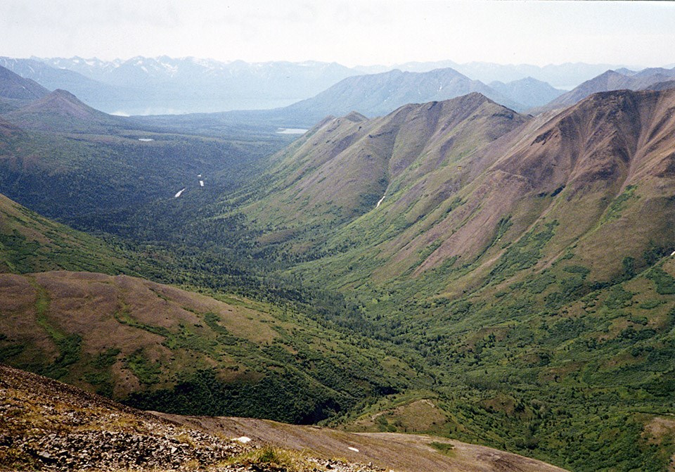
Dramatic chasm is the gateway to Telaquana country, known as S.O.B. Canyon
The area just northwest of Kijik and Lake Clark, affectionately known as S.O.B. Canyon, is the gateway to Telquana country.

NPS Photo

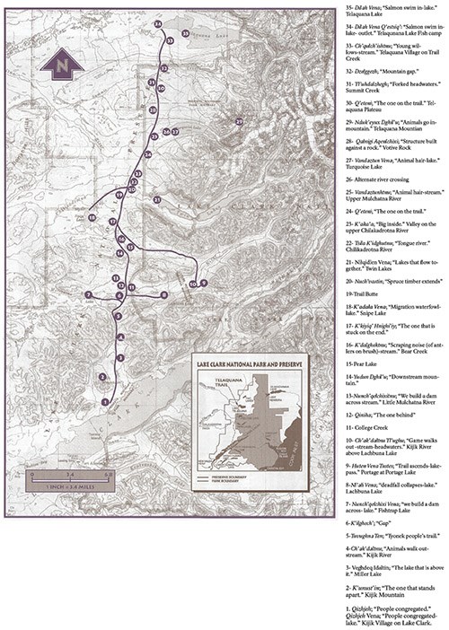
The Telaquana Corridor is located in Lake Clark National Park and Preserve. The corridor originates at Lake Clark and terminates at Telaquana Lake, roughly 50 miles away. The Telaquana Corridor is not a defined trail, but has been used for centuries by the Dena’ina and others to access interior Alaska.
Map of sites along the Telequana Corridor with a key of Native place names and English translations
Oral stories passed down through generations of Inland Dena’ina served as cognitive map. The Inland Dena’ina tell a sukdu (traditional story) called Ch’iduchuq’a about the releasing of the animals from inside Nduk’eyux Dghil’u (Telaquana Mountain) for the people to hunt. Since the Dena’ina survived through subsistence, they continued to live off the animals “released from the mountain.”

It was believed that the Dena’ina moved into the Lake Clark area around 1600 AD, but recent carbon dating suggests they were in the area around 1000 AD. The Alaska Range and surrounding area (Htsaynenq’) is the heartland of the Dena’ina people. Their lifestyle was transient in nature, and they were known to be skilled hikers.

The Dena’ina would move with the seasons following the availability of resources. Though permanent villages were not established, family units would return to the same areas year after year for the resources. Oral stories and songs allowed the Dena’ina to find their way within the corridor and navigate between gathering places. The corridor provided access to salmon and large game, and served as a trade route to other Dena’ina further into the interior.
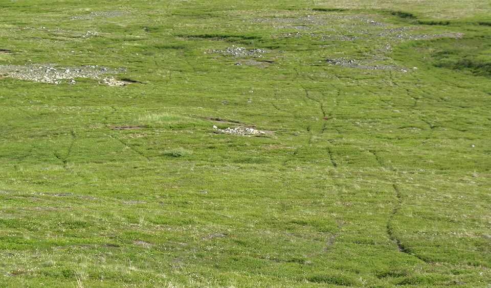
Pathways through low green grass indicates caribou trails
Caribou trails through the high plateau.

NPS Photo

Russians arrived in the area sometime around 1788 and 1789. The first Russians scouted the Lake Iliamana region and were more than likely lead through the Telaquana Corridor by Dena’ina. Russian influence began to have a large effect on the region when Russian priests arrived. The next European Americans to venture into the region were gold seekers, who profited little; however, some choose to stay and live a subsistence life and trade furs. The exposure to different cultures lead the Dena’ina to live a more domestic lifestyle. Today, the corridor is used by ancestors of the original Dena’ina users, hikers, and sportsman.
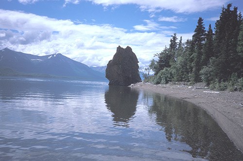
A rock bulges at the end of a gently curving lakeshore
Hnitsanghi’iy (Priest Rock)

NPS Photo

The practice of wayfinding allows travelers to traverse through unmarked terrain without the use of a physical map. By identifying unique natural markers along the route, one can navigate to the next marker. The Athabascan language denotes direction, distances, and location through the use of prefix and suffix attached to words. By using this method to name places and natural features, the Inland Dena’ina were able to incorporate them into songs and stories that served as guidance in the Telaquana Corridor. Some of the native place names include Hnitsanghi’iy (Priest Rock), Veghdeq Dgilenka’a (Miller Lake), Yudun Dghil’u (downstream mountains), and Satal’iy (one that is leaning).

For More:

  • Telaquana Trail - Lake Clark National Park and Preserve website
  • Project Jukebox - This University of Alaska Fairbanks project has recorded elders describing parts of the Corridor

Lake Clark National Park & Preserve

Last updated: March 12, 2019