Last updated: September 2, 2019
Article
Water Quality and Flow Monitoring in the Yellowstone, Lamar, and Madison Rivers
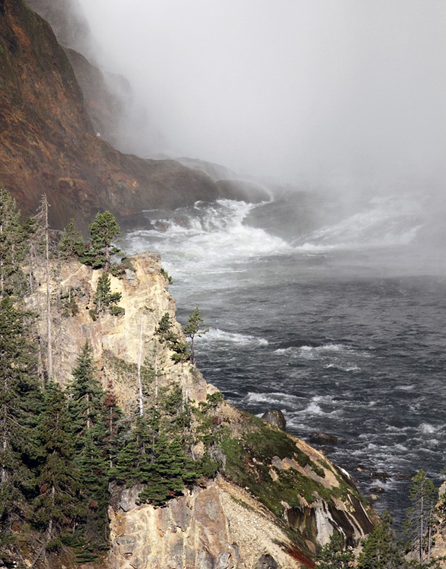
NPS/Jim Peaco
Overview
Yellowstone National Park contains a diversity of near-pristine surface water features, including over 600 lakes and ponds, 2,500 miles of streams and rivers, and seasonal wetlands. The park's iconic waters provide recreational opportunities, plant and wildlife habitat, and scenic vistas. While these water resources are largely unimpaired and of high quality, water chemistry in the park is nearly as varied as the geologic terrain. Water quality is affected by numerous human and natural influences, including geothermal inputs and water from mountain snowpacks.
While park waters are protected, there are several potential human threats, including high visitation, sewage treatment discharges, and dated infrastructure and utility systems. Park waters are also threatened by various symptoms of the changing climate, including changes in the hydrologic cycle resulting from less precipitation as snow and earlier snowmelt. Documented low-flow conditions and elevated air temperatures in the park also influence water temperatures. This in turn may influence visitor experiences in the park. For example, the park may issue seasonal fishing closures to protect fish populations when water levels are low and water temperatures are high. Air and water temperature increases may trigger additional ecological changes, including shifting biological communities and increasing threats from invasive or nuisance aquatic species.
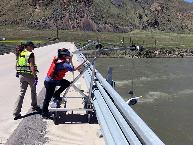
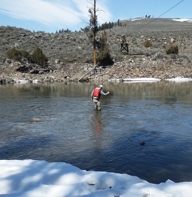
The National Park Service Greater Yellowstone Inventory & Monitoring Network monitors water quality and flow in the Yellowstone, Lamar, and Madison rivers as an early warning of undesirable changes and to track long-term trends in these special aquatic systems.
NPS
What We Monitor
Because of its importance to the park and surrounding communities, water has been monitored in Yellowstone National Park for over a century. Flow monitoring records began in 1889 at the Yellowstone River, 1923 at the Lamar River, and 1913 at the Madison River. These long-term records provide unique opportunities to examine how flows in the region may be responding to documented changes in air temperatures and snowpacks.
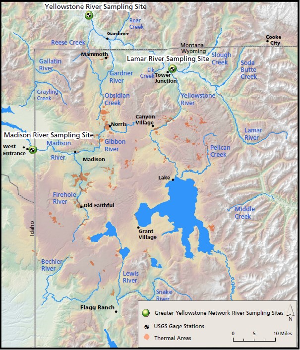
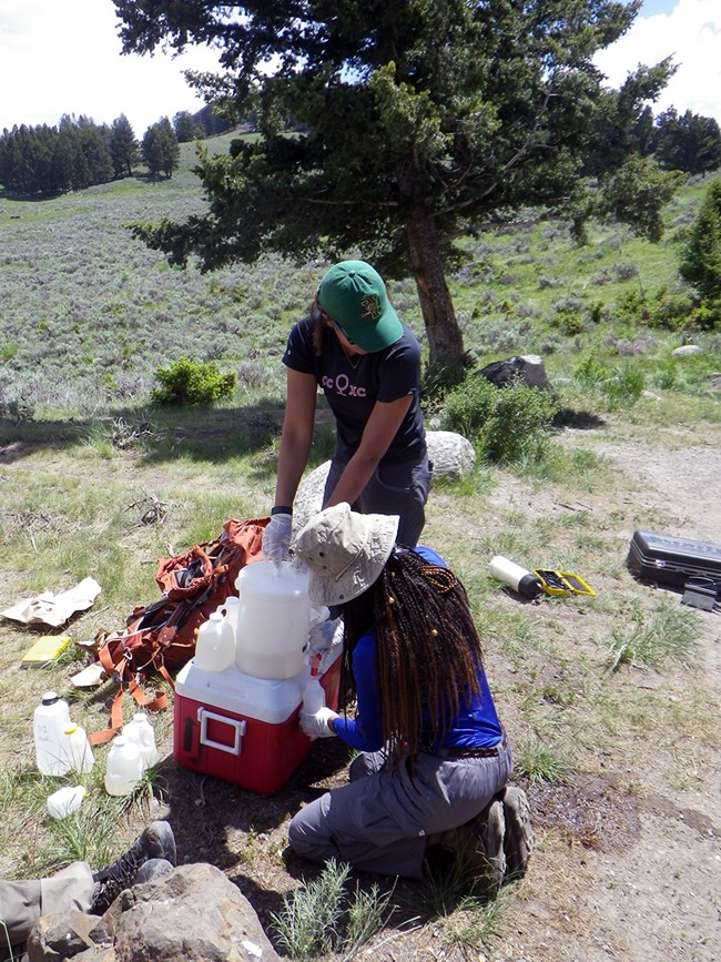
We monitor water quality and river flow at sites in the Yellowstone, Lamar, and Madison rivers. Daily flow measurements are recorded from U.S. Geological Survey streamflow gages that are co-located with monitoring sites. Between April and November each year, we measure core water quality parameters, including dissolved oxygen (how much oxygen a river has), pH (how acidic or alkaline the water is), water temperature, and conductance (a useful measure of its total dissolved compounds). We also collect water from across the entire width of the river and at multiple depths that is tested for various chemical and metal components in commercial laboratories. Local climate stations provide air temperature and precipitation information.
NPS
The Rivers
Yellowstone River
The Yellowstone River is the longest (671 miles) undammed river in the lower 48 states. It begins on Younts Peak, WY, flows northwest through Yellowstone Lake, and exits the park near Gardiner, MT.
Lamar River
The Lamar River flows northwest from the Absaroka Range to join the Yellowstone River just below the Grand Canyon of the Yellowstone. Much of the Lamar River watershed is protected within the boundaries of Yellowstone National Park.
Madison River
Many of the park's geyser basins drain into the Firehole River, which joins the Gibbon River to form the Madison River. The Madison River is characteristic of a groundwater influenced system, as opposed to snowmelt driven systems like the Yellowstone and Lamar rivers.

NPS

NPS
2016 Results
Climate
The 2016 average annual minimum and maximum air temperatures at the Yellowstone River were 2°C above the historical average (30 years of records). Average annual minimum and maximum air temperatures were 2°C and 0.5°C above average at the Lamar River and 1.2°C and 1°C above average at the Madison River. At all three sites, December 2016 was one of the colder Decembers in the historical record.
Total 2016 pecipitation was similar to the 30-year average at all three rivers. A large amount of precipitation fell in October, and it fell as rain instead of snow, which led to significant runoff in October and November and contributed to annually high flows in the Madison River.
NPS
Water Quality
Not unexpectedly, water quality is high in the Yellowstone, Lamar, and Madison rivers because watersheds for these rivers are largely undeveloped. The greatest variability in water quality occurred during high flows. Dissolved nutrients were low at all three rivers. Specifically, nitrogen and phosphorus levels were low and ammonia as nitrogen (NH3 as N), nitrate + nitrite as nitrogen (NO3+NO2 as N), and ortho-phosphorus (ortho-P) were mostly below laboratory detection levels in 2016. While some nutrients are essential in aquatic systems, high concentrations of nutrients can degrade water quality and potentially threaten some aquatic species.
Trace metals (such as arsenic, zinc, mercury, lead) have been detected in the waters of Yellowstone National Park and are often naturally present at measurable concentrations. Most measured metals occur below the state standards for aquatic life (below levels that are detrimental to aquatic species). Total arsenic levels in the Yellowstone and Lamar rivers did not exceed the Montana or Wyoming standards, but arsenic levels in the Madison River did exceed state standards during all sampling events in 2016. Surface water and groundwater contributing to the Madison River inside the park boundary are influenced by geothermal features such as hot springs, so arsenic in the Madison River is likely naturally occurring from the geothermal geology in the watershed.
Water Flow
Yellowstone River
2016 peak flow in the Yellowstone River occurred at the same time as average historical peak flow, but runoff flows from snowmelt began earlier than average and were lower in magnitude than the historical average. Total volume of flow was also lower than the historical average. Daily flows were in the bottom 25% of long-term daily flow records for 143 days of of the year. 2016 daily flows were the 7th lowest out of 109 years of flow records.
| Flow Measurement | Average for the Period of Record (1890 to 1892 and 1911 to 2015) |
2016 |
|---|---|---|
| Day of year of peak flow (calendar date) | 160 (June 9) | 160 (June 8) |
| Peak flow (cubic feet per second) | 16,996 | 10,200 |
| Total volume (in billions of cubic feet) | 98.4 | 75.8 |

NPS
Lamar River
2016 was the 5th lowest year for peak flow in the Lamar River out of 75 years of available records, and it occurred nearly a month earlier than the historical average date. Late winter (February and early March) increases in flow coincided with above-average air temperatures in those months. These warm temperatures likely contributed to earlier snowmelt. Daily flows were in the bottom 25% of long-term daily flow records for 112 days of the year in 2016. Total volume of flow was less than the historical average.
| Flow Measurement | Average for the Period of Record (1923 to 1968 and 1989 to 2015) |
2016 |
|---|---|---|
| Day of year of peak flow (calendar date) | 154 (June 3) | 130 (May 9) |
| Peak flow (cubic feet per second) | 8,150 | 4,580 |
| Total volume (in billions of cubic feet) | 27.4 | 22.1 |
Madison River
2016 summer peak flow in the Madison River was the 2nd lowest out of 89 years of records and occurred four days earlier than the historical average. A second and slightly larger peak flow occurred in October following an unusually large late-season rain. Daily flows were in the bottom 25% of long-term daily flows for 185 days in 2016. The total volume of flow was below the long-term average. In 2016, peak discharge was 715 cubic feet per second (cfs) on October 31 following a 1-inch rain event on October 30 and a 7-day precipitation total of 3 inches (see table below). For comparison, the snowmelt generated peak was 701 cfs and occurred on May 20 (see table below).
| Flow Measurement | Average for the Period of Record (1913 to 1973 and 1989 to 2015) |
2016 |
|---|---|---|
| Day of year of peak flow (calendar date) | 145 (May 25) | 141 (May 20) 305 (October 31) |
| Peak flow (cubic feet per second) | 1,337 | 701 (May) 715 (October) |
| Total volume (in billions of cubic feet) | 15.0 | 12.3 |
NPS
Long-term Flow Trends
While there is considerable variation between years, peak flows in the Yellowstone River are, on average, decreasing 148 cfs (cubic feet per second) per decade, with peak flows occurring four days earlier per decade. 2016 peak flows in the Lamar and Madison rivers were lower than the historical averages. However, peak flows are, on average, increasing 280 cfs per decade in the Lamar River and increasing 200 cfs per decade in the Madison River. Peak flows are occurring one day earlier per decade in the Lamar River and 1.75 days earlier per decade in the Madison River.
