Last updated: October 21, 2019
Article
Fire and Ice, Birds and Burns, Lakes and Streams
By Jennifer Barnes

NPS photo/S. Adams
As fires become more common due to climate change, the National Park Service (NPS) is interested in looking at the ecosystem impacts of fire across the landscape. In 2019, Alaska national parks initiated an integrated study of vegetation, birds and other wildlife, aquatic ecology, and physical changes resulting from fire, sometimes repeated fires, and regeneration. This project was in collaboration with the NPS Central Alaska Inventory and Monitoring Network and NPS Alaska Fire Management Program, and was partially funded by the NPS fire program.
The fire...
The 2018 Andrew Creek Fire in Yukon-Charley Rivers National Preserve provided an ideal location to investigate the short and long-term impacts of fire and climate change. The fire burned through previously established long-term vegetation and lake monitoring sites. This area also has ice-rich permafrost soil type (yedoma) that is very susceptible to permafrost thaw, erosion and thermokarst, the slumps, hollows, and hummocks that result from permafrost thaw and ice melt.
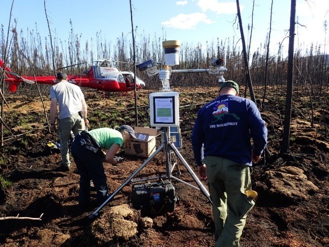
From the banks of the mighty Yukon River, NPS fire ecologists, botanists, and aquatic ecologists set out to measure burn severity and sample changes in vegetation, permafrost, lake, and stream chemistry. Meanwhile, acoustic recording equipment monitored birdcalls, and a weather station recorded hourly weather observations. Initial findings show…
Abundant birds…
Bird surveys are a good way to understand changes in ecology. Because birds are highly mobile, they can leave disturbed areas or be attracted to them, depending on what they need. Which birds are found can tell you about what is happening at the site. For example, woodpecker are commonly found in burned areas feeding on beetle and insects that inhabit the dead fire-killed trees.
The crew identified birds within the burned area by recording birdcalls on an SM4 acoustic recorder. The recordings were taken from May through August 2019. The initial list of birds was long, and included Wilson's Snipe, Northern Hawk Owl, Canada Jay, Common Raven, Arctic Three-toed Woodpecker, Hairy Woodpecker, Olive-sided Flycatcher, American Robin, Varied Thrush, Swainson's Thrush, Ruby-crowned Kinglet, Northern Waterthrush, Wilson's Warbler, Yellow-rumped Warbler, White-crowned Sparrow, Dark-eyed Junco, and Common Redpoll, to name a few. The study will investigate which of these bird species are expected in a recent burn.

NPS photo/S. Adams
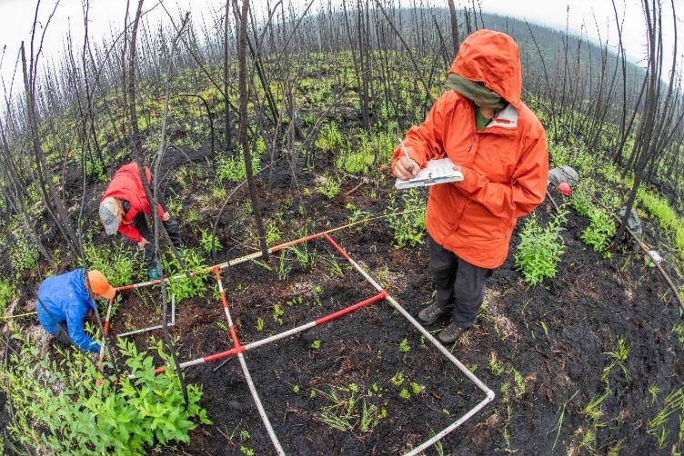
Twenty-nine vegetation-monitoring sites were measured for seedling establishment, vegetation cover, soil carbon consumption, active layer depth (this is the ground above permafrost that thaws every summer and is where live plant roots can grow), and burn severity. Early successional plants, like fireweed, grasses, and resprouting shrubs were growing after the fire. In addition, many tiny black spruce and paper birch seedlings established. The abundant black spruce prior to the fire provided a good seed source for forest regeneration.
Burn severity influences vegetation succession and composition, carbon consumption, and permafrost. Satellite data was used to map the burn severity of the fire. The crew field-verified the burn severity maps utilizing the Composite Burn Index method which measures the impacts of the fire from the ground layer to tree layer. The ground measurements of burn severity appeared to match well with the satellite-derived burn severity maps.

NPS photo/A. Larson
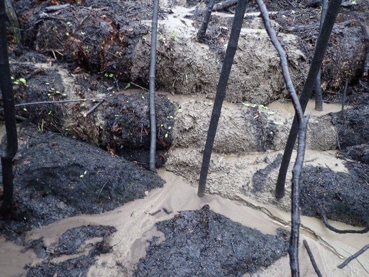
Many thermokarst features and unexpected springs of water were observed, along with mudslides on the steep banks of the Yukon River due to thawing permafrost. As the ground warms after a fire and permafrost thaws, carbon is released when organic compounds decompose or are transported through groundwater and runoff to rivers and streams. Structure from motion, an imaging technique to estimate three dimensions from two-dimensional images, will be used to detect large changes in the landscape including erosion and thermokarst features. On the ground measurements of depth to permafrost (active layer depths) will be compared to the pre-burn depths at the vegetation monitoring plots.

A weather station equipped with phenology cameras will record weather data, soil temperatures, snow cover, and green-up within the fire area. These data will be compared to a nearby unburned site and used to relate the vegetation and permafrost data being collected at the site.

NPS photo/S. Adams
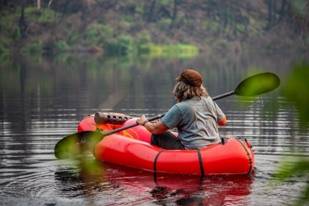
Water temperature, pH, dissolved oxygen, specific conductance and lake level were measured hourly at two continuous monitoring stations that were installed on a lake within the Andrew Creek Fire and a second in a non-burned region with similar geomorphological conditions. These data will help detect changes in the aquatic ecosystems after the fire.
What will we learn from this data?
Fire managers now face fire management decisions that are becoming more complex with warming temperatures and more fire on the landscape. This project may provide them with a better understanding of how wildfire affects the landscape and the interconnected effects to aquatic systems, permafrost, wildlife and vegetation.
Fire managers now face fire management decisions that are becoming more complex with warming temperatures and more fire on the landscape. This project may provide them with a better understanding of how wildfire affects the landscape and the interconnected effects to aquatic systems, permafrost, wildlife and vegetation.
