Last updated: February 12, 2020
Article
Inventory and Monitoring Data Help Flagstaff Area National Monuments Meet Resource Management Challenges
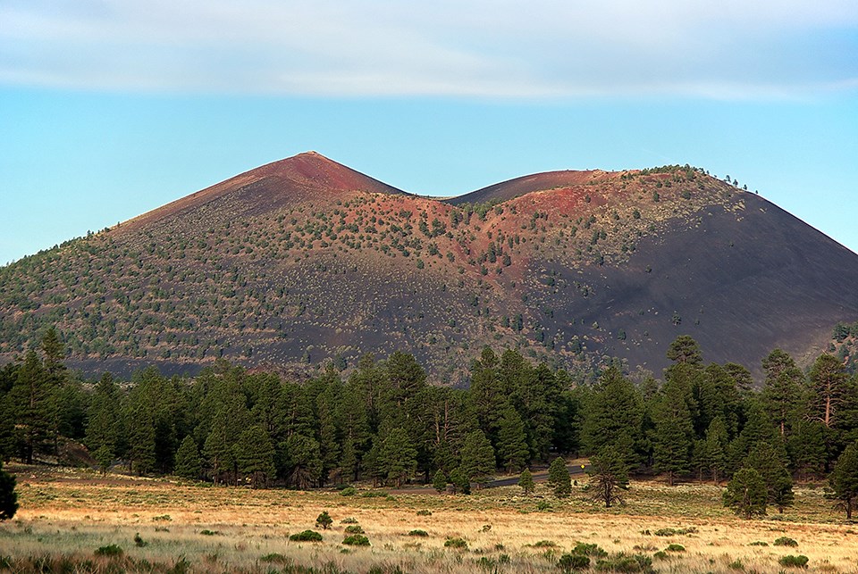
Photo by Al HikesAZ. Creative Commons license.
Introduction
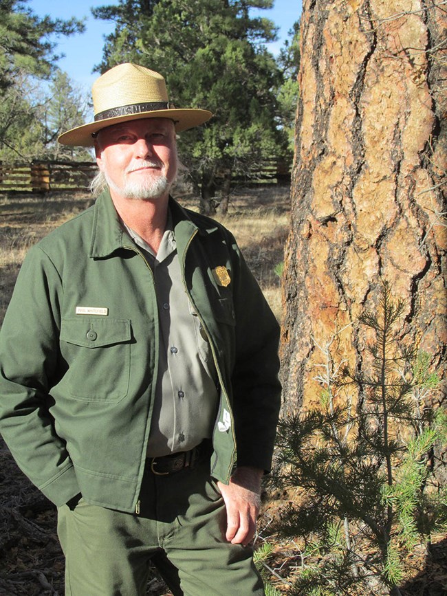
For more than 15 years Paul Whitefield has been part of the team dedicated to protecting and improving the conditions of natural resources in Sunset Crater Volcano, Walnut Canyon, and Wupatki national monuments near Flagstaff, Arizona. As the natural resource specialist, he has worked on wildlife survey and habitat restoration projects, baseline condition assessments, management plans, and cooperative studies related to park natural resources. Any one of these projects requires a great deal of information about the resources in these parks. Whitefield teams with a wildlife biologist and a seasonal biological technician for most day-to-day work, but that’s not enough person power to gather, synthesize, and analyze all the long-term data needed to make science-based resource management decisions.
As a result, Whitefield has relied on partners within the National Park Service (NPS) and other agencies to help gather natural resource information for the parks. One of those partners has been the Southern Colorado Plateau Inventory and Monitoring Network (SCPN). SCPN is one of 32 regional inventory and monitoring (I&M) networks set up across the National Park Service to gather and analyze information on park natural resources. For the Flagstaff Area National Monuments, SCPN has inventoried mammals, amphibians and reptiles, plants, and geologic resources. Working with the monuments' staff, the network established bird community monitoring in Wupatki National Monument (NM), riparian monitoring in Walnut Canyon NM, and upland vegetation and soils monitoring in Wupatki and Walnut Canyon national monuments. From inventory data, to long-term monitoring data sets, to special projects, SCPN data on vegetation communities, wildlife, and hydrology has informed much of the work being done in the network’s 19 parks. To illustrate, here are a few examples from Whitefield’s work.
NPS photo.
Natural Resource Condition Assessments
In 1916, the Organic Act, passed by Congress, created the National Park Service to not only conserve and protect parks, but also to leave them “unimpaired for the enjoyment of future generations.” Natural Resource Condition Assessments (NRCAs) provide snapshots of the condition of park natural resources, identify critical gaps in resource data, and inform parks about conditions that affect resources--all critical information that helps park staff to manage resources so that parks remain unimpaired into the future.
Whitefield is a coauthor of the recently completed NRCAs for Walnut Canyon, Wupatki, and Sunset Crater Volcano national monuments. SCPN inventory and monitoring data, and SCPN scientists provided valuable information about upland vegetation, habitat-based bird communities, amphibians and reptiles, mammals, and hydrology that was incorporated into the assessments (Baril et al. 2018).

NPS
Fire Management Plans
In many national park units, fire is an essential ecological process, but in many others, fire is the result of unnatural conditions caused by the actions of humans, such as grazing and fire suppression. While fire can be a natural process that contributes to healthy functioning ecosystems, unnatural, high severity fire can result in catastrophic losses of forests, and even convert the landscape to an altogether different vegetation type. It is important to differentiate between the two types of fire and to have a plan that explains how and when to use fire on the landscape. Fire management plans 1) identify park resources at risk should a fire occur, 2) specify organizational responsibilities, and 3) establish strategies for how a park will manage wildland fire (both prescribed and wildfire) and non-fire fuel treatments to either restore or maintain a healthy ecosystem in a national park unit (Miller 2008).
“Under the current fire planning framework,” Whitefield explains, “the first thing we are supposed to do is assign a fire regime class to all of the vegetation in a park. A fire regime condition class assessment assesses how many natural wildfires the forest has missed since the 1880’s, how far the vegetation has deviated from the historic stand structure, and how vulnerable it is to an unnaturally hot, severe fire.”
Whitefield used the vegetation classification and GIS distribution data layers developed by the I&M program for all three national monuments. He and the GIS specialist assisting with the plan condensed the SCPN vegetation map classes into broader cover categories that could be assigned a fire regime condition class. This helped to guide management objectives for restoring fire as a natural process and to create a ten-year fuels reduction and prescribed fire plan.
NPS
Wildlife Studies
Whitefield and coworkers also use the condensed vegetation map layers as surrogate wildlife habitat layers. Using SCPN wildife inventory reports and the existing knowledge about wildlife in the parks, Whitefield has been able to match up species, such as the endemic Wupatki pocket mouse, and the endangered Mexican spotted owl, with their habitat as depicted in the vegetation map layers. He conducts field surveys in the corresponding habitat areas to document actual occurrence of the species in the monuments. These data serve as baseline population numbers for future monitoring of status and trend. He has also cooperated with other agency biologists to use these layers to model the vulnerability of species habitats to climate warming.
NPS photo.
Heiser Spring Restoration
Heiser Spring is one of three springs in Wupatki National Monument. The other two are Wupatki and Peshlaki springs. People have used these springs since the ancient Puebloans settled the area in the 1100s AD. Later, continuous use by Navajo sheepherders, ranchers, the Civilian Conservation Corps, and the National Park Service caused the springs to decline. Wupatki Spring ceased to flow in the 1950’s. By 2003 the water table had dropped so low at Heiser Spring that Whitefield wondered if water would ever flow, or even seep to the surface again. Of the three springs, Peshlakai Spring is the only one that was not developed as a water supply for ranching or the NPS, and has remained a source of surface water for wildlife within the monument over the last 130 years.
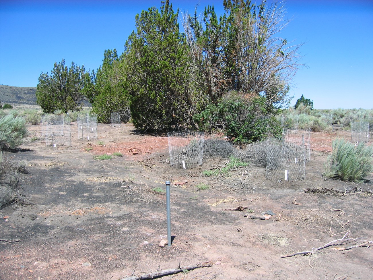
Under the 2002 General Management Plan for Wupatki, NPS use of the Heiser Spring area for employee housing and administrative operations ended, and the area was zoned for restoration to natural conditions. “Riparian areas, seeps and springs are crucial to conserving biodiversity in the arid Southwest,” said Whitefield, “and that’s why we focused a restoration effort on the Heiser Spring area.”
Whitefield was the project leader on the Heiser Spring restoration, which began in 2007 and was completed in 2010. The goal was to establish a small area of more diverse riparian vegetation to enhance wildlife habitat. Although it was not known if water would again rise to the surface, it was a desired result that would also benefit wildlife.
“We were hoping to restore a place for animals to come in and get water,” Whitefield explained. “We're especially hopeful that the pronghorn antelope will eventually be able to get water here. They're a significant grassland species, and they seem to have been impacted greatly by habitat fragmentation and loss of natural surface waters throughout the Wupatki area. Other wildlife that would benefit are desert mule deer, foxes, bobcats, jack rabbits, and cottontail rabbits. We were also hoping to provide some structural diversity, perches and nesting cover for a number of song birds species, such as the mourning dove, black tailed gnatcatcher, canyon towhee, rock wren, and western king bird. We know that the larger trees are really important for providing perches for raptors.
In 2008 and 2009, Whitefield installed a series of shallow wells to monitor groundwater levels around the spring restoration area. SCPN helped him to instrument the wells and continues to provide data management and analysis. In 2013 Wupatki had a record wet monsoon, resulting in a record wet year. From the well data, Whitefield learned that the water table rose 1.1 m in 60 days. And it has held steady at 2/3 m underground ever since.
“That those springs recharged that quickly from summer monsoon rainstorm recharge instead of winter snowmelt recharge is huge news,” Whitefield explained. In addition, SCPN’s data manager modeled the surface of the water table using the well data, which has revealed an upwelling of the water table. “So the water’s actually coming out of that sandstone bed under pressure,” Whitefield said, “a localized area of gravity-fed artesian-type well flow.”
Long term monitoring data collected from the wells near Heiser Spring is helping area hydrologists learn about perched aquifers in the Moenkopi Formation on the Coconino Plateau. Two of the wells are instrumented with data loggers, which take measurements of water level every hour. An SCPN tech downloads the data 2-4 times per year, and the data is then uploaded to a database managed by SCPN. Perched aquifers occur when groundwater flows down along a gradient, discharging at springs or collecting deeper into the subsurface. They occur more commonly in volcanic rock, but at Wupatki NM perched aquifers occur along the sandstone layers of the Moenkopi formation. While less common, this type of aquifer feeds numerous springs and seeps across the Colorado Plateau (Bills et al. 2016).

Graph prepared by Southern Colorado Plateau Network.
NPS / D. Rakestraw.
Collaborations: Management of the Lake Mary/Walnut Creek Watershed
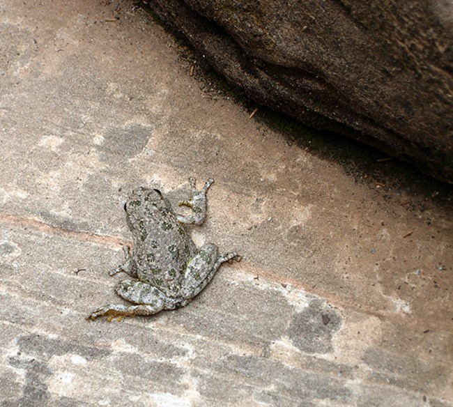
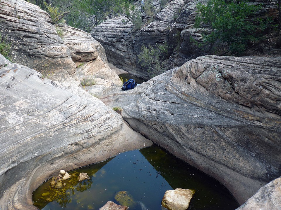
Water is critically important for natural communities. For example, if the water in the Cherry Pools of Walnut Canyon NM were to disappear, the isolated population of canyon tree frogs there would disappear also. When it comes to balancing the needs of human and natural communities, data and sound science are of the utmost importance.
Walnut Canyon NM was established in 1915 to protect the ancient cliff dwellings of the prehistoric Sinagua people and the cultural and natural resources associated with their occupation. While there are no records of flows for Walnut Creek within the monument prior to the construction of the upstream dams, historical reviews concluded that Walnut Canyon had “an ephemeral stream channel, that flowed seasonally with snow melt and summer rain” (Rowlands et al. 1995). As a creek in “proper functioning condition” (Wagner et al. 2017), Walnut Creek would have been able to maintain aquatic and riparian habitats and provide important ecosystem functions. But with the construction of Lower Lake Mary Dam in 1905, and Upper Lake Mary Dam in 1941, not only was the total runoff into Walnut Creek reduced ten-fold, but the frequency of high flow events in the creek was also reduced from 19 to two over a 44-year period. A 2017 study by the NPS Water Resources Division found three reaches of Walnut Creek so adversely impacted by the dams, in terms of vegetation, hydrology, and erosion and deposition, that they were classified as in “non-functional condition” (Wagner et al. 2017). The dense mix of relict riparian and upland vegetation communities on much of the canyon floor today is linked to the severe reduction in stream flows that occurred after the dams were built. The lack of water adversely affects wildlife in the monument, such as Mexican spotted owls, peregrine falcons, and the canyon tree frog.
Walnut Canyon NM, the City of Flagstaff, and the Coconino National Forest have been working together since 2001 to determine how best to manage the Lake Mary/Walnut Creek watershed. They have been researching ways that Flagstaff residents can have drinking water and enjoy recreational opportunities, and, at the same time, increase the chance that water would flow into Walnut Creek to enhance the inner Walnut Canyon environment. Vegetation management is one strategy to accomplish that. As Whitefield explained, “Research has shown that when you manage ponderosa in a more open state, which restoration is all about, then surface water increases, and so does the water yield to groundwater. So the Flagstaff Area Monuments have been advocating for restoring the watershed with fire as the best way to increase the chance of water making it to Walnut Creek.”
In 2010, SCPN installed two recording stage gauges along Walnut Creek and one on Cherry Creek, which flows into Walnut Creek. These gauges document the timing and duration of surface water flows, and were installed adjacent to existing crest stage gauges, which capture magnitude of surface water flows. An SCPN tech goes 2-4 times a year to download the data from these gauges, which is then uploaded to SCPN’s Aquarius database. SCPN staff also surveyed three transects perpendicular to the channel and a longitudinal profile at each station. That data can be used to monitor channel and floodplain morphology over time. The stage recording stations are providing critical data that are being used to model conditions resulting from different treatment options. Combined with hydrology data collected from a network of 10 to 12 research hydrology stream flow stations in subwatersheds that drain into Upper and Lower Lake Mary, these data are recording the amount of flow that results from different types of forest thinning treatments, as well as when no treatment is done.
“Another treatment option," Whitefield continued, "is to lower the spillway on the older Lower Lake Mary Dam, which is owned by Coconino National Forest. A 1941 permit established a spillway level that is actually below the current level. It could be lowered and still leave standing water for recreation and wildlife and wetlands…We would have to conduct a hydrologic modeling exercise in which we looked at the results of lowering the spillway to several different levels, not just for the flow to Walnut Creek, but also for the stakeholders who use the lakes for wildlife watching and recreational fishing. We need the type of data we’re getting from the SCPN gauges to do that.”
“With the science framework provided by long-term monitoring datasets, we can learn what the best balance is in terms of watershed management and use of wildland fire to provide water for wildlife and for people,” Whitefield concluded.
Prepared by Jean Palumbo
Literature Cited
Baril, L., P. L. Valentine-Darby, K. Struthers, and P. Whitefield. 2018. Walnut Canyon National Monument: Natural Resource Condition Assessment. Natural Resource Report NPS/SCPN/NRR—2018/1637. National Park Service, Fort Collins, Colorado.
Bills, Donald J., Marilyn E. Flynn, and Stephen A. Monroe. 2016. Hydrogeology of the Coconino Plateau and Adjacent Areas, Coconino and Yavapai Counties, Arizona. U.S. Geological Survey, Reston, Virginia.
Miller, McKinley-Ben. 2008. The essence of fire regime-condition class assessment. In: Gottfried, Gerald J.; Shaw, John D.; Ford, Paulette L., compilers. 2008. Ecology, management, and restoration of pinon-juniper and ponderosa pine ecosystems: combined proceedings of the 2005 St. George, Utah and 2006 Albuquerque, New Mexico workshops. Proceedings RMRS-P-51. Fort Collins, CO: U.S. Department of Agriculture, Forest Service, Rocky Mountain Research Station. p. 209-212.
National Park Service. 2019. Natural Resource Condition Assessment Program. Available at https://www.nps.gov/orgs/1439/nrca.htm.
Wagner, Joel, Christine Taliga, and Mike Martin. 2017. Technical Assistance Report: Condition Assessments for the Walnut Creek and Lower Cherry Creek Riparian Systems at Walnut Canyon National Monument. National Park Service, Water Resources Division. Fort Collins, Colorado.
Tags
- sunset crater volcano national monument
- walnut canyon national monument
- wupatki national monument
- scpn
- southern colorado plateau network
- walnut canyon national monument
- sunset crater volcano national monument
- wupatki national monument
- inventory and monitoring division
- sw science
- american southwest
- southern colorado plateau
- monitoring
- inventory
