NPS Photo
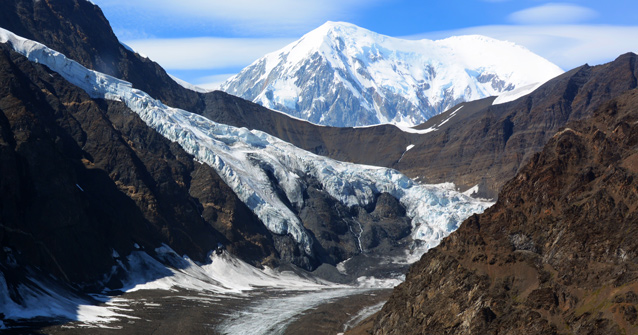
Glaciers are the enigmatic sculptors of the mountains. They are a sensitive indicator and powerful symbol of climate change. Almost all glaciers across the globe are thinning and retreating in unison from the warming climate. Denali’s glaciers are no exception, however the highest elevation glaciers that sit on the roof of North America are robust and not seeing as dramatic loss as many other glaciers in Alaska and the world. Denali is a stronghold for glaciers because the high mountains provide a cold and snowy refuge, the best habitat for glaciers.

NPS Photo
Why Monitor Glaciers?
Glaciers are integral components of the region’s ecosystem. Glacier behavior affects other components of the ecosystem, such as rivers, microclimate, and the creation and destruction of terrestrial and aquatic habitat.
Monitoring seasonal snow accumulation and ice loss at points on a glacier surface provides unique data on high elevation climate variability and trends. Such data is difficult and expensive to obtain using an instrumented climate station. Measuring total winter snow accumulation in the early spring and summer snow and ice melt provides data on winter precipitation and average summer temperature (and in some cases snowfall) that are important to the mountain environments that glaciers occupy.
Glaciers have been a feature of scientific interest since the first explorations of geologists in the early 1900s and the NPS has been conducting long term monitoring since 1991.
Recent Monitoring Results
- In 2013, the Kahiltna and Traleika glaciers were monitored for mass balance at index sites for the 22nd year.
- In 2013, the Traleika glacier had a slightly positive balance year. This year departs from the negative trend for a second year in a row.
- Snowfall/winter balance was 110% of average
- Melt/summer balance was 99% of average.
- The Kahiltna Glacier as a whole also had a slightly positive balance year in 2013. This is a departure from the negative trend on this glacier since 2004.
- Snowfall/winter balance was 127% of average.
- Melt/summer balance was 60% of average.
Glaciology Citizen Science Project in 2015
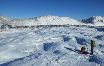
Imagine strapping on a backpack, stepping off the road into the brush and hiking up and fording one of the grand braided glacial river valleys in Denali National Park and Preserve. Your backpack is filled with everything you and your group needs to survive for the next four days as well as some high tech GPS equipment. You have joined Alaska Geographic’s “Glaciology: Backcountry Science” field course. The purpose of the course is to provide education, adventure, exploration, and participation in scientific measurements to document change on some of Denali’s smaller hiking-accessible glaciers.
The goal of the science is to determine rates of ice loss through time on glaciers in the upper Toklat watershed. Participants help map the glacier terminus as well as hike up on to the glacier itself to map surface elevations of the ice. They then can compare the data they collect with previous maps and GPS measurements. Data collected by the citizen scientists on the glacier in the middle fork of the Toklat River show that rates of ice loss have increased since 2010. Compared with ice loss rates between 1952-2010, rates increased by 38% glacier-wide between 2010 and 2015. A 2010 digital elevation model (DEM) is used to compare and calculate ice surface elevation and glacier terminus changes with the GPS data collected during the courses. The 1952-2010 ice loss estimate is based on differencing a 1952 DEM with the 2010 DEM. More recently, rates increased ~20% when comparing the periods of 2002-2010 and 2010-2015.
More Information
- Learn more about the 2014 glaciology citizen science trip with a video.
- Discover more about Alaska Geographic's wide selction of field courses.
- Virtually explore Denali's glaciers through panoramic images.
- Explore a science summary about Denali's glaciers.
- Read the annual report on vital signs of glacier in the Central Alaska Network
Last updated: May 24, 2016
