Last updated: April 20, 2024
Article
Checking Great Sand Dunes' Vital Signs

NPS/Patrick Myers
Rocky Mountain Network Science in the Park and Preserve
National parks are the guardians of our unique American natural and cultural history. But perhaps more than ever before, parks exist in a rapidly changing landscape. Urban growth, replacement of native species by exotics, air and water pollution, increasing visitor use, and climate change all impact the natural web of life. This leads us to ask:
How healthy are our parks?
How are they changing?
To answer these questions, the National Park Service clustered parks into 32 Inventory and Monitoring Networks. In 2007 at Great Sand Dunes and nearby park units, a small team of scientists representing the Rocky Mountain Network began monitoring natural resources, called “vital signs,” that serve as red flags if conditions deteriorate. We support park managers’ efforts to make science-based management decisions.
What Do We Monitor at Great Sand Dunes National Park and Preserve?
Wetland Ecological Integrity

NPS/Scott Hansen
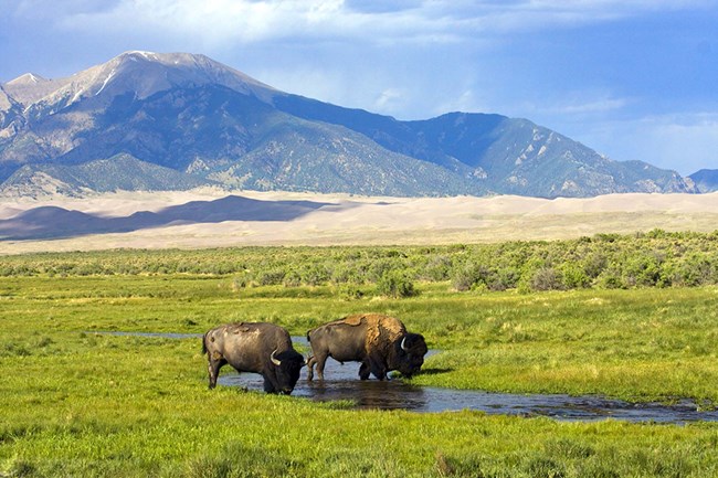
Great Sand Dunes has abundant and diverse wetlands. From wet meadows, marshes, salt flats and riparian wetlands in the park to fens and alpine wetlands in the preserve, these biodiversity hotspots are important to myriad species. Migratory birds, like the Wilson’s warbler and Lincoln’s sparrow eat, nest, and shelter in wetlands. Amphibians, like the chorus frog, need wetlands to reproduce. Elk and bison dine on wetland plants. Rapid climate change and invasive exotic plants, however, threaten wetlands. Furthermore, heavy grazing by elk and bison, especially in the national park, has impacted native wetland plants and possibly the water cycle. We monitor wetland health across the park and at select sites in the preserve to learn how these biologically rich ecosystems function and respond to stresses. We are working with park staff to enhance our wetland monitoring to address information needed to adaptively manage elk and bison in the park.
Some resources we measure:
- The different native plant species and forms (sedges, forbs, shrubs)
- Change in groundwater levels over time
- Presence/absence of invasive exotic plants
- Deer, elk, and bison use of wetlands
Learn more and find recent publications:
Wetland ecological integrity monitoring in Rocky Mountain Network parks
Alpine Communities

NPS/Patrick Myers
Visitors delight in the views atop high mountain peaks in the preserve. On these windswept slopes above treeline, alpine plants must adapt to extreme wind, temperature, snow, ice, and intense solar radiation. To do this, they are shorter, grow frugally, and bear leaves resistant to freeze damage and desiccation. Predictions are for alpine temperatures to moderate and snowpack to decrease. This could lead to invasion by subalpine plants that outcompete alpine plants in the absence of heavy snowpack and extreme temperatures. Alpine communities are also sensitive to heavy visitor use, air pollution, and overuse by
animals (such as elk). We monitor alpine communities because of their value to visitors and vulnerability to multiple stresses in the preserve. Our sites are included in the international GLORIA research network (Global Observation Research Initiative in Alpine Environments) of 130+ alpine monitoring sites worldwide. As temperatures increase, evidence from GLORIA sites indicates that trees and other subalpine species are invading alpine
communities.
Some resources we measure:
- The different native plant species and forms (sedges, forbs, shrubs, trees)
- Soil temperatures at different elevations and aspects (direction the slope faces)
- Presence/absence of invasive exotic plants
Learn more and find recent publications:
Alpine vegetation and soil monitoring in Rocky Mountain Network parks
Learn more about the GLORIA project in national parks.
Snow Chemistry

NPS/Patrick Myers
Ultimately, snowpack in the Sangre de Cristo Mountains drives the streams and groundwater systems in the park and preserve that helped create and maintain the Great Sand Dunes. Unfortunately, it also acts like a collection basket for air
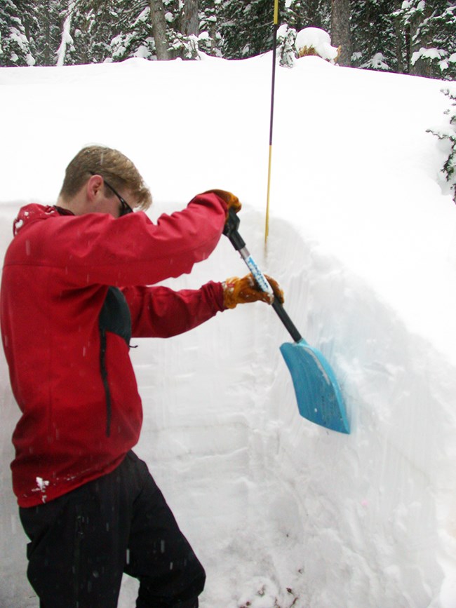
pollution. Particles of nitrate, ammonium, sulfate, and mercury enter falling snow and concentrate in the snowpack. Over the spring and summer, these pollutants find their way into Great Sand Dunes' streams as snows melt, affecting downstream ecosystems and species. Each winter we partner with other National Park Service and US Geological Survey scientists to sample snowpack chemistry. This helps us track current conditions and long-term trends.

NPS
Some resources we measure:
- Dissolved concentrations of air pollutant, including nitrate, ammonium, and sulfate
- Total mercury concentration
- Snow depth and water contained in the snowpack (snow water equivalent)
Learn more and find recent publications:
Snow chemistry monitoring in Rocky Mountain Network parks
Explore these links:
USGS Rocky Mountain Regional Snowpack Chemistry Monitoring
Changing Regional Emissions of Airborne Pollutants Reflected in the Chemistry of Snowpacks and Wetfall in the Rocky Mountain Region, USA, 1993–2012
More Information and Vital Sign Publications
Rocky Mountain Inventory and Monitoring Network
Download a printable pdf of this article.
Prepared by Sonya Daw and the Rocky Mountain Network
