These are the accompanying maps for the Sea Turtle 2014 Annual Report for Cape Hatteras.
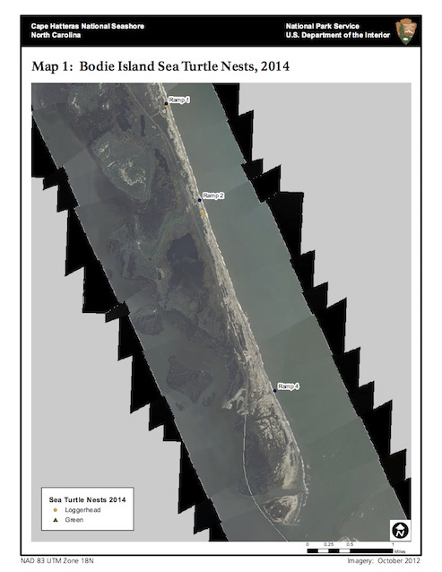
Map 1: Bodie Island Sea Turtle Nests, 2014
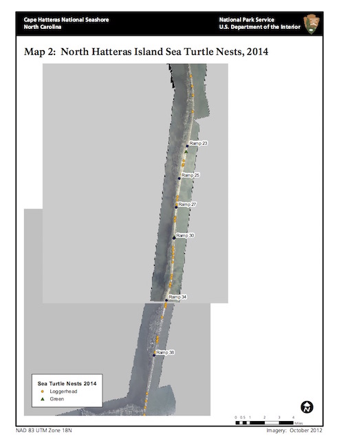
Map 2: North Hatteras Island Sea Turtle Nests, 2014
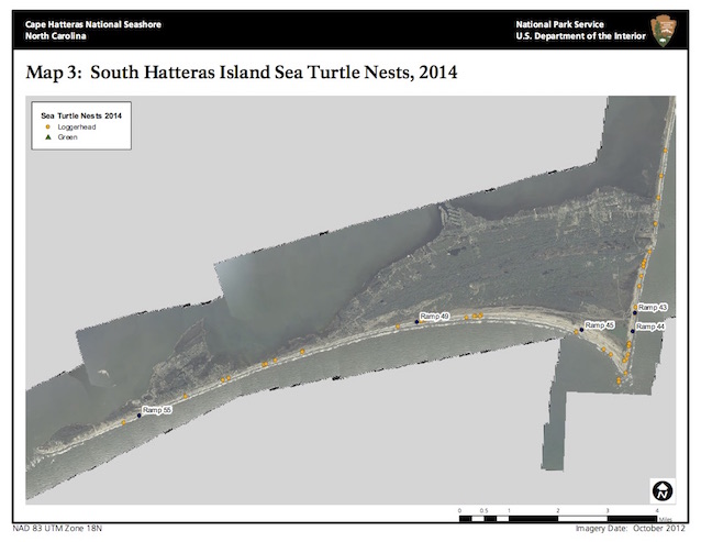
Map 3: South Hatteras Island Sea Turtle Nests, 2014
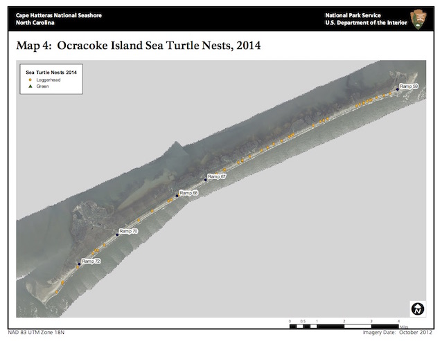
Map 4: Ocracoke Island Sea Turtle Nests, 2014
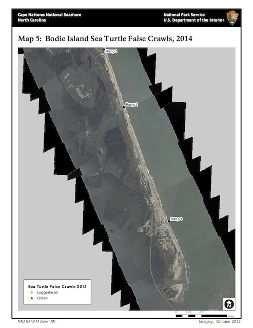
Map 5: Bodie Island Sea Turtle False Crawls, 2014
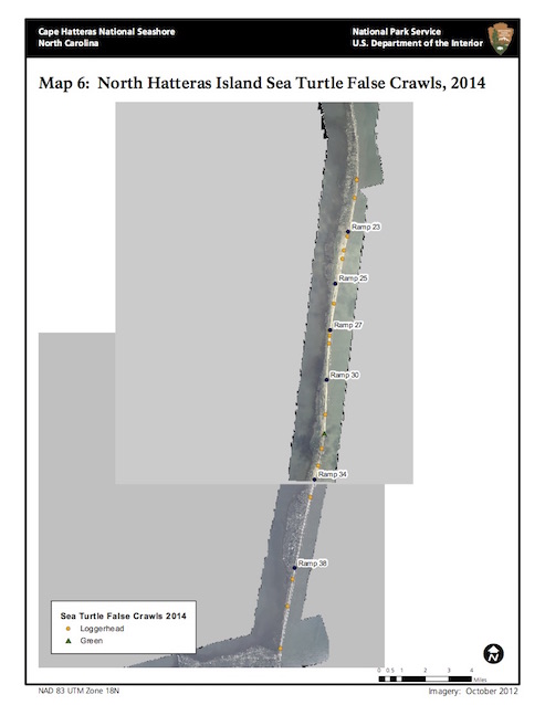
Map 6: North Hatteras Island Sea Turtle False Crawls, 2014
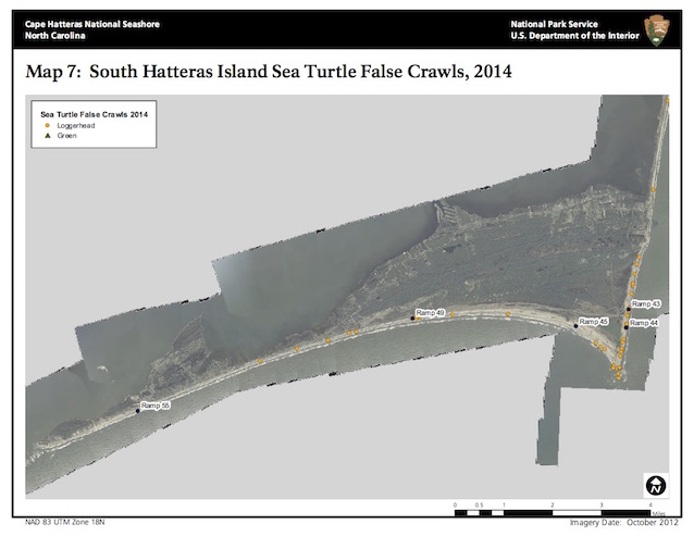
Map 7: South Hatteras Island Sea Turtle False Crawls, 2014
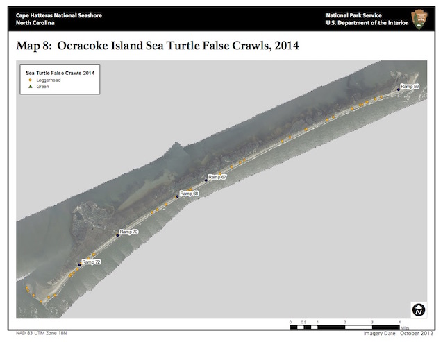
Map 8: Ocracoke Island Sea Turtle False Crawls, 2014
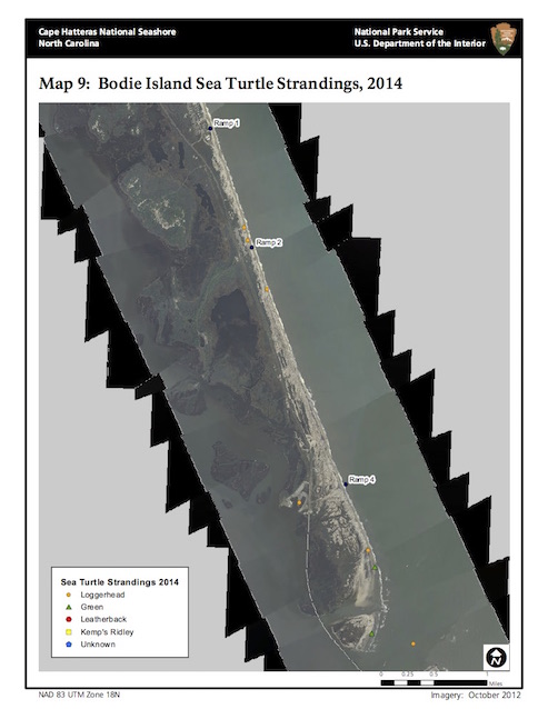
Map 9: Bodie Island Sea Turtle Strandings, 2014
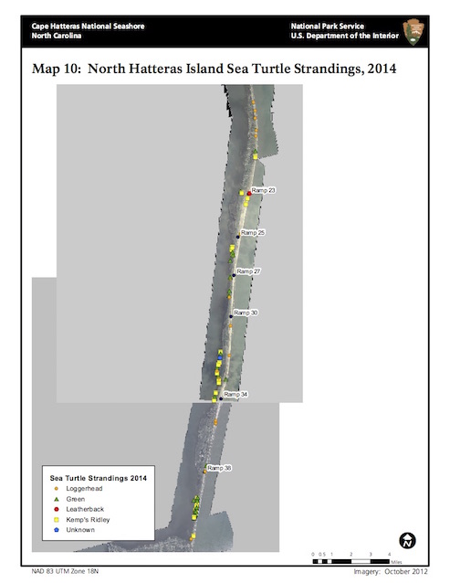
Map 10: North Hatteras Island Sea Turtle Strandings, 2014
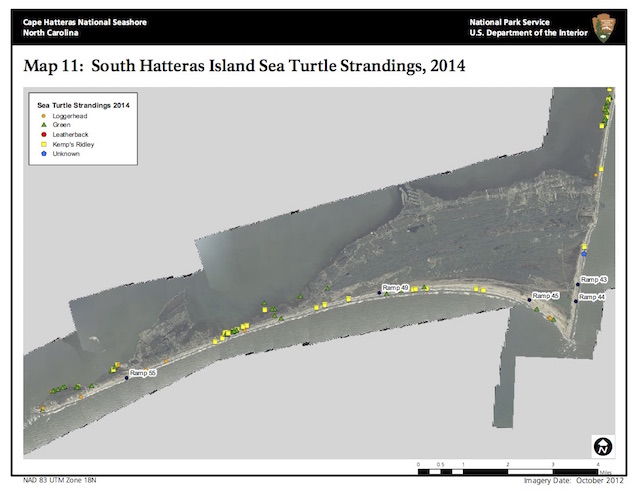
Map 11: South Hatteras Island Sea Turtle Strandings, 2014
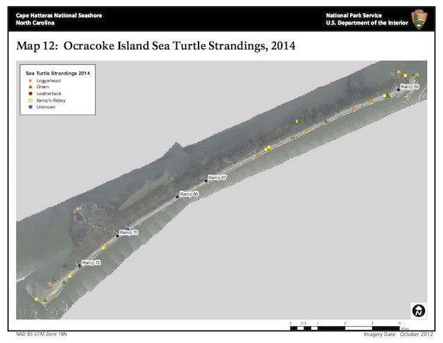
Map 12: Ocracoke Island Sea Turtle Strandings, 2014
For the report, select the Sea Turtle 2014 Annual Report for Cape Hatteras article.
Last updated: December 19, 2017
