MODIS
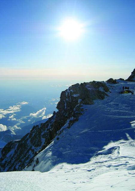
On a clear day, Denali dominates the landscape from the vantage point of Wonder Lake, impressively tall and snowy, seemingly close enough to touch. These are the days when people in Anchorage look out their windows 130 miles away to gaze at the mountain on the horizon, and the air quality monitoring instruments near park headquarters measure some of the cleanest air in the nationwide monitoring network. This is the Alaska that people expect to see when the weather cooperates—clean, crisp views of distant snowy peaks, and deep blue skies above.
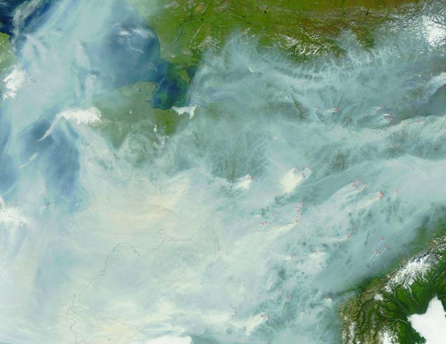
But some days, the view is obscured by more than clouds. During the summer, wildfires burn throughout Alaska, agents of change and renewal in the state’s relatively undisturbed arctic and subarctic ecosystems. Some years, wildfire smoke blankets wide swaths of the state, a naturally occurring nuisance that can be seen from outer space. At ground level, the smoke can sometimes make the mountains disappear, causing eyes to sting and lungs to burn. But like the troublesome mosquitoes, which are an integral part of Denali’s food web, the lightning-sparked wildfires and their accompanying smoke play an important ecological role. As long as the fires are burning in areas where they do not threaten human life or valuable cultural resources, the smoke must be tolerated or avoided, not suppressed.
With the availability of satellite imagery today, it is fairly straightforward to determine which fires send smoke swirling into the park. In addition to smoke from fires in Denali and around the state, traces of smoke from fires as far away as Canada, Russia, and Indonesia have been documented in Denali. In 2004, the largest fire year on record in Alaska, wildfire smoke from Alaska fires extended as far south as the Mississippi River Delta. Since wildfire smoke is observed to travel such long distances, is it reasonable to expect that human-caused pollution does not follow some of the same pathways across and between continents? The answer seems obvious now, but before satellite imagery was widely available, conventional wisdom held that pollution was primarily a local and regional phenomenon. Places like Denali, a six million acre wilderness tucked away in a vast, sparsely populated, sparsely industrialized state, seemed safe from pollution.
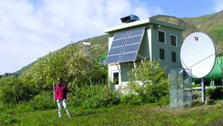
Therefore, when nationwide air quality monitoring networks were established to address airborne contaminant issues such as acid rain, reduced visibility, and smog, they included Denali as a “background” site, a monitoring station which was expected to measure air quality conditions close to pre-industrial values. The experts turned out to be not far off the mark. Through 25 years of continuous air quality monitoring, Denali nearly always records the cleanest values in the country. However, when the data are analyzed for trends, some curious patterns emerge, leading to questions such as: a) why do small amounts of sulfur compounds show up each winter, grow in concentration until they peak in early spring, and diminish again in the summer? and b) why does dust show up on the monitoring filters in springtime when there is still snow on the ground in Interior Alaska?

NPS Photo
The simple answer to both questions is that Denali is linked to the rest of the world through atmospheric pathways that carry industrial and agricultural contaminants, as well as smoke and dust, across the oceans from one continent to another. Two pathways in particular carry airborne contaminants to Denali, each with a characteristic seasonal pattern of transport.
The first pathway brings industrial pollution over the North Pole into arctic and subarctic regions around the world, primarily from metal smelters and power plants in Europe and Asia. The resulting pollution is called arctic haze, named for the visible haze layers first documented in arctic Canada and Alaska, far from any known sources of pollution. Arctic haze occurs during winter and early spring, when the arctic air mass covering the top of the globe expands into industrial areas and traps airborne contaminants within its circumpolar boundary. The arctic air mass is cold, stable, and relatively dry, so there is limited opportunity for pollution to be washed out of the air through rain or snowfall. Sulfates and sulfur dioxide, two important components of arctic haze, demonstrate this strong seasonal pattern in Denali, though in relatively low concentrations.

NPS Photo
The second pathway brings airborne contaminants directly across the Pacific Ocean into western North America. At times, these air currents sweep across deserts in Asia before crossing the ocean, picking up soil particles along the way. Like wildfire smoke, dust storms can be seen in satellite photos, serving as tracers for the invisible pollutants carried along by the same winds. This is why dust is often found on Denali air quality monitoring filters in springtime while the ground in Alaska is still frozen and covered with snow.
Although the amount of pollution reaching Denali from international sources is currently low, knowledge that the park’s air quality is affected by sources thousands of miles away is a concern as well as a reminder of the numerous connections that exist between continents. Airborne contaminant pathways are like superhighways in the sky, carrying the equivalent of either sparse or heavy traffic. If emission levels increase in the source areas over time, pollution will increase in Denali. As the global human population continues to grow, industrial and agricultural contaminants are bound to increase as well.
The good news is that emission control technology is continually improving, significantly decreasing emissions where control measures are in place. If we tackle international pollution problems as a species, rather than as members of particular nations, regions, or continents, then remote wilderness areas like Denali will continue to inspire future generations with their crisp air and spectacular vistas.
Further Information
National Park Service Air Resources Division. 2002.
Air Quality in the National Parks, Second Edition. National Park Service. Lakewood, Colorado.
Air Resources Division website
Wilcox, Walter James II. 2001.
The origin and composition of aerosols in the Alaskan airshed. Master of Science Thesis. University of Alaska Fairbanks.
Webcams in Denali
Part of a series of articles titled Alaska Park Science - Volume 5 Issue 1: Scientific Studies in Denali.
Last updated: March 16, 2015
