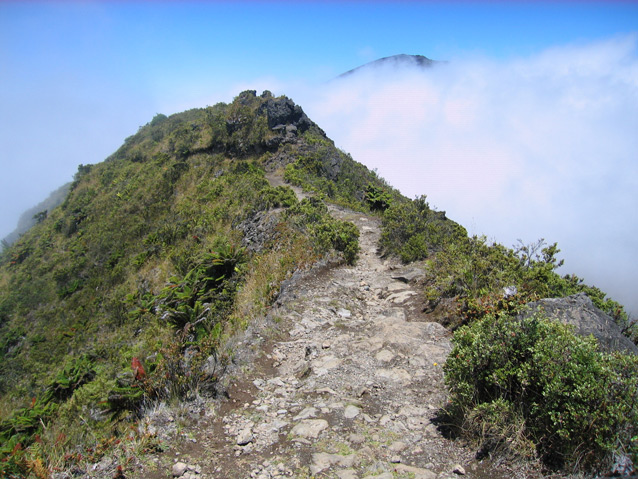
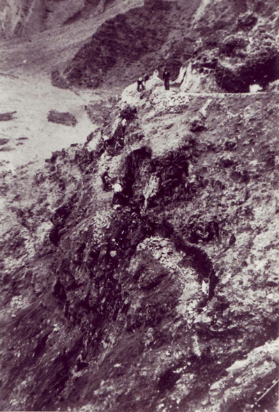
A hike on the trail system at Haleakalā National Park invites views of the Haleakalā Crater and an intimate experience of the natural features that characterize the area. The intent to blend the designed system with the topography, views, and materials of the landscape follows the rustic design principles common to the era of its creation. Built in the 1930s by the Civilian Conservation Corps, the trail system still encourages visitor access on foot - just as it did more than eighty years ago.
“I was just an ordinary worker...And I learned to handle picks, and shovels, and a crowbar. We didn’t use dynamite. We did all the work by hand tools, all the breaking stones, making trails through lava formations, and all that." Alvin Ornellas, former Civilian Conservation Corps (CCC) member at Haleakalā on the island of Maui during the 1930s and early 1940s, 2010 interview.

NPS

NPS / Haleakalā National Park archives
The Civilian Conservation Corps (CCC) Haleakalā Crater Trails District is located in Haleakalā Crater in the center of Haleakalā National Park. The trail system was designed by NPS landscape architects and constructed and/or improved by CCC enrollees between 1930 and 1941 to encourage visitor access into the crater by foot, instead of vehicle.
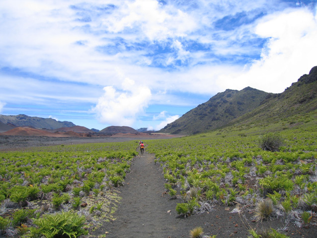
Located at the summit of a massive 10,000-foot dormant shield volcano, Haleakalā Crater is a 3,000-foot deep depression, measuring approximately 7.5 miles by 2.5 miles wide. Defined by its rich volcanic history, cinder cones and dark courses of lava rock serve as reminders of past eruptions.
Today, the western half of the crater is covered by lava flows and cinder desert, while the eastern edge of the crater is lush, with remnants of a native forest still in existence. The most prominent natural feature includes a series of cinder cones, which run in a line up to the summit and down over the crest occupying central and western portions of the crater.
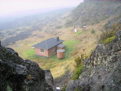
The 26.5-mile-long historic trail system includes 24.7 miles of contributing historic trails and 1.8 miles of non-contributing trails, which provide visitor access to three historic developed areas in the crater. These developed areas include: Holua, located in the northwest portion of the crater at the foot of the towering, 3,000-foot Leleiwi Pali; Kapalaoa, located in the southern reaches of the crater and; Paliku, defined by lush grass and ferns, overhanging forest trees, and a verdant cover located in the eastern extent of the crater.

NPS
The CCC Haleakalā Crater Trails District is significant for its association with early park master planning as implemented by NPS and CCC labor crews, and for its association with park service rustic style. The period of significance begins in 1930 with the initial construction of the crater trail system and extends to 1941 when CCC work on the trails ended.
Following rustic design principles, the trails and associated developed areas were designed to highlight crater views and associated volcanic features, while effortlessly blending with the natural environment. The depth of consideration put into the design is evident in trail width, gradient, alignment and use of native stone materials used in construction of buildings and structures, which contribute to the rustic-character of the district.

NPS
blank
Quick Facts
- Cultural Landscape Type: Designed
- National Register Significance Level: Local
- National Register Significance Criteria: A, C
- Period of Significance: 1930-1941
Landscape Links
- Cultural Landscape Inventory park report
- NPGallery Photos
- Landscape Flickr Album
- More about NPS Cultural Landscapes
Last updated: December 30, 2020
