In 1902, James McCarthy staked a number of claims in the Kuskulana drainage on Nugget Creek. Within several years, a mining camp and copper mining operations had been developed by the Alaska Copper Corporation. The site developed as the demand for copper grew at the onset of WWI. The mining operation was short lived, ending in 1919, yet traces of the Nugget Creek Mine and its associated road remain to commemorate this historic activity in the larger Kotsina-Kuskulana Historic Mining District.
After twenty years of exploration, the results from the Kotsina-Chitina area were less than anticipated. According to one historian, "...the region is the best Alaskan illustration of disappointment following long-proclaimed expectations of wealth." Alaskan historian William Hunt, "Mountain Wilderness: Historic Resources Study, Wrangell-St. Elias National Park and Preserve," 1991

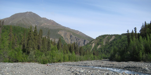
NPS/S. Ferreira, 2008

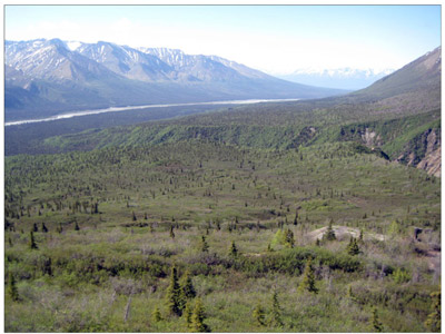
S. Ferreira/NPS Photo, 2008
Nugget Creek is a historic vernacular landscape that exemplifies the evolution of small scale copper lode mine on the Kuskulana drainage in the copper belt of the Chitina Valley, Alaska. The Kuskulana drainage is situated along the western slope of the Wrangell Mountains, and is a tributary of the Chitina River, which is the major western flowing tributary of the Copper River. It is a part of the larger Kotsina-Kuskulana Historic Mining District cultural landscape, which encompasses the Kotsina and Kuskulana drainages and the historic mining properties therein.
The property is owned by the federal government within the boundaries of Wrangell St.-Elias National Park and Preserve. Access is along the historic Nugget Creek Road from Strelna, at mile 14.5 of the McCarthy Road. The McCarthy Road was the original route of the Copper River and Northwest Railroad, which connected the famous copper mines at Kennecott with the port at Cordova. Strelna was an important railroad stop in its day as it was the main point from which both the Kotsina and Kuskulana drainages were accessed after 1910.

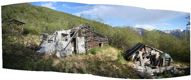
S. Ferreira, NPS Photo, 2008
The Nugget Creek landscape contains four main sites, the camp, the developed mine workings, an isolated cabin ruin, and the former McCarthy cabin site near the mouth of Nugget Creek. The landscape also contains numerous isolates that are past evidence of exploratory prospecting. The landscape is significant for its camp and mine remains, which exemplify a small scale copper mining operation typical of the era and the region. Its period of significance is from 1902, when James McCarthy first staked his claims in the drainage, to 1919 when the Alaska Copper Corporation shut down operations indefinitely.

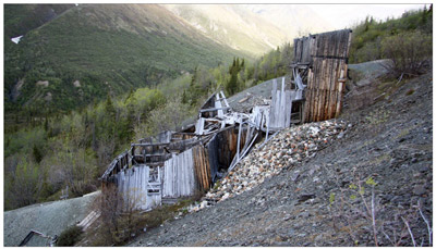
S. Ferreira, NPS Photo, 2008
Extant features include a number of log buildings and structures which reveal information concerning the domestic material culture of an Alaskan mining camp. The buildings, although partially in ruins, exhibit a high level of sophistication in design and craftsmanship, which is atypical of most mining camps in the region. The mine also has a wide variety of artifacts which illustrate the extractive technologies and methods of the early twentieth century copper lode mining. Often overlooked are the mine workings themselves. The Nugget Creek Mine had over 5000 feet of tunnels, shafts, and drifts. In addition to these resources the landscape had an extensive network of roads and trails, connecting the camp to the mine, as well as routes to the railroad at Strelna and over the pass to the Kotsina drainage.
Quick Facts
- Cultural Landscape Type: Vernacular
- National Register Significance Level: Local
- National Register Significance Criteria: A, D
- Period of Significance: 1902-1919
Landscape Links
Last updated: November 22, 2021
