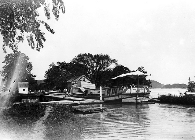
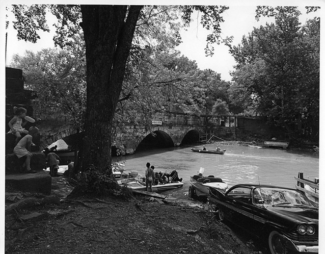
Seneca Lock, located at the mouth of Seneca Creek in Montgomery County, Maryland, is a component landscape of the Chesapeake and Ohio Canal National Historical Park. The 30-acre landscape is located near Lockhouse 24 at Mile 22.80.
Before the development and construction of the canal, land use in the Seneca Lock area was primarily agricultural. The first European settlers to the area of the eighteenth century primarily grew grain and raised some livestock.

NPS / Chesapeake and Ohio Canal National Historical Park
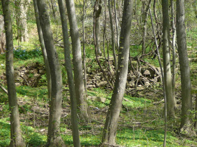
A section of berm-side sandstone retaining walls marks the western boundary of the landscape, at Mile 23.65. These walls are located about three-tenths of a mile west of Culvert 35 (Bull Run Creek Culvert).
The National Register nomination was accepted on August 9, 1979. The Chesapeake and Ohio Canal is listed on the National Register for its significance in areas of architecture, engineering, commerce, transportation, conservation and military history, for the period of significance 1828–1924.
The period of significance for the Seneca Lock component landscape is 1828 to 1924, related to the years of the canal’s construction, operation, decline, and final closure. Like the rest of the canal, Seneca Lock reflects the ascent of canal-based transportation and its ultimate decline in nineteenth-century America. Early nineteenth century canals were superseded by railroad transportation by the mid-nineteenth century. Therefore, the landscape and its associated events have made a significant contribution to the broad patterns of history (Criterion A for listing to the National Register). The canal landscape also contains individual resources that embody the distinctive characteristics of a type, period or method of construction (Criterion C), exhibiting vernacular and industrial stone construction.

NPS/Chesapeake and Ohio Canal National Historical Park
The purpose of Seneca Lock, like other locks along the C&O Canal, was to raise and lower watercraft between stretches where the water level varied, allowing canal boats to travel uphill or downhill. While there have been some changes to the landscape and some features no longer exist, the overall integrity of Seneca Lock is high and the current landscape evokes the character of the historic period.

NPS
The canal and its associated structures serve as an example of nineteeth century canal-building technology and engineering, and this is especially true at Seneca Lock. The Seneca Aqueduct was the first to be built along the canal, and it is the only one in which the lock and the aqueduct are incorporated into a single structure. Today, the landscape contains ruins and constructed water features at the point where Seneca Creek meets the Potomac River.
Businesses developed around Seneca Lock to support the historic trade route, including stone quarries, grist mills, a feed store, and several warehouses. Additionally, the area is unique from other C&O Canal landscapes as the site of a red sandstone quarry, which may date to the pre-Revolutionary War era.
The quarry supplied building material for many locks and structures along the canal and provided stone for George Washington's Pawtomack Canal on the Virginia side of the river. The Seneca quarries also supplied the stone used in building the Smithsonian Castle and other historic buildings in Washington, D.C. and other cities.
Quick Facts
- Cultural Landscape Type: Vernacular
- National Register Significance Level: National
- National Register Significance Criteria: A, C
- Period of Significance: 1828-1924
Landscape Links
Last updated: October 7, 2021
