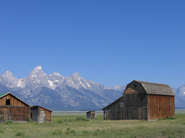
The Mormon Row Historic District is located at the southeast corner of Grand Teton National Park, in a gently sloping sheltered cove formed by Blacktail Butte and the Gros Ventre Mountains. The District is defined by a linear array of uniform building complexes lining the Jackson to Moran road. The Teton Range to the northwest and is a dominant visual presence of the landscape.
The community represents late-frontier Mormon settlement of high, arid country. Domestic and agricultural infrastructure was constructed of locally procured materials, and irrigation systems represented the life-blood of the community.

NPS/C. Mardorf
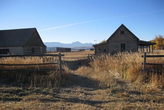
The community once extended north from the Gros Ventre River to the initiation of the arid and rocky soils north of Blacktail Butte. Now, six building clusters and an isolated ruin (representing six homestead withdrawals) are the only physical structural remains within the historic community boundaries. These homestead withdrawals comprise the Mormon Row Historic District.
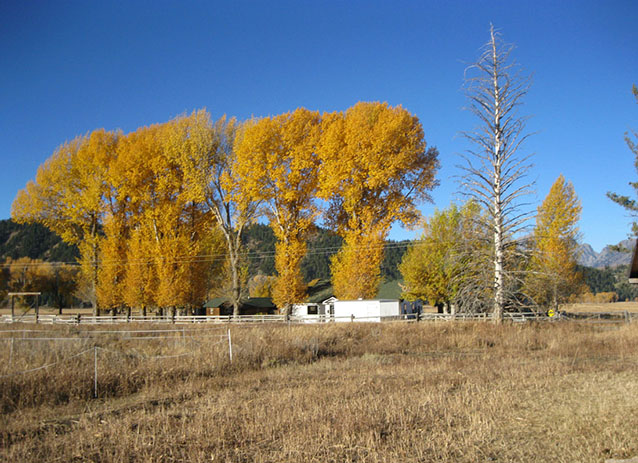
The building clusters incorporate domestic and agricultural infrastructure and are constructed of locally procured materials in a simple vernacular style. Associated landscape features include fence and corral systems, the extant Mormon Row Ditch system, remains of the Johnson/Eggleston ditch, a hay derrick, the community swimming hole dammed in an intermittent drainage, windrows marking the location of former homes and of the community church, and the still sage-free cultivated fields and pasturage laboriously cleared by the original settlers.
Important natural features within the general area include adjacent sage covered valley bottomlands, The Knoll (a sled and ski hill used by area children), Ditch Creek, the Gros Ventre River, and Blacktail Butte. Timbered Island, Shadow Mountain, and Teton National Forest lands can be seen in the distance.

NPS/C. Mardorf
The historic road that once linked residents of Moran, Wyoming with those of Jackson bifurcates the community and largely defines the strikingly linear pattern of settlement. This linear pattern is reinforced by fence and field lines. The curvilinear, irregular patterns of tree lined drainages (such as Ditch Creek and the primary canal of the Mormon Row Ditch system) as well as topographic features outside the district boundary (most notably Blacktail Butte, The Knoll, and the Teton Range) stand in stark contrast to the human-imposed grid.
Mormon Row is significant for its history, vernacular architecture, and landscape architecture from 1908 to 1950. The year 1908 marks the settlement of the Andy Chambers, John Moulton, and T.A. Moulton homesteads, while 1950 marks the end of concerted agricultural development in the area with the expansion of Grand Teton National Park. Significant dates include 1927, when residents were granted a dependable water source, and 1943, when the Jackson Hole National Monument (today's Grand Teton National Park) was created by Executive Order.

NPS
The community illustrates the extension of the "Mormon Culture Region" from Utah, Idaho, and Arizona, to interspersed communities throughout the West. The community also represents late frontier Mormon settlement of high and arid country. Here, homesteaders practiced diversified agriculture on a limited land base, multiple generations inhabited the family farm (or adjoining farm), and the number of failed homesteads equaled or exceeded the successful enterprises, as shortcomings of farming 160 acres became self evident.
The domestic and agricultural infrastructure was constructed of locally procured materials and is a significant expression of vernacular architecture and landscape architecture. The irrigation systems also represented the life blood of the community; engineered systems assured proper distribution of water from distant sources to extensive fields and continue to represent the unique contribution of Mormons to western irrigation and settlement patterns. Additionally, the Andy Chambers complex, the John Moulton complex, and the Reed Moulton barn (Heninger barn) retain a remarkable degree of physical architectural fabric.
Quick Facts
- Cultural Landscape Type: Vernacular
- National Register Significance Level: State
- National Register Significance Criteria: A, C
- Period of Significance: 1908-1950
Landscape Links
Last updated: April 20, 2020
