West Rim Drive is a component landscape within the Grand Canyon National Park in northeastern Arizona. West Rim Drive starts at the intersection of the Village Loop Road and ends at the Hermits Rest Trail Head, winding its way along the South Rim of the Grand Canyon. Numerous auto pullouts and pedestrian overlooks are located along the Drive, and a pedestrian trail (West Rim Trail) is found to the north of the road.
This road was designed so that motorists would have to stop and get out of their cars to take advantage of the views. Turnouts, spur roads, parking loops, and viewpoints with guardrails and retaining walls provided scenic yet safe views for visitors.

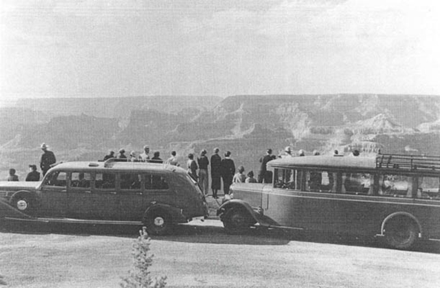
NPS / GRCA archives
The current road, trail, and overlooks were constructed in 1934-1935, and they continue to be popular attractions that receive high use throughout the year. Large numbers of tourists began visiting the Grand Canyon in the late 1800s and early 1900s, and access to the canyon was made relatively convenient by the completion of the Grand Canyon Railway in 1901.
In response to tourists’ needs for accommodations, touring opportunities, and other concessions, the Santa Fe Railroad partnered with the Fred Harvey Company in the early 1900s and invested millions of dollars in developing the Grand Canyon Village and related infrastructure. In 1911-1912 the Santa Fe Railroad constructed a macadamized road from the village to Hermits Rest, and this road became a popular scenic drive (carriage ride) for many visitors to the canyon.
Unable to withstand the pressure of the automobile traffic that was allowed on the road in 1919, the National Park Service, in a cooperative effort with the Bureau of Public Roads, re-designed the road and oversaw construction by a private contractor during the 1930s. The CCC worked on formalizing the West Rim Trail at this same time. This road was designed so that motorists would have to stop and get out of their cars to take advantage of the views. The road continues to be used today by autos, Fred Harvey tour buses, and other tour shuttles. The West Rim Trail is heavily used by pedestrians.

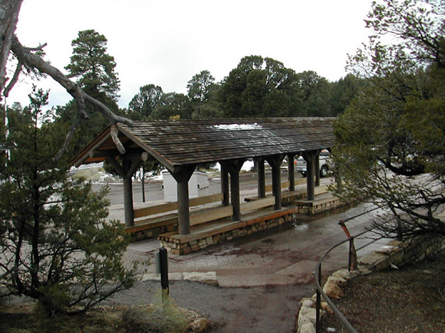
NPS / J. Galbraith
The road route is essentially unchanged since construction. Stone walls of Kaibab sandstone illustrate the NPS Rustic style along the roadway. The most important feature of the road is the many overlooks and pullouts designed into the original plan, to allow visitors a safe vantage point to view the canyon. Various small scale features occur along the drive, including the Powell Memorial, CCC plaque, and gravel quarries. The vegetation along West Rim Drive consists primarily of piñon and juniper, and other native species.
Views and vistas are the reason for the road’s existence, and some of the features visible from the road and West Rim Trail include the Colorado River, the North Rim, Grand Canyon Village, Bright Angel Trail, Indian Garden, and others. Historic cultural traditions that continue today include hiking, car touring, bus touring, and sightseeing. Land use in this landscape has included mining related activities, camping, residential, touring, and gravel extraction. This cultural landscape can be compared to a long, meandering ribbon of land, with several bulges to accommodate overlooks. The topography of the road is fairly gentle, though very curvy, with one steep grade where the West Rim Trail and road cross Bright Angel fault.
Quick Facts
- Cultural Landscape Type: Vernacular / Historic Site
- National Register Significance Level: National
- National Register Significance Criteria: A, C
- Period of Significance: 1934-1936
Landscape Links
Last updated: December 31, 2019
