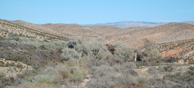
Tassi Ranch, located north of the Grand Canyon in the Mojave Desert, consists of approximately 200 acres of creosote bush ranchland in Grand Canyon-Parashant National Monument. Today, remnants of the early twentieth century ranch stand in the shade of an oasis of cottonwood trees, fed by the Tassi Springs. The ranchers practiced agriculture in the extreme, remote desert, making adaptions that are still visible in the landscape today.

NPS
Tassi Ranch is a rural historic district whose buildings, structures, and other landscape features comprise a unique and intact ranch core in northwestern Arizona, dating from the first half of the twentieth century.
Located on the edge of the Grand Wash in the western portion of the Arizona Strip, which encompasses the lands north of the Grand Canyon, the surrounding desert topography is rough. Steep canyons rise hundreds of feet to flat tablelands above. Immediately to the east are the Grand Wash Cliffs, which rise in a series of steps over 1500 feet to the Shivwits Plateau.

NPS
Tassi Springs was an important stopover for both Native Americans and Mormon traders as they journeyed across the desert. In 1876, it became part of the Pearce Ferry Road that connected St. George, Utah and the Pearce Ferry Crossing on the Colorado River, though use of the road soon declined.
In 1902, the land was withdrawn from public sale as part of the Reclamation Act in preparation for the construction of the Hoover Dam. However, within a year settlers began to claim water rights at the springs and bring their livestock to graze. A stone house and well had been constructed by the spring by 1912.
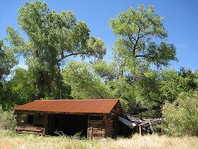
After a string of fraudulent land titles, Ed Yates began occupying Tassi Ranch in 1929. Yates improved the springs and planted crops and shade trees. He constructed the standing ranch house reservoir, corrals, and field irrigation system, which provided a permanent base for a full range of stock-raising functions. The system provided water for cattle and irrigation for pasturage and crops.
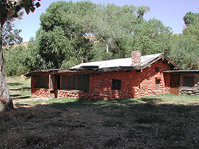
The ranch house is built of rock rather than the log construction typical for the region at the time, and it is likely the same rock that was used in the previous structure. The house was occupied intermittently until 1981. In the 1990s, the National Park Service made a variety of improvements to stabilize the house and landscape.

NPS Photo
Ranchers in the desert adapted to their dry climate by clustering development around available water sources. While outlying ranch features exist, the majority of Tassi Ranch developments are clustered around Tassi Springs, a system consisting of numerous spring heads at the center of the property. Here, buildings, corrals, agricultural fields, irrigation ditches, a row of large cottonwood trees, and other vernacular ranch features remain intact from the first half of the 1900s. These features compose a shady oasis in the extreme desert environment of the Arizona Strip.

NPS
The ranch is organized in a way to best utilize the natural springs. The core area, with its house, barns, corrals, and other features is located adjacent to the springs and on a terrace above the wash, under the shady cottonwood trees.
Above both the core area and the fields are large, generally open pastures enclosed with barbed wire fences. These pastures do not require irrigation and are therefore located upslope from the springs. The agricultural fields at the southwestern end of the site are located furthest from the springs. Thickets of native shrub species have overgrown portions of the site as a result of channeling of the spring.
Many of these features remain today, and represent a unique complex whose elements display local adaptations to the needs of living and running a ranch in the desert environment of Northern Arizona.
Quick Facts
- Cultural Landscape Type: Historic Vernacular Landscape
- National Register Significance Level: Local
- National Register Significance Criteria: A, C
- Period of Significance: 1936-1947
Landscape Links
Last updated: December 30, 2020
