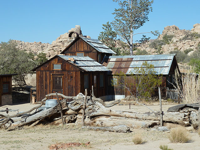
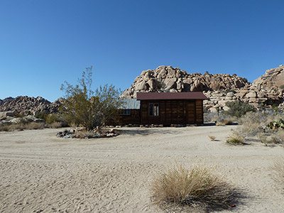
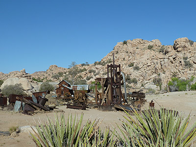
In the high desert country that was to become Joshua Tree National Park, rugged individuals tried their luck at cattle ranching, mining, and homesteading. William F. Keys, prospector and rancher, used the area primarily as a grazing area with limited agricultural use. Keys, the only settler in the area now known as Joshua Tree National Park, gained a comfortable long-term livelihood from his livestock, homesteading, and mining ventures.
Keys and his family were able to sustain a livelihood due to their ambition, independence, self-reliance, and hard work. Keys realized the potential for adversity in the desert, yet he also appreciated its natural beauty and assets.

NPS

NPS
The Keys Ranch Historic District is twenty miles from the Joshua Tree National Park headquarters and visitor center in the town of Twentynine Palms. The landscape is approximately 880 acres, to the west and southwest edges of an approximately 4.5 square mile cluster of large granite outcroppings and boulders called the Wonderland of Rocks.
The Keys Ranch Historic District, a vernacular landscape, contains three National Register Properties: the Desert Queen Ranch, Cow Camp, and the Barker Dam. The historic vernacular character is evident in the materials, design, and workmanship throughout the ranch, represented by the carpentry, stonework, masonry, and metalwork. Basic materials such as igneous rock, lumber, and native plants were used at the ranch, Cow Camp, and Barker Dam. The period of significance begins in 1894, when Keys purchased the land, until Keys's death in 1969.
The district is of local significance (National Register Criteria A and B) for its association with the William F. Keys family and their influence in agriculture and industry (mining) in the Twentynine Palms region of the Mojave desert. Keys began living at the Desert Queen Ranch in 1910 and homesteaded the property in 1918. The ranch district represents one individual's ability, along with his family, to adapt and succeed in settling a challenging environment.
The wide variety of features that remain within the district include the ranch house, ore milling facilities, ranching compounds, agricultural areas, and several dams. The outcome of this development was a ranch that provided a home as well as facilitated the mining and agricultural operations of Keys and his family. The ranch remains a vivid example of the ingenuity, work ethic, and vision necessary to survive in the Mojave desert.
Keys’s occupation of the Desert Queen Ranch and his utilization of Cow Camp and Barker Dam established one of the most successful desert settlements in the region. He raised cattle, horses, burros, and goats; cultivated a fruit orchard, garden, grain crops; had numerous mining ventures; provided supplies and services for numerous other miners; established a local school; and raised a family.

NPS
Cow Camp is of local significance for its connection to the area's ranching history and its association with William F. Keys and his agricultural and ranching influence in the Mojave desert. Located in a small canyon south of the Desert Queen Ranch, the area was first used in 1879 by the "McHaney Gang," a group of rustlers that used parts of what is now known as Joshua Tree National Park in the mid 1800s as shelter and to water cattle. The canyon created a sheltered area for cattle to water and graze. The Barker Dam is within a large canyon containing a water source that was easily dammed. Although other water impoundments existed, the first Barker Dam was built around 1902, replacing the Meyers Dam located further upstream. The dam still impounds water and is a hiking destination for visitors to the park.
The Keys Ranch historic district retains historical integrity through the following landscape characteristics: natural systems and features, spatial organization, cluster arrangement, topography, vegetation, circulation, buildings and structures, cultural traditions, views and vistas, and small scale features.
Quick Facts
- Cultural Landscape Type: Vernacular
- National Register Significance Level: Local
- National Register Significance Criteria: A, B
- Dates of Significance: 1894 - 1969
Landscape Links
- Cultural Landscape Inventory park report
- National Register of Historic Places: Keys Desert Queen Ranch
- National Register of Historic Places: Cow Camp
- National Register of Historic Places: Barker Dam
- Landscape Photo Album (Flickr)
- NPGallery Photos
- Keys Ranch Virtual Tour
- More about NPS Cultural Landscapes
Last updated: January 6, 2020
