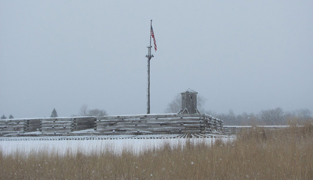
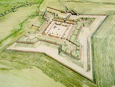
The Fort Stanwix that visitors experience today is relatively modern, built between 1974 and 1976 as a modified reconstruction of the original fort. Located on the site of the historic fort, the construction incorporated historic drawings and archeological studies to replicate the presumed appearance of the fort. The Fort Stanwix landscape has a period of significance between 1758 and 1781, associated with the American Revolution.
The historic Fort Stanwix was sited at the Oneida Carry, a strategic portage known by the Oneida as ”De-O-Wain-Sta.” Fort Stanwix was constructed by the British in 1758 to replace five smaller forts built in the area during the French and Indian War.

NPS / Fort Stanwix National Monument

NPS
Fort Stanwix National Monument is a modified reconstruction based on the conjectural location of the 18th-century earth and timber fort which previously stood on the site. The site is historically significant from 1758 to 1781 for its associations with the American Revolution as the site of Fort Stanwix.
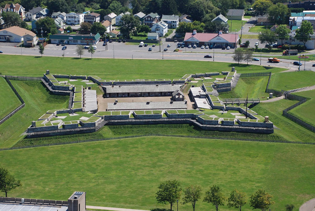
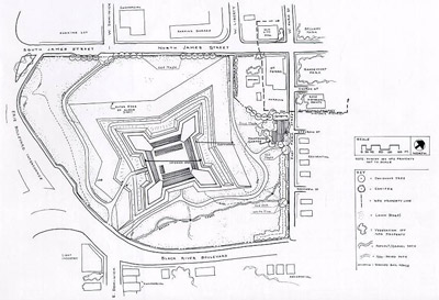
Construction of the recreated fort, which also incorporates modern structural components, began in 1974 and was complete enough in 1976 for the fort to open to the public. Fort Stanwix National Monument occupies a 15.5-acre site in downtown Rome, New York that was cleared through the city’s Urban Renewal Agency in the early 1970s.
The site is bordered by a combination of business and residential areas, developed as part of the city's urban renewal plan. Immediately to the north of the fort is the Gansevoort-Bellamy Historic District, which encompasses Rome’s civic square.

NPS
The existing Fort Stanwix is an earth and timber-clad reinforced concrete structure that replicates how the historic fort may have appeared in 1777. Located on the site of the historic fort, a brick hearth is the only original feature within the construction. The central part of the fort forms a square. Timber and earth pentagonal bastions with flanks of 36 feet and faces of 90 feet extend from each corner.
Outside of this structure, the fort is covered in turf, as is the surrounding property. The outer edges of the fort on the north, south, and west sides are composed of a berm followed by a ditch, a parapet, a low palisade fence, and a glacis. The glacis is the low, gently-sloping outermost earthwork, the outer edges of which are almost imperceptible. The interior of the fort has three freestanding log buildings edging the parade grounds, along with frame casemates that are built into the four outer earthen walls.

NPS
British forces built the original Fort Stanwix in 1758, and in 1781 Americans withdrew permanent garrison. That spring, a combination of heavy rains and fire destroyed much of what was left of the fort's defenses and barracks. Though this ended the fort's military role for the remainder of the war, Fort Stanwix would still have an important role to play in bringing the war to an end. In October of 1784, representatives of the new United States of America and the Six Nations Confederacy met at the ruins of the fort to sign on of the final peace treaties of the American Revolutionary War.
The property is historically significant for its association with the American Revolution as the site of Fort Stanwix. However, the National Register documentation states that only the site itself is eligible for listing, and none of the features on it are historically significant. The cultural landscape is considered non-contributing to the site's significance, and the present fort is also non-contributing.
From its postition on high ground, Fort Stanwix would have offered expansive views of the surrounding areas. The area surrounding the fort was likely cleared in order to provide open views for defensive purposes. These historic views have been lost due to urban development.
The Marinus Willett Center, named for the fort's second-in-command during the 1777 seige, opened to the public in 2005. The facility includes exhibits and audio-visual programs for visitors, as well as secure museum collection storage space.
Quick Facts
- Cultural Landscape Type: Historic Site
- National Register Significance Level: National
- National Register Significance Criteria: A
- National Historic Landmark
- Periods of Significance: 1758-1781, 1768
Landscape Links
- Cultural Landscape Inventory park report
- 40 for 40: 40 short videos to celebrate the 40th anniversary (2016) of Fort Stanwix National Monument opening to the public
- National Register of Historic Places: Fort Stanwix National Monument
- More about NPS Cultural Landscapes
Last updated: April 24, 2022
