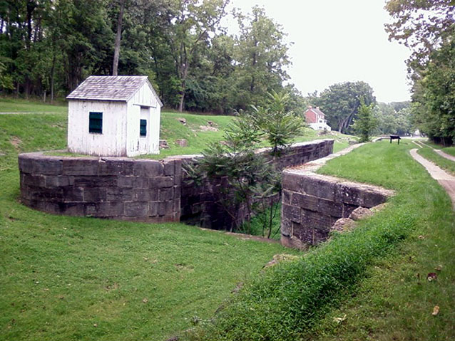
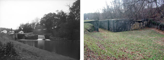
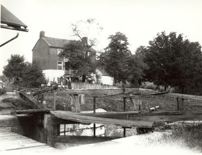
Four Locks, located southwest of Clear Springs, Maryland, is a component landscape of the Chesapeake and Ohio Canal. In addition to sharing in the historic significance of the wider canal landscape, Four Locks is notable as an example of one of the canal communities that developed alongside the waterway. The landscape still contains many features that reflect the historic period, showing how the community followed the rising and falling success of the canal.
When the canal company began to build the four locks across Prather's Neck, it expanded the industrial and commercial land use of the area. Land acquisition began in the 1830s, and the construction of Locks 47-50 began in February 1836.

NPS
Four Locks is centered on the Chesapeake & Ohio Canal, bordered to the north by the Western Maryland Railroad and to the south by the Potomac River where it meanders around the curving peninsula known as Prather's Neck.
The National Park Service manages a large portion of the landscape as part of the Chesapeake and Ohio Canal National Historical Park, while an area located on Prather’s Neck is owned either by the state of Maryland or by private individuals. The Chesapeake and Ohio (C&O) Canal was listed on the National Register of Historic Places in 1979, recognized for its importance in areas of architecture, engineering, commerce, transportation, conservation, and military history during the period 1828–1924.

NPS
The period of historic significance for the Four Locks component landscape is the same as for the C&O Canal: 1828 to 1924, which spans the canal’s construction, operation, decline, and final closure. Like the rest of the canal, Four Locks reflects the ascent of canal-based transportation and its ultimate decline in nineteenth-century America and provides evidence of how this landscape and its events have made a significant contribution to the broad patterns of history. Illustrative of vernacular and industrial stone construction, the canal landscape also contains individual resources that embody the distinctive characteristics of a type, period or method of construction.

NPS
While the Four Locks cultural landscape is historically significant in the same ways as other parts of the C&O Canal, it also has an additional element of importance. The canal gave rise to several communities that rose and fell alongside the fortunes of the waterway. The Four Locks community was positioned to connect the canal to larger towns of Williamsport and Hancock, and it grew to support three stores/warehouses, a school, a post-office, and a bakery.
Most of the residents of Four Locks had a connection to the Canal Company. The tight-knit community of families formed, grew, and was sustained by the canal, and with the demise of the canal came the decline of the community. Today, the landscape of Four Locks retains many elements that stand as reminders of this period, including buildings, the historic circulation system, and spatial organization.
While there have been some changes to the landscape, particularly in the vegetation and the loss of some features, the overall integrity of Four Locks is high and the landscape invokes its historic character.
Quick Facts
- Cultural Landscape Type: Vernacular
- National Register Significance Level: National
- National Register Significance Criteria: A,C
- Period of Significance: 1828-1924
Landscape Links
Last updated: October 7, 2021
