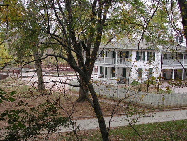
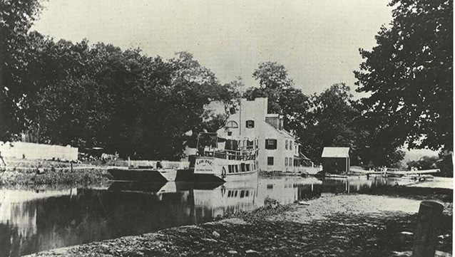
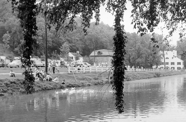
The Great Falls Tavern component landscape contains historic structures and features relating to both the Chesapeake and Ohio Canal and the Washington Aqueduct. The landscape was transformed in the 1800s by the construction of the canal. As the use of the canal declined, the use of the Great Falls area shifted towards recreation and interpretation of the area's history.
Initially a remote and undeveloped locale patented primarily for use as an area for hunting and fishing, the site changed dramatically with the start of canal construction in 1828 and the building of the Washington Aqueduct.

NPS
The Great Falls Tavern component landscape is located on the east bank of the Potomac River in Maryland, approximately fifteen miles northwest of Washington, D.C. This cultural landscape contains historic structures relating to both the canal and to the Washington Aqueduct, along with a modern concession stand and interpretive/recreational trails.

NPS
The site is defined by its periods of development, beginning in the early eighteenth century. The landscape was primarily industrial and commercial until the closing of the canal in 1924, when it became known as a recreational destination. The National Park Service took over the property in 1938, interpreting the canal history of the site and furthur developing the recreational features of the landscape.
The historic significance for the Great Falls Tavern component landscape is in line with that of the wider canal landscape, with the landscape reflecting the ascent and eventual decline of canal-based transportation in nineteenth-century America. Its historic period of significance, 1828-1924, includes the construction and operation of the C&O Canal and the Washington Aqueduct, as well as the rise of the site as a tourist destination.
When the Chesapeake and Ohio Canal National Historical Park was listed on the National Register of Historic Places in 1979, the Great Falls Tavern landscape was not adequately documented in the nomination. Additionally, the Washington Aqueduct is a National Historic Landmark and a major nineteenth-century engineering feat. These important aspects of the landscape are addressed in the Cultural Landscape Inventory report (below).

NPS
The canal and its associated features, such as the canal locks, the towpath, and lock houses, provide evidence of the technology of nineteenth-century canal construction. Moreover, the expansion of Lock House 12 into a tavern illustrates the economic, technological, and social importance of the Six Locks area.
Located along the C&O Canal, the Great Falls Tavern area was a vital industrial and commercial landscape in the mid-nineteenth century. Following a major flood of 1889, this aspect of the site began to decline, and tourism became more prominent. After the flood of 1924, the canal was not repaired, and it no longer functioned as a viable commercial enterprise.
Around this time, hiking trails, a trolley line, and bridges out to the mid-river island facilitated visitor recreation. The tavern became a private social club (1913-1925). The impressive view of the Great Falls, some historic trails, and remnants of the trolley track bed at Great Falls Tavern continue to illustrate the importance of the area as a tourist destination.
The historic tavern building now serves as a visitor center, and park employees offer interpretive canal boat rides between April and October. Several mid-river islands are also a part of this landscape. Olmsted Island is accessible by footbridge and provides views of the Great Falls of the Potomac.
Quick Facts
- Cultural Landscape Type: Historic Site / Vernacular
- National Register Significance Level: National
- National Register Significance Criteria: A, C, D
- National Historic Landmark (Washington Aqueduct)
- Period of Significance: 1828-1924
Landscape Links
Last updated: October 7, 2021
