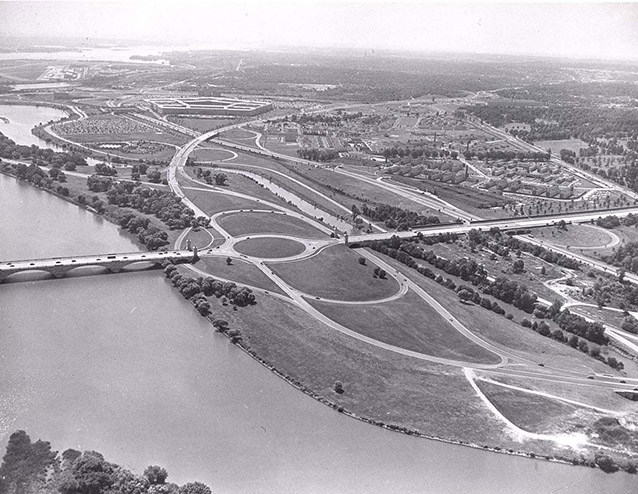
Lady Bird Johnson Park is a constructed island that extends along the Virginia shore of the Potomac River. Originally known as Columbia Island, the island was created between about 1915 and 1930 to serve as the western terminus of Arlington Memorial Bridge and a symbolic entrance into the nation’s capital. It is a unique landscape within the wider, nationally significant areas of the Mount Vernon Memorial Highway and the George Washington Memorial Parkway.
"The essential consideration is that Columbia Island shall be so treated as to be a constituent part of one large composition. It should not be suffered to fall from this intended high estate into a mere thoroughfare.” Commission of Fine Arts Chairman Charles Moore to U.S. Grant III, Chairman of the Arlington Memorial Bridge Commission

NPS
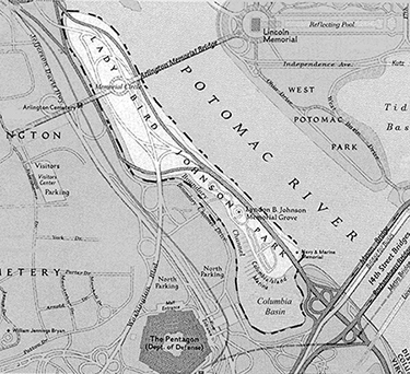
A traffic circle, known as Memorial Circle, marks the place where the bridge axis intersects with two roadways. The Mount Vernon Memorial Highway was mostly completed by 1932 and connects Arlington Memorial Bridge and Mount Vernon. The George Washington Memorial Parkway, completed in 1965, extends from Arlington Memorial Bridge to the Capital Beltway, I-495.
Two pairs of classical pylons flank Memorial Circle on the east and west, framing the entrances to Arlington Memorial Bridge and Memorial Avenue. The island is traversed by a complex system of roadways that includes ten bridges, many of them faced with granite.
Much of the undulating terrain is covered by lawn. Groupings of deciduous and evergreen trees frame and define views for motorists and pedestrians. Numerous native tree species have been retained.

NPS (MRCE, Abbie Rowe)
Two constructed water features define the western boundary of the island. The narrow Boundary Channel flows from the river at the north end of the island, passing between the island and the Virginia shore and emptying at the south into the artificial Columbia Lagoon. The flow of the channel reverses during the incoming tide. The small Columbia Marina is situated on the eastern shore of the basin, opposite the Pentagon.
The Navy-Marine Memorial, an aluminum sculpture depicting sea gulls flying over a curling wave, was constructed in the 1920s to honor sailors lost at sea and moved to the site in 1934. A component landscape, the Lyndon Baines Johnson Memorial Grove on the Potomac, was built in the 1970s in memory of the late president. The Memorial Grove is clearly delineated from the rest of the island and encompasses a secluded meadow area, white pine grove, and an open plaza with a large stone monolith.

NPS
A succession of landscaping and development plans were prepared for the island over the years. About 75 flowering trees were planted along Mount Vernon Memorial Highway on the south end of the island in the early 1930s, and grass was seeded for lawns. No extensive landscaping was carried out on the island until the 1950s, which allowed native riparian growth to became established, particularly along the shorelines.
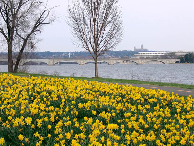
In the 1960s, landscaping of the entire island was undertaken as part of the Johnson administration's Beautification Program, and a planting plan was developed by landscape architect Edward D. Stone. Large drifts of daffodils and flowering dogwoods were planted, with the initial efforts focused on developing the area around Memorial Circle.
Over the last 30 years, the Stone plan has been implemented in phases. Thousands of the original dogwoods have been lost, and daffodil beds have been altered and thinned. Locally native species of trees of similar character have been substituted for some that have failed to thrive.
The landscape's historic period of significance begins in 1915, the year when deposition of dredged material for the island is believed to have begun, to 1979, the date of the last known revision and implementation of Edward Durell Stone, Jr.'s planting plan. This period includes construction of the island and all its major features, including roads, bridges, and the two memorials. It is also associated with the Beautification Program (1964-1968) and conception and initial implementation of the Stone planting plan, developed under that program.
Quick Facts
- Cultural Landscape Type: Designed
- National Register Significance Level: National
- National Register Significance Criteria: A, C
- Period of Significance: 1915-1977
Landscape Links
Last updated: October 8, 2021
