"We are now in beautiful country. In every direction, yellow fields of grain extended themselves; on every farm were droves of the fattest cattle, gardens thronged with inviting vegetables; orchards pave a promise of bounteous fruit yield..." Description of the landscape by a South Carolina officer crossing into Maryland, 1863.
NPS
NPS
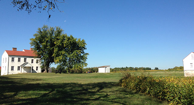
The Monocacy National Battlefield landscape is located about three miles south of Frederick, Maryland, thirty miles northwest of Washington, D.C., and about forty miles from Baltimore. This cultural landscape comprises the park, which is approximately 1,650 acres in size and contains historic structures, interpretive/recreational trails, and a small museum located in the visitors center.
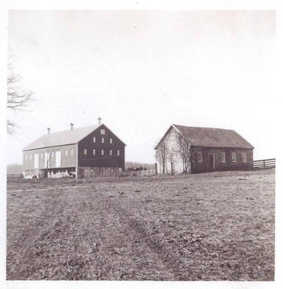
The battlefield properties form a significant cultural resource reflecting three centuries of occupation and development around the historic crossroads, positioned at a convergence of river, roads, and railroad. The fertile soil and available waterpower enticed a variety of investors and families who settled here, interacted, and developed the agricultural character of the rural landscape.
Against this backgrop, events of the Civil War unfolded across the summers of 1862 and 1863, culminating in the Battle of Monocacy in July of 1864. Later, as veterans groups and other organizations memorialized and commemorated the site throughout the twentieth century, these contributions have become another aspect of the cultural landscape. The two periods of significance for Monocacy National Battlefield landscape are 1860-1890, when the agricultural properties acheived their historic appearance that set the scene for the Civil War events, and 1890-1934, marking the period of memorialization and commemoration.
NPS
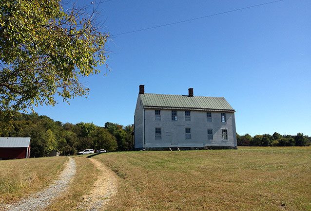
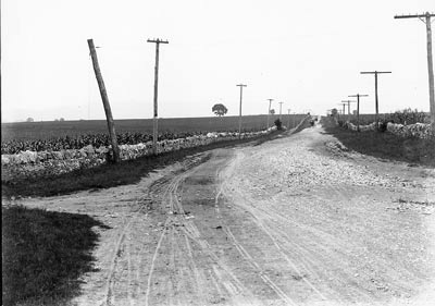
Located at the western edge of the piedmont, the primarily agricultural landscape includes both riverside bottomlands and steep bluffs. Thick riparian vegetation borders both the river and a major tributary, Bush Creek. Fence lines and roads, modern and historic, divide and connect the battlefield landscape. The historic route of the Baltimore and Ohio Railroad (now CSX Railroad) passes through the park near its northern boundary, paralleling both the river and Bush Creek.
In NPS Monocacy National Battlefield Cultural Landscape Inventory report
The park landscape is defined by patterns of development that occurred from the mid-eighteenth century and continue to the present day. During the eighteenth century, speculators, frontiersmen, and early settlers gave shape to the landscape by mapping and patenting tracts and clearing areas for cultivation.
The nineteenth century brought the rise of milling, the development of a transportation system of turnpikes and railroads, and agricultural innovation, leading to an extended period of prosperity. This prosperity was only slightly affected by the Civil War and the Battle of Monocacy. However, due to the impact of this event, the existing agricultural landscape would acquire a commemorative overlay in the form of monuments and the eventual creation of a national park. The twentieth century then gave rise to an increasingly suburban landscape.
NPS
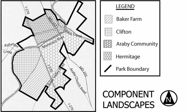
The landscape contains four component cultural landscapes, which contribute to the significance of the park as a whole while also being defined by individual histories and characteristics.
Quick Facts
- Cultural Landscape Type: Historic Site / Vernacular
- National Register Significance Level: National
- National Register Significance Criteria: A
- National Historic Landmark
- Period of Significance: 1860-1890 and 1890-1934
Landscape Links
Last updated: October 8, 2021
