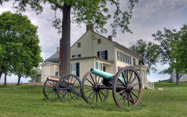
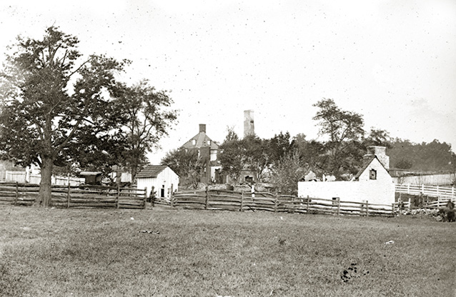
The current Mumma Farm consists of nearly all of the property that was associated with the Samuel Mumma Farmstead at the time of the Battle of Antietam (Sharpsburg) on September 17, 1862. The contemporary park tour road system, which provides access to the landscape, follows parts of historic roads that traverse sections of the farm.
During the Battle of Antietam, the Mumma farm buildings were the only properties in the area intentionally destroyed during the fighting.

NPS
The Mumma Farmstead consists of a cluster of domestic and agricultural outbuildings arranged on a ninety-degree turn in Mumma Lane, which connects the farm with Smoketown Road and the Sunken Road, better known by its Civil War moniker "Bloody Lane." The buildings include the main farm house and large bank barn, both of which were constructed less than a year after the original structures were burned by Confederates during the Battle of Antietam, as well as numerous smaller outbuildings.
Farm fields surround the main building group on all sides, extending to the north boundary along the Smoketown Road, to the east boundary with the historic Roulette Farm, and to the south along “Bloody Lane.” The farm landscape can be explored on foot from the park's visitor center that is located at the western edge of the property.
The western portions of the farm, bounded roughly by the old Hagerstown and Sharpsburg Turnpike, have undergone some changes. The visitor center now occupies a prominent knoll that played a critical role in the battle. The landmark Dunker Church, a reconstruction, stands across the turnpike on a residual piece of property that was donated by Samuel Mumma in the 1850s.

Alexander Gardner, Library of Congress (2018671846)
The landscape's integrity is very good except for the changes along the western boundary. The farm has remained in agricultural use since the time of the Battle and retains much of its original historical appearance. The 1960s visitor center and numerous stone monuments and memorials are the only major visual changes, and the latter date from the period of commemoration of the battle.
Quick Facts
- Cultural Landscape Type: Vernacular
- National Register Significance Level: National
- National Register Significance Criteria: A
- Period of Significance: 1761-1933
Landscape Links
Last updated: January 13, 2026
