The construction of Rim Drive was central to efforts of the National Park Service and the Bureau of Public Roads to develop Crater Lake National Park. The landscape's period of historic significance, 1926 to 1941, reflects the planning and design efforts of this development. With work relief funding from the federal government, the road and its associated features were designed to provide access to the area's unique scenic features while also blending into the area's natural character.
The Rim Drive plan included the development of “stations” where certain views helped visitors appreciate “elements derived from the geological story of Crater Lake and those arising from elements of pictorial beauty.” John C. Merriam, from "History of Rim Drive," Crater Lake National Park, pg. 18

NPS

NPS/ Gjesfjeld
Rim Drive is located in Crater Lake National Park in southwestern Oregon. Built by the Bureau of Public Roads (BPR) and the National Park Service (NPS) with federal work relief funding in the 1930s, the 31.6 mile Rim Drive Historic District and its associated 4.9 miles of hiking trails are at the center of the park’s vehicular and pedestrian circulation system during the busy summer season.
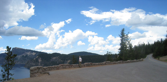
The road is circuitous, aligned around the lake starting from the junction at Rim Village and traversing clockwise to Park Headquarters in Munson Valley. Designed to highlight the natural beauty of the lake, Rim Drive was sited to avoid impinging on the splendor of the setting, the rugged surroundings shaped by the cataclysmic eruption of Mount Mazama, which occurred more than 7,700 years ago. Constructed to primarily provide vehicular access to scenic features, the road provides numerous observation stations, substations, and parking areas with views and constructed vistas of Crater Lake, its geological formations, and surrounding environs.
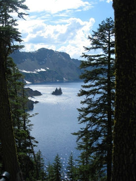
Viewed from the rim, the intense color of the lake is striking, framed by the caldera walls that tower from 550 feet to 1,900 feet above the surface. While much of the area around the lake and its immediate surroundings is heavily forested, distant peaks and other topographic features that are characteristic of this portion of the Cascade Range can be seen from Rim Drive.

NPS / Gjesfjeld
The approximately 250-acre historic district was listed on the National Register of Historic Places in 2008 and is significant for its association with the history and development of Crater Lake National Park. Rim Drive is also significant for its association with landscape architects and engineers who produced an outstanding example of blending naturalistic and functional design elements.
The Rim Drive Historic District can be divided into five segments, corresponding to the chronological order that the road was constructed. The stopping places along each segment were designed to provide information and highlight natural features that were visible from each location. The observation stations were intended as formal stops on a ranger-led caravan of vehicles, and the subsations were intended as stops that motorists could make on their own. The design also included parking areas, where motorists might stop to enjoy the view, although these locations did not offer the optimal illustrations of geological processes and natural features.
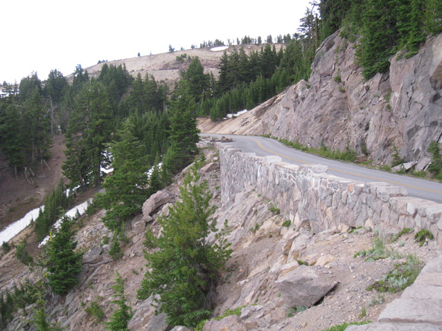
The linear designed landscape also encompasses slope treatments, cuts, fills, planting beds, as well as road-related structures such as retaining walls, culverts, spillways and curbing.
Quick Facts
- Cultural Landscape Type: Designed
- National Register Significance Level: State
- National Register Significance Criteria: A, C
- Period of Significance: 1926-1941
Landscape Links
Last updated: November 19, 2020
