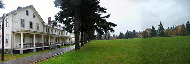
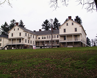
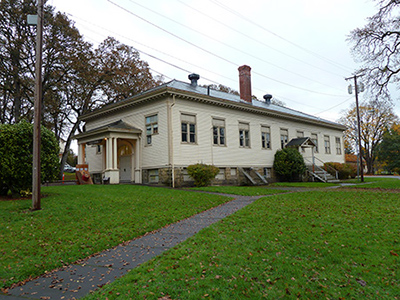
The East Barracks/Parade Ground is an approximately 38 acre designed historic landscape central to the Vancouver Barracks, developed by the U.S. Army between 1849 and 1947. This landscape includes the Parade Ground and the East Barracks and was listed on the National Register in 2007 as part of the Vancouver National Historic Reserve Historic District.
"The fort is now surrounded by the Garrison of American troops under General Harney of San Juan renown; alas the poor old Fort once the great depot of all the western fur trade is now sadly shorn of its glories..." Charles Williams Wilson, a royal engineer with the British Northwest Boundary Commission, May 1, 1860

NPS

NPS
The Parade Ground is a large, roughly rectangular, open lawn running east west across the northern portion of Fort Vancouver National Historic Site. The flat terrace is punctuated with mature trees and a bandstand. The edges are marked by roads and walkways, historic U.S. Army buildings, trees, and fences. Historically, the Parade Ground was developed for army drills, ceremonies, and recreation. Today, it is used as a public park for community events, picnicking, and recreation.
The East Barracks is the portion of the Vancouver Barracks located to the east of Fort Vancouver Way (historically known as McLoughlin Road), a historic roadway that came to define the west edge of the Parade Ground. The East Barracks includes sixteen contributing structures built between 1904 and 1941. The development of the East Barracks is representative of a typical army posts with buildings clustered according to function. Buildings contained within the Vancouver Barracks and Officers’ Row reflect military architecture from a variety of periods, including the 1880s, 1910s, 1930s, and 1940s.

NPS
The edges of the East Barracks/Parade Ground are clearly defined by roads, buildings, fences, and vegetation. An S shaped road constructed by the NPS as part of its Mission 66 era development defines the eastern edge. The north edge is defined by Evergreen Boulevard and Officer’s Row. The western boundary follows Fort Vancouver Road. The southern boundary follows East 5th Street.
The period of significance for the East Barracks/Parade Ground extends from 1849 through 1947. In 1849 the U.S. Army began construction of four log buildings: an 11-room log building for the officers (Grant House), kitchen/servants’ quarters, mess hall/kitchen, and hospital kitchen/bakehouse. Many HBC structures were rented to house officers and provisions. By 1851, the U.S. Army completed buildings on three sides of the area that would become the Parade Ground, defining its shape and size. The East Barracks/Parade Ground was further developed over time with other buildings, fences, paths, and formal plantings. The Parade Ground became the location for U.S. Army drills, ceremonies, and recreation. The East Barracks/Parade Ground played significant roles during the Pacific Northwest Indian Wars, the Spanish American War, World War I, and World War II. By the end of the period of significance, 1946, the post began reporting to Fort Lewis and the Vancouver Barracks ceased to play an important role in national military affairs.
Quick Facts
- Cultural Landscape Type: Historic Site / Designed
- National Register Significance Level: National
- National Register Significance Criteria: A,B,D
- Period of Significance: 1849-1947
Landscape Links
- Cultural Landscape Inventory park report
- National Register of Historic Places: Fort Vancouver National Historic Site
- Library of Congress: American Memory Collection
- Landscape Flickr Album
- NPS Photo Gallery
- More about NPS Cultural Landscapes
Last updated: December 21, 2020
