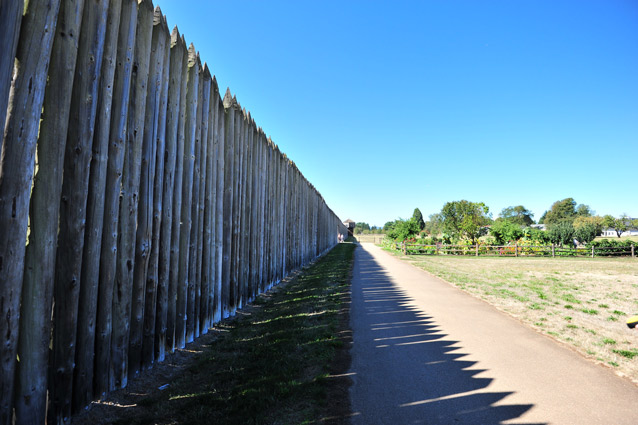
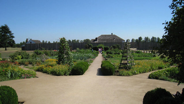
The Fort Vancouver landscape that visitors experience today is a reconstruction, based on archeological records, drawings, and other historic evidence. The Hudson's Bay Company (HBC) established its first settlement in the area in 1824. Positioned on the Columbia River, it played a significant role in Great Britain's attempts to establish control of the natural resources of the Pacific Northwest. The self-sustaining settlement developed into a hub of industry, agriculture, and trade operations.
"On the banks of the Columbia River...where the soil and climate are favorable to cultivation, we are directing our attention to agriculture on a large scale, and...we shall soon be able to establish important branches of export trade..." Recorded by George Simpson, 1837, in service with the Hudson's Bay Company and Governor of the Northern Department
NPS
NPS
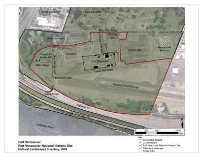
Fort Vancouver is a component landscape within Fort Vancouver National Historic Site, which is part of a larger reserve called the Vancouver National Historic Reserve (VNHR), which encompasses lands owned and managed by multiple government agencies and private land owners. In 2007, the VNHR Historic District was listed on the National Register of Historic Places.
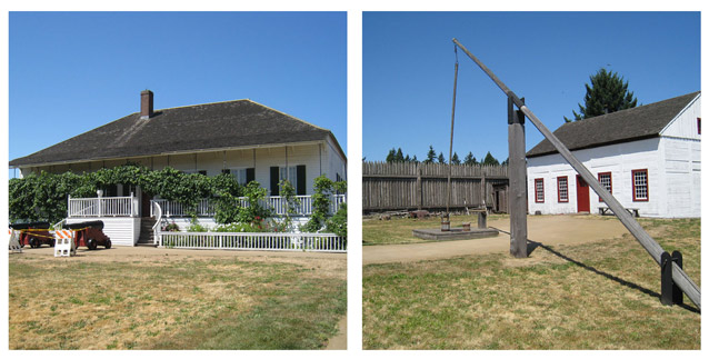
As part of the VNHR Historic District nomination, Hudson’s Bay Company (HBC) archeological resources were listed under Criterion A for their association with the company’s occupation and activities in the area and under Criterion D for archeological resources dating to the HBC era. HBC resources span across property owned by several government agencies, however, the core of the Fort Vancouver development (the stockade and employee village) is located on NPS property. Since the 1960s, the NPS has been incrementally reconstructing the buildings, structures, and landscape features associated with the HBC era of development.
NPS
The reconstruction of Fort Vancouver was mandated by Congress in 1966. Although the reconstruction is ineligible for the National Register, it is managed as a cultural resource to reflect the Hudson’s Bay Company era of occupation. The HBC fort was the first trading post in the Northwest and greatly influenced settlement of the region.
The historic era for the HBC, as established by the 2007 National Register Nomination, is 1824-1860, beginning when the HBC established its first settlement in 1824 and ending in 1860 when they left the area and it was assumed by the U.S. Army.
NPS
Following the HBC’s departure in 1860, the fort was partially razed by the U.S. Army and the remainder was destroyed by a fire in 1866. Between 1860 and the start of NPS ownership in 1948, the area was used for the U.S. Army’s World War I Spruce Mill operation, a Civilian Conservation Corps (CCC) camp, the Pearson Field runway, and other U.S. Army developments.
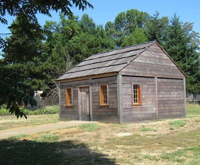
Since 1947, numerous archeological investigations have uncovered data from the HBC era that has informed the reconstruction of the fort and employee village. Enough of the Fort Vancouver buildings, structures, circulation routes, agricultural fields, and orchard plantings have been reconstructed to effectively convey the historic association, feeling, workmanship, materials, and design of an HBC-era fort. Today, the Fort Vancouver cultural landscape reflects the Hudson’s Bay Company development at its peak in 1845.
NPS
The setting has undergone the most change with the development of the Burlington Northern Railroad berm, Highway 14, and Interstate 5, which have created physical and visual barriers between the fort, the Columbia River, and downtown Vancouver.
Quick Facts
- Cultural Landscape Type: Historic Site
- National Register Significance Level: National
- National Register Significance Criteria: A, D
- Period of Significance: 1824 - 1860
Landscape Links
Last updated: December 21, 2020
