Last updated: October 12, 2021
Article
Stream Communities & Ecosystems Resource Brief for the Arctic Network

NPS/Ken Hill

Status and trends of streams and rivers in the Arctic Network
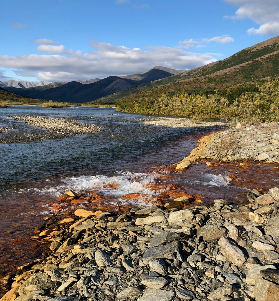
Stream flow has changed in recent decades at monitoring sites near the Arctic Network. The timing of peak discharge during spring snowmelt now occurs nearly 10 days earlier than it did 30 years ago. The Kobuk River is now re-freezing later in fall than it did in the 1980s. In headwater streams of the Arctic Network, permafrost thaw is changing watershed hydrology, causing streams to cool and discharge to decline during summer months.Water quality data from 2013 to 2019 indicate that most streams and rivers in the Arctic Network are pristine with respect to carbon, nutrient, and trace metal concentrations. However, stream chemistry is shifting in response to climate change and landscape disturbances in the Arctic Network. For instance, permafrost thaw is driving changes in the concentration, chemical composition, and age of dissolved organic matter in streams. Old carbon released from thawing permafrost is being taken up by stream food webs and appears to affect productivity of juvenile fish. Permafrost thaw is also releasing iron from soils to streams, causing water color to change from clear to orange. At one monitoring site, this shift in stream color was associated with acidification and loss of biodiversity. Tundra fires in the Arctic can also impact stream water quality by transporting large amounts of nutrients from burned soils to streams.
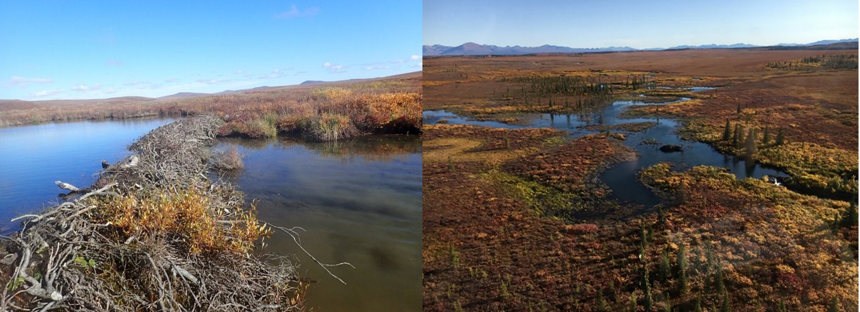
Many streams in the Arctic Network are also being affected by beavers, which have expanded their range dramatically in recent decades. Beavers build dams that block stream flow, create ponds, and flood nearby soils. Monitoring data indicate that Arctic beaver ponds are hot spots for the formation of toxic methylmercury, which can be taken up by stream food webs. Beavers may also impact drinking water quality through the spread of diseases such as Giardia and Cryptosporidium in some stream reaches.

NPS/Jon O’Donnell and USGS/Michael Carey

NPS/Jon O’Donnell
Why large Arctic streams and rivers are important
Streams and rivers are critical natural resources of the Arctic Network in northern Alaska. Arctic rivers transport large amounts of water, carbon, nutrients, and sediment from headwater streams through larger rivers to the Arctic Ocean. Along their flow paths, Arctic rivers emit large quantities of greenhouse gases, like carbon dioxide and methane, to the atmosphere. Arctic streams also serve as important habitat for a variety of fish species, including Arctic Grayling (Thymallus arcticus), Dolly Varden (Salvelinus malma), Pacific salmon (Oncorhynchus spp.), and whitefish (Coregoninae). Rivers support local communities in Arctic Alaska, where people rely on rivers for drinking water, transportation, and subsistence fishing and hunting activities.What we want to know about streams and rivers
- Long-term trends in stream flow and temperature at designated sites within or adjacent to Arctic Network lands
- Trends in chemical composition of stream water over space and time
- Effects of changing hydrology (discharge, temperature) and chemistry on stream biota
- The vulnerability of streams to climate change and landscape disturbances in the Arctic

NPS/Jon O’Donnell
How we monitor streams and rivers
- We monitor long-term trends in stream flow using discharge data from six U.S. Geological Survey gages adjacent to Arctic Network parks. At a subset of headwater streams, we continuously monitor discharge during summer months. At all monitoring sites, we use a qualitative approach to categorize stream flow.
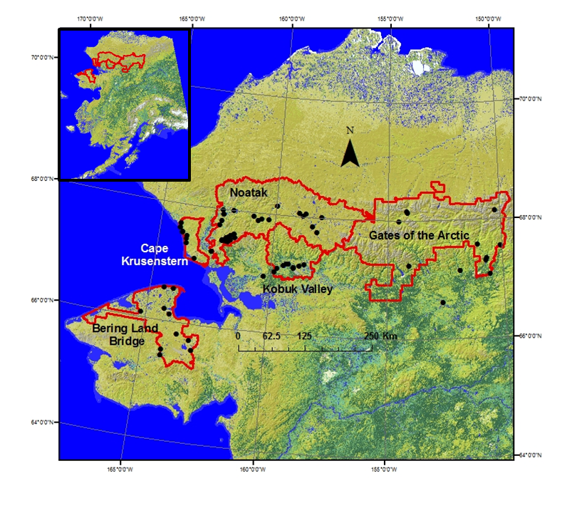
- We monitor stream temperature and water quality at 25 streams and rivers. These monitoring sites include streams that drain different watershed types (e.g., different soil types and permafrost conditions) and all seven National Wild & Scenic Rivers within the Arctic Network.
- We monitor stream water quality (temperature, pH, conductivity, dissolved oxygen) using multi-parameter sensors. We collect stream water samples to quantify concentrations of carbon, nutrients (nitrogen and phosphorus), major ions, and trace metals. We monitor stream productivity by conducting field measurements of benthic (streambed) algae and chlorophyll-a concentrations.

NPS/Jon O’Donnell
How monitoring streams and rivers can help park managers
Stream monitoring in the Arctic Network provides critical data and observations for park managers. Streams integrate hydrological and chemical signals from their surrounding watershed, and stream monitoring data reflect broader changes to Arctic ecosystems. Stream monitoring can provide critical information about drinking water quality, flooding and drought, and changes to fish habitat. Stream monitoring also provides data to test hypotheses on climate warming and landscape dynamics to understand these changing Arctic ecosystems. Outreach and interpretive products from stream monitoring will educate and inform the public about stream ecosystems, climate change, and other emerging concerns.
For more information, contact:
Jon O’Donnell
e-mail us
907-644-3696
