Last updated: April 21, 2021
Article
The Sierra Nevada Monitor: Spring 2021
NPS / Kelly Martin
In 2020, we adapted our lives, our work, and our field season to a global pandemic, and from August through October, we shifted gears again, as smoke, evacuations, park closures, and severe impacts on giant sequoia groves occurred from local wildfires. Now we're taking what we learned and planning for another different kind of field season in 2021. To learn more, and for additional news, read articles on:
- Impacts of wildfires on Sierra Nevada Network Parks
- Windstorm topples 15 giant sequoias in Yosemite's Mariposa Grove
- Field season 2021
- Farewell to valued colleagues
- Welcome to new park superintendents and our budget analyst
- Recent publications
- Bust of César E. Chávez loaned to White House
The Sierra Nevada Monitor is the newsletter for the Sierra Nevada Inventory and Monitoring Network.
Severe Wildfires Have Major Impacts on Sierra Nevada Network Parks
Castle Fire Kills Giant Sequoias and Triggers Evacuations (of People, Data, and Archives)
The 2020 Castle Fire (part of the SQF Complex Fire) started from a lightning strike on August 19 in Sequoia National Forest and later burned into the southern portion of Sequoia National Park. Firefighting teams worked to contain the fire, however, a combination of fuels, topography, and weather resulted in high fire severity in some areas. Hazardous and smoky conditions hampered fire control efforts, and many fires burning at once across the state competed for fire-fighting resources. Sequoia National Park closed September 15-30 to ensure visitor and resource protection, as many park staff had been evacuated. Kings Canyon National Park closed from September 17-23 due to smoke and hazardous air quality. When the fire was declared contained in December, it had reached over 171,000 acres in size, and nearly 19,000 acres burned in Sequoia National Park.
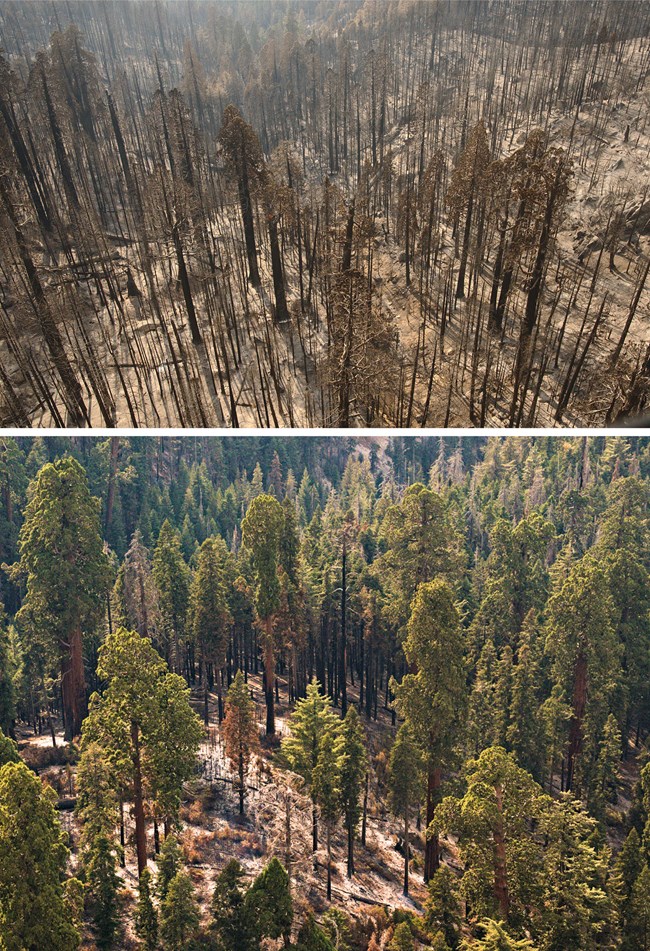
NPS / Anthony Caprio (taken on a November 2, 2020 helicopter survey of burned areas in the South Fork Kaweah River drainage, Sequoia National Park)
Fire Kills Unprecedented Number of Large Giant Sequoias
In the past, when a fire burned through a giant sequoia grove, we would expect to see death of mostly small and medium-sized trees; occasional patches of high severity fire would burn areas of denser trees or more fuel. However, since 2015, a series of four fires have killed many more mature giant sequoias (trees larger than four feet, or 1.2 meters, in diameter) than past fires. The Castle Fire burned 22 giant sequoia groves on National Park Service (NPS), U.S. Forest Service (USFS), and private lands, and killed an unprecedented number of large sequoia trees. An estimated 340 were killed in Sequoia National Park, and between 2000 and 2500 in USFS groves. Thus an estimated 3-4 percent of the entire population of large sequoias may have been lost in one fire.
Fire severity varied depending on grove fire history and location. Groves on warmer and drier south-facing slopes, and with no recent fire, sustained extensive mortality of monarch giant sequoias. Other groves, growing on cooler, more moist north-facing slopes or having recent history of fire had more mixed and moderate fire severity or limited fire spread.
Overall fire severity was low to moderate in the 12 NPS groves burned, and in these areas the fire is expected to have restorative effects – reducing fuels, thinning smaller tree densities, and increasing seedling establishment. However, in the approximately 13 percent of the grove area that burned at high severity, where hundreds of large sequoias were destroyed by fire, there are questions about whether enough trees remain to establish seedlings again. On neighboring USFS lands, 35 percent of sequoia grove acres burned (in 10 groves), 61 percent of those at high severity.
Factors that contributed to more severe fire, and increased death of these fire-adapted trees include: 1) decades of fire suppression; 2) drought-related mortality of non-sequoia tree species that added to existing fuel loads; and 3) warming temperatures. The data presented in this article are from aerial surveys and estimates or modeling of numbers of dead trees. Ground surveys will be done to more fully document fire effects in sequoia groves this summer.
NPS
Evacuations: Staff, Data, and Collections
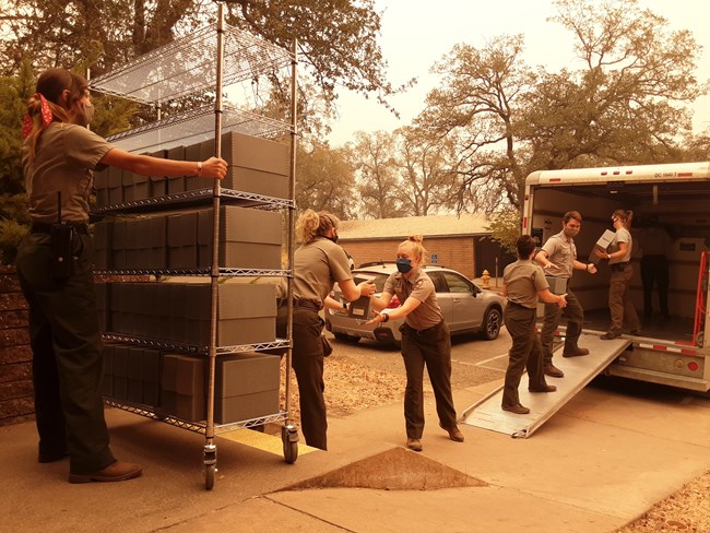
When the Castle/SQF Complex Fire caused the headquarters of Sequoia and Kings Canyon National Parks and surrounding community to be placed under evacuation warning on September 14, we moved quickly to secure not only our homes and personal belongings, but critical data. When evacuating our field station, we prioritized removing the data backup unit and plant vouchers associated with our wetland monitoring protocol. We then joined park staff in evacuating irreplaceable archival materials from the museum at park headquarters, including the entire herbarium collection. This was made possible due to the rapid response of library staff at University of California Merced, who mobilized at a moment’s notice to move the collections to safe storage on their campus, and participation of over a dozen park staff who helped pack and move the materials.
Sierra Nevada Network Ecologist Jonny Nesmith and Data Manager Alex Eddy lived in mandatory evacuation zones, so both were evacuated from their homes, and the rest of us had our bags packed. Many residents left for weeks due to smoke impacts ranging from unhealthy to hazardous. While the fire remained some miles away from our community of Three Rivers outside of Sequoia National Park, many structures were lost in communities south of the park.
Creek Fire Threatened Yosemite National Park and Devils Postpile National Monument
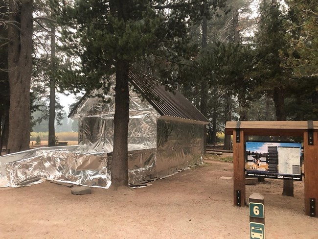
The Creek Fire started on September 4th near Shaver Lake in the Sierra National Forest. At 379,895 acres when declared contained in December, it was the fourth-largest wildfire in modern California history, and the largest single fire not part of a greater complex. The fire threatened both Yosemite National Park and Devils Postpile National Monument but did not end up burning into the parks. There were several days early in the Creek Fire when Yosemite staff thought the fire threatened the Mariposa Grove and Wawona community, and there was potential for it to burn into Devils Postpile. Park staff cleared fuels around monarch sequoias in the Upper Grove that had no recent prescribed fire, and on NPS lands in Wawona. In Devils Postpile, firefighters cleared fuels around all buildings. At both NPS sites, historic buildings were wrapped with fire-resistant material. Hazardous air quality and smoke levels disrupted operations throughout Yosemite, including one week of park closure (September 17-25). Devils Postpile closed on September 7th due to both hazardous air quality and the threat of the fast-moving fire, and it effectively remained closed until December 7th when the road to the monument through the Inyo National Forest re-opened.
NPS / Chad Drew
Windstorm Topples 15 Giant Sequoias in Yosemite's Mariposa Grove
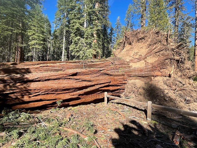
On January 19th, a fierce Mono windstorm struck Yosemite, knocking down trees and damaging cars, homes, and other infrastructure. At least 15 giant sequoias were toppled in the Mariposa Grove, ranging in size from 4 to 9 feet in diameter. Seven fell in the Upper Grove, where some may have caught high winds near the ridgetop; fourteen of the 15 trees grew near a wetland, where sequoias can have shallow root systems in the saturated soils, making them vulnerable to uprooting. While giant sequoias do occasionally fall in wind events, it is unusual for so many to fall at once. The winds caused damage throughout the park, but they hit the community of Wawona particularly hard, with treefalls sounding like artillery explosions for hours; many homes, cars, and other structures sustained extensive damage. This storm was followed by a snowstorm, hampering cleanup efforts. The park closed for nearly two weeks to assess and clear hazards. The Mariposa Grove remains closed.
Mono winds are strong winds that blow downhill across the western slopes of the central Sierra Nevada from the northeast. Air moving from the northeast flows up and over the high peaks. As this air rushes several thousand feet downhill, it increases in speed. The rugged topography of the Sierra Nevada funnels the air through tight spaces which further increases its speed. This results in winds that can reach speeds of 50 mph or more.
NPS / Wesley Meyers
Field Season 2021
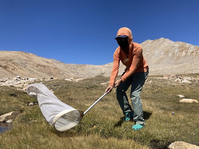
We learned a lot about what it takes to conduct field monitoring safely and effectively during a pandemic from our 2020 field season. One of the decisions that helped us be successful last year was to limit our fieldwork to two projects: lakes and wetlands. To ensure the safety of our field staff and community, we will also scale back field work in 2021 to two projects – landbirds and high elevation forests.
Landbird Monitoring
We will welcome our bird crews in late April for three weeks of intensive training, and after passing their examinations they will begin their monitoring season in mid-May. Lee Bryant and Jared Swenson, coming as a team from Arizona, will conduct monitoring at Sequoia & Kings Canyon (SEKI). Quinn McMahon (who was on our 2019 SEKI bird crew and worked on the North Coast and Cascades Network bird crew last year) and Gabrielle Bedeian (who is working her first season with The Institute for Bird Populations - IBP, our partner organization) will be our Yosemite crew, who also monitor at Devils Postpile. IBP and our sister North Coast and Cascades Network, will provide additional support this year with data management and other project needs. Dustin Garrison from the Yosemite National Park Wildlife Program (and a former Sierra Nevada Network lakes crew field lead) is applying his knowledge of the Network parks to developing itineraries.
High Elevation Forest Monitoring
With our Ecologist Jonny Nesmith leaving, we needed to find a temporary lead for this project in order to conduct field work this summer. We decided we could move forward with a field season when Monica Buhler, Natural Resource Manager at Devils Postpile National Monument, offered to take on oversight of the project, and after a long, careful GAR (Green-Amber-Red) risk analysis. We wanted to be sure we had sufficient staffing and good contingency plans (in case a fire or pandemic status requires us to stand-down fieldwork). Sean Auclair, experienced forest crew lead from previous seasons, will return, and be joined by Emma Kahle as the only other crew member. Emma has extensive wilderness travel and field work experience and like Sean, also spends winter months in Antarctica. Sean will come on-board early in April to assist with preparation for the field season.
Farewell to Two Valued Colleagues
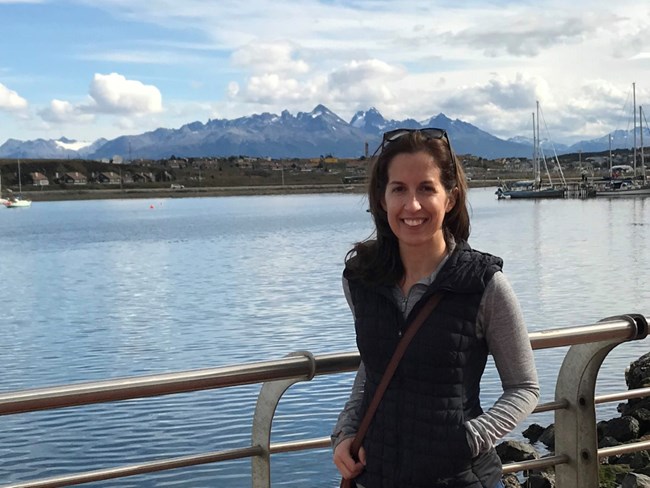
Alex Eddy, Data Manager
Alex Eddy joined our team as Data Manager in 2016, and her last day with us was in late December. She moved on to an Information Resources Specialist position with the U.S. Forest Service at the Intermountain Regional Offices in Ogden, UT. She supports 12 national forests with data collection, data management, GIS, and cartography. Among her roles is the regional coordinator for Natural Resource Manager, which is a system of data applications that support forest management and decision-making. She also serves as a coordinator for inventory and monitoring data management.
Alex worked closely with network staff and outside cooperators to take data stewardship great strides forward. She also collaborated with local park GIS and Data Management staff to help improve local data management practices. She was known locally and across the Inventory and Monitoring (I&M) program for her artistry in cartography – her beautiful maps helped us communicate our science in technical publications as well as on posters meant for general audiences. Alex worked with our field crews to ensure they collected high-quality data, knew how to use digital field equipment, and had reliable computer access. Her technical and communication skills aided our local parks in standing up an effective COVID-19 Incident Management Team, using the MS Teams environment for activities that had previously been in-person.
When asked what three things she is most proud of in her time with the Sierra Nevada Network, she noted –
- Our collaborations with park staff, partners, and other I&M networks. One of the most rewarding parts of working at I&M is the opportunity to get to know staff from every park within our ecoregion. I also truly appreciated the opportunity to work with other I&M networks and find out what we can do with our intersecting skills and knowledge.
- The opportunity I've had to provide support to interns and technicians and help steward others' careers and professional development. I've learned so much from our technicians over the last four years, and I hope that I've been able to help them out as well.
- Facilitating the shift from paper to mobile, increasing data sharing, visualization, and publication, and mapping all of the things!
And what will she miss most? Friends and colleagues, as well as big trees, granite, and blue lakes.
Jonny Nesmith, Ecologist
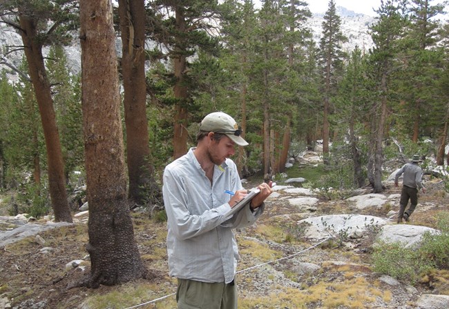
Jonny Nesmith has been Ecologist with the Sierra Nevada Network since 2012. He will begin his new position in April as Supervisory Biological Scientist with the U.S. Forest Service Pacific Northwest Research Station in Portland, Oregon. He will serve as the Data Collection Team Leader for the Forest Inventory and Analysis (FIA) Program, overseeing data collection of all FIA data in California, Oregon, and Washington.
Jonny was the lead for Sierra Nevada Network high-elevation forests and wetlands monitoring projects. He shepherded the wetlands protocol through its final revisions and peer review, oversaw wetland mapping efforts that informed sample design, and implemented field data collection starting in 2014. Our forest monitoring project, focused on whitebark pine and foxtail pine, benefitted from Jonny’s prior research experience with Sierra Nevada white pines. Jonny worked collaboratively on data analysis and publications with other Inventory & Monitoring Networks that share this protocol (Klamath, Upper Columbia Basin, and North Coast and Cascades).
Jonny went above and beyond his specific local project responsibilities to partner with numerous scientists in academia, the U.S. Geological Survey, and the U.S. Forest Service to seek funding and conduct research on white pines in the Sierra Nevada. These efforts included:
- Assessing the severity and rate of spread of white pine blister rust in the Sierra Nevada
- Whitebark pine persistence in the Sierra Nevada (including genetics of drought tolerance and other adapted traits)
- Genetic conservation of high-elevation white pines at risk from Climate Change, Invasive Pathogens and Climate Driven Outbreaks by Mountain Pine Beetle
- Assessing the condition of sugar pine in the Sierra Nevada
Jonny's ability to engage beyond the network level to facilitate white pine research projects leaves a wealth of data and publications that will benefit Sierra Nevada Network parks and regional white pine management for years to come.
Jonny played a local leadership role in whitebark pine conservation planning. He was the point of contact for network parks and subject matter expert on the Interagency Conservation Strategy for whitebark pine in California, as well as the regional representative on the NPS work group for the National Whitebark Pine Restoration Plan.
What is Jonny most proud of from his time with our network?
- Multiple publications using I&M forest data from a protocol I stepped into when it was first getting off the ground.
- The amazing things many of the people who have worked for me have gone on to do (permanent positions in government agencies, Master’s/Ph.D programs, and more). Those friendships and relationships have been a huge part of why I love this job so much!
- The network of collaborations and projects I have been able to help pull together related to whitebark pine and White Pine Blister Rust. Being able to help bring the right people together and support those efforts has been super meaningful.
What will he miss the most?
- The Sierra Nevada backcountry. It is so magical and such a meaningful place for me. Really hard to think about moving away!
- The people I get to work with (both within local parks and I&M more broadly). What a committed, smart, passionate, thoughtful bunch! I don't think I will ever have it as good as I have had it these last 9 years in terms of amazing co-workers.
- The community. Three Rivers all in all has been a wonderful place and community to raise our girls. We have made some incredible friends and don't think we will ever be able to fully leave this place behind!
Welcome!
Two New Superintendents Lead Network Parks
On November 8, 2020, Cicely Muldoon transitioned from Acting Superintendent to Superintendent at Yosemite National Park, and Clay Jordan started as the new Superintendent at Sequoia and Kings Canyon National Parks. Both are 35-year veterans of the National Park Service. Cicely Muldoon previously served as Superintendent at Point Reyes National Seashore, as Deputy Regional Director in San Francisco, and as Superintendent at two additional NPS sites. Clay Jordan previously served as Deputy Superintendent at Great Smoky Mountains National Park and worked in numerous other parks and at the regional level in visitor and resource protection positions. They each bring a wealth of experience and enthusiasm, and we are grateful to have their leadership on our Board of Directors.
Budget Analyst Starts Shared Position
In March, we will welcome Lynne St. Martin into a new Budget Analyst position shared among five Inventory and Monitoring Networks - Pacific Islands, Klamath, Mediterranean, San Francisco Area, and Sierra Nevada. Lynne will be duty-stationed with the Klamath Network in Ashland, Oregon.
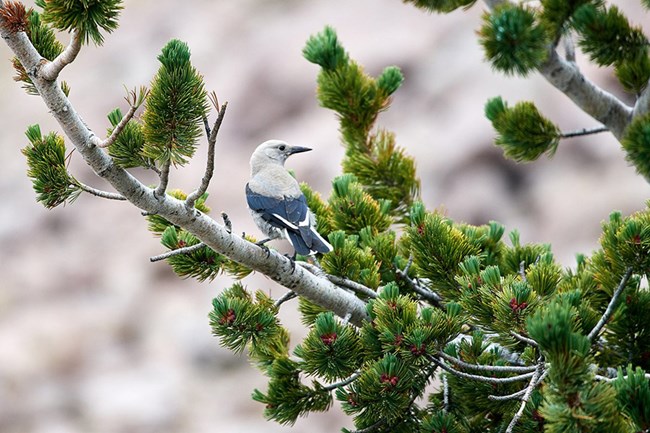
Photo by Frank D. Lospalluto / Flickr CC BY-NC-ND 2.
Recent Publications
Study Highlights the Tenuous Nature of Clark’s Nutcracker and Whitebark Pine Mutualism
To better understand the relationship between Clark’s Nutcracker and whitebark pine stands, scientists used data from separate tree and bird monitoring programs in five national parks (Sequoia and Kings Canyon, Yosemite, Mount Rainier, and North Cascades). These regional-scale analyses were possible because the Sierra Nevada and North Coast and Cascades inventory & monitoring networks are both monitoring birds and high-elevation white pines using similar objectives and methods. This collaborative research project included The Institute for Bird Populations, National Park Service scientists from both networks, including Sierra Nevada Network Ecologist Jonny Nesmith and Program Manager Sylvia Haultain, and the Northern Rockies Conservation Cooperative. The study found that when whitebark pine seeds are not abundant, the Clark’s nutcracker will leave to seek other sources of seeds, making it harder for remaining whitebark pines to reproduce. To learn more, visit our brief web article, and check out the recently published research paper.

Photo courtesy of Joan Dudney
Park White Pines in Decline ‒ New Publication Highlights 20 Years of Change
Recently published research by the Sierra Nevada Network, University of California-Berkeley, and partners examined changes in white pine species in Sequoia and Kings Canyon National Parks over the past 20 years. These parks are home to five species of white pine: sugar pine, western white pine, foxtail pine, whitebark pine, and limber pine. But white pines are threatened by multiple stressors that have led to sharp declines for several species. An extensive survey for white pine blister rust infection (a non-native pathogen) in the 1990s provided baseline data about the status of white pines across the parks, but researchers and park managers were concerned about white pine declines since that initial survey.
To learn about the declines they found in sugar pine and western white pine, and the relatively good condition of higher elevation foxtail and whitebark pine stands, take a look at this brief web article or take a look at the research paper.
An Assessment of Vulnerability of Whitebark Pines in Pacific States National Parks
Sierra Nevada Network Ecologist Jonny Nesmith and scientists from Humboldt State University, the US Geological Survey, and North Coast and Cascades Network used whitebark pine monitoring data in Sequoia & Kings Canyon, Yosemite, Lassen Volcanic, Crater Lake, Mount Rainier, and Olympic national parks to summarize stand structure, presence of white pine blister rust, and mountain pine beetle prevalence. They developed a size-structured population model to speculate on future trends in these whitebark pine populations under conditions of increased mountain pine beetle and ongoing blister rust infection observed at Crater Lake National Park. This study describes conditions at seven western parks and illustrates potential rates of whitebark pine decline if pest outbreaks and/or blister rust infections worsen. View the Northwest Science publication to learn more.
NPS photo/ C. Hennessee
Bust of César E. Chávez Loaned to White House
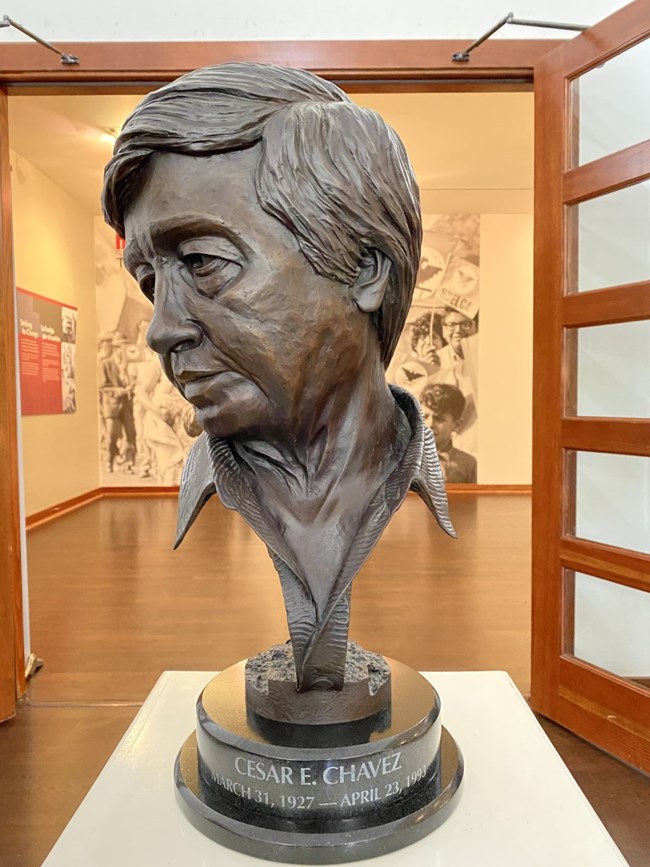
At César E. Chávez National Monument, a bronze bust of Cesar Chavez normally sits to the left of the main desk in the visitor center. But now this bust is on loan to the White House, and sits on a table behind the Resolute Desk in the Oval Office, along with photos of President Biden’s family. The bust was made by artist Paul A. Suarez and is based on the César E. Chávez statue commissioned by Fresno State University. There are only 25 like it. The Cesar Chavez Foundation owns this one. In a January 22nd Facebook post, Monument staff state “We are incredibly honored by the fact that this remembrance of Chávez has been called upon to serve in the White House. We hope that his ideals of community, strength and compassion are remembered every day.”
Widely recognized as the most important Latino leader in the United States during the twentieth century, César Chávez led farm workers and supporters in the establishment of the country's first permanent agricultural union. His leadership brought sustained international attention to the plight of U.S. farm workers, and secured for them higher wages and safer working conditions. Visit the monument website to learn more.
