Last updated: September 27, 2022
Article
Botany News – August 2022
Issue compiled by Plant Community Monitoring Intern Alexandria Knoell, San Francisco Bay Area Network Botany Program
Intern Insights
Back in June we introduced our fantastic Scientists-in-Parks interns, Yvonne and Alee. One element of their internship is an independent project that is meant to support their professional goals while also enhancing the I&M Botany program. As their internship comes to a close over the next few weeks, they will be finalizing these projects and presenting their work to the larger I&M network. Here is a summary of what they accomplished this summer!
Yvonne, ISED Intern
My role in the ISED program was to monitor priority invasive plants throughout the north bay and peninsula by hiking vast lengths, searching for a list of species, and mapping and recording their presence along with updating past observations. This sparked a lot of cool ideas and questions about anything and everything: societal norms, changes in our environment due to climate change, past experiences, food recommendations, and how data collection plays a role for restoration and management.
The goal of my individual project was to learn something new while helping the botany team to make data collection easier. ISED uses two apps when collecting data—CalFlora ObserverPro and ArcGIS FieldMaps. CalFlora keeps our data consistent and accessible, both to the public and to natural resources management staff, who use it to locate plants that we’ve observed, while FieldMaps tracks our progress internally, including surveyed areas and species presence.
There were issues that made it difficult to record observations accurately and smoothly in the field, such as map visibility and nuances in creating polygons that show the range of a species. Additionally, editing these polygons in the field is quite challenging and often not worth the hassle. This leads to an extensive post-field work load as the observations need to be fixed individually.
My individual project was to create an Esri ArcGIS Survey123 form that mimicked CalFlora ObserverPro and consolidated it with ArcGIS FieldMaps. Through FieldMaps, one would ideally be able to see past CalFlora observations and also access the Survey123 form to record new observations. These observations could then be uploaded into CalFlora for other crews to reference; as time goes, the past forms would be used for past observations. Ideally, this would make in-field workflow, post-field data management, and postseason reporting easier. Survey123 was entirely new to me which made it all the more fun, and I hope for it to be a useful tool in the long term!

Alee, PCM Intern

My primary role as the PCM intern was, as the title implies, plant community monitoring. This involved plenty of hiking and plenty of staring at plants, silently begging them to tell us their secrets. Such close work with the Bay Area flora got me pretty jazzed about plants, particularly native species. Especially considering some of the ecological problems the state is facing (i.e. drought and fire), I felt like it would be a very beneficial service to get the general public equally jazzed about native plants.
My main goal with this project was to use science communication techniques to reach new audiences that may not have previously given much thought to growing native plants, or even tending a garden for that matter, and to encourage and assist them in doing so. Science communication is my side-passion, and, despite encountering several creative juice blockages due to the busy nature of field work, I remain quite excited to apply that passion to this project and to share some stellar little plants with Bay Area locals.
I am currently working on an Esri ArcGIS Survey123 application to accompany the planting guide infographic template pictured. The app is intended to narrow down the extensive list of options to a selection of native plants that match the garden specifications and needs of the grower. For example, someone whose garden receives only partial sun, is worried about hungry deer, is looking to fill a large space, and is partial to blue flowers may get recommended Ceanothus thyrsiflorus (creeping blueblossom). The app would also provide a list of nurseries that distribute seeds, based on the user's location. Each plant suggested through the app and/or highlighted on the infographic is geared toward water conservation and pollinator support, and needs fairly low maintenance. Calscape has been a huge resource for this project.
August Surveys
NPS / Lisa Schomaker
ISED
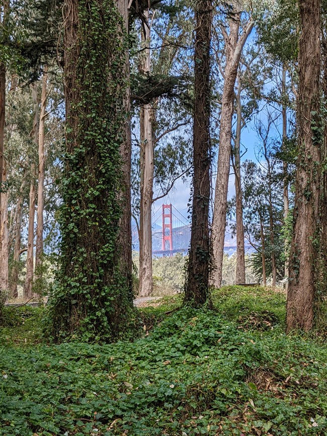
In August, the ISED team had the opportunity to survey a variety of ecosystems throughout Golden Gate National Recreation Area (GOGA) units. Surveyed areas ranged from the high Douglas-fir / coast redwood ridgelines north of Stinson Beach to the scrubby foothills near Montara, and even the more manicured urban locales of the Presidio of San Francisco. By covering an area spanning approximately 40 miles north to south, the team was able to observe floristic differences across a wide range of Bay Area environs. While the trails of Rancho Corral de Tierra play host to common grassland invasives such as Rytidosperma penicillatum (purple-awned wallaby grass) and Trifolium angustifolium (narrow leaved clover), the shaded forests of Muir Woods hide swaths of Clematis vitalba (old man's beard) and Ilex aquifolium (holly). Though it may come as no surprise to learn different species are suited to different park regions, it is interesting to note the species that make their home across all corners of GOGA. Two vines, Hedera helix (English ivy) and Delairea odorata (cape ivy) are perhaps the least discriminating of ISED’s target species, having been observed making their home across all corners of the surveyed regions. The ISED crew will continue to survey the Presidio until the field season comes to a close in mid-September.
PCM
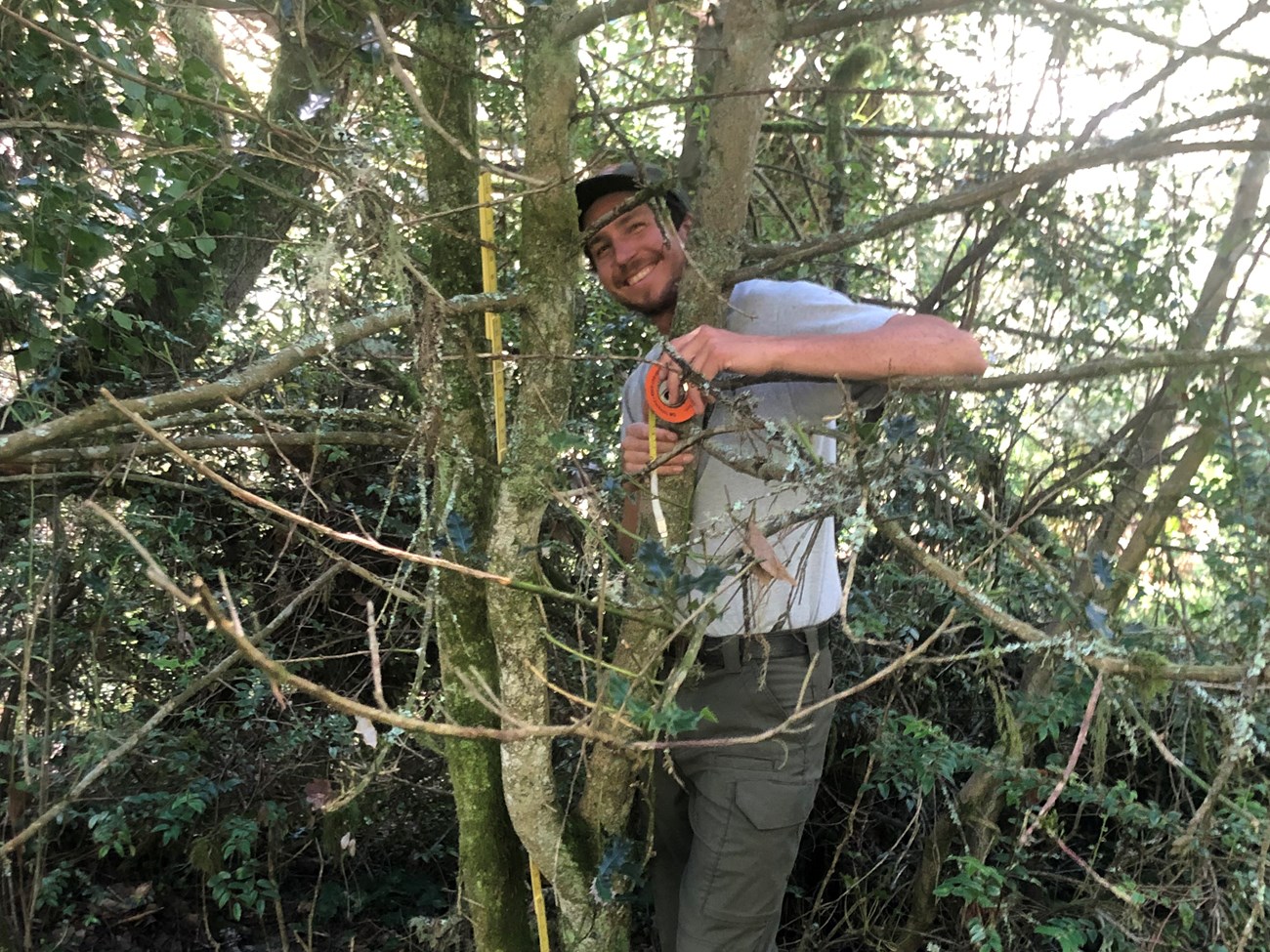
PCM plots were a mixed bag this month, bouncing between squishy salt marshes and densely wooded Douglas-fir forests. The Douglas-fir plots visited this season are quite special in that they lie within the burn scar of the Woodward Fire, and are thick with scorched trunks and lush new growth. Another special attribute of these mystical plots is an extended protocol. Along with the usual pin dropping, visiting a Douglas-fir (or any forest) plot requires plenty of tree-hugging to measure DBH (diameter at breast height) (below), and neck-craning to gauge forest canopy cover.
NPS / Alee Knoell
While canopy cover is a metric for each habitat type, there is no overstory to consider in the coastal salt marsh. In the thick of Pseudotsuga menziesii var. menziesii, however, for which the Douglas-fir forest is named, one can imagine that the canopy over our quadrats and transect lines can be quite dense, and even requires a densiometer to accurately estimate. Additionally, the team recorded fuel load along plot transects and scoured 3-m x 3-m plots along each transect for tiny seedlings.
Our favorite pesky plants, Toxicodendron diversilobum (poison oak), Urtica dioica (stinging nettle), and Rubus ursinus (California blackberry), were common sightings at almost every Douglas-fir plot, ensuring we didn’t wrap up the season without one final, bittersweet goodbye.
Noteworthy Early Detections
NPS / Eric Wrubel
Parrot’s Feather
(Myriophyllum aquaticum)
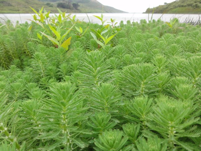
Myriophyllum aquaticum is an annual species native to South America that tends to grow in shallow wetlands and wet areas such as sloughs, lakes, and slow moving streams with high nutrients. While they typically grow in water bodies as deep as 10 feet, the depth of water determines how fast and how much M. aquaticum will grow.
The leaves of M. aquaticum are different based on whether or not it emerges from the water. In water, leaves are whorled, stiff, flat, and needle-like, whereas the leaves of an emerged M. aquaticum appear glaucous and feather-like. Primarily obtaining nutrients from the water itself, M. aquaticum only requires soil for anchorage, however it does have the ability to grow only in soil. While plants can be either male or female, it is rare for males to occur. Most M. aquaticum plants are female and grow vegetatively.
M. aquaticum was brought to North America as an ornamental for water gardens, from which it subsequently expanded out of. It grows densely where it occurs, blocking sunlight and oxygen exchange and slowing water circulation, consequently decreasing native species richness as well as preventing recreational use of waters for people. It can also be used as a refuge for mosquito larvae and increase evapotranspiration. Control of M. aquaticum is difficult due to the sheer density, habitat, and vegetative growth. Cutting the plant may facilitate growth, while chemical and mechanical provide only temporary control. In SFAN, there has only been one occurrence this season at Sutro Baths.
Resources
Old Man’s Beard
(Clematis vitalba)
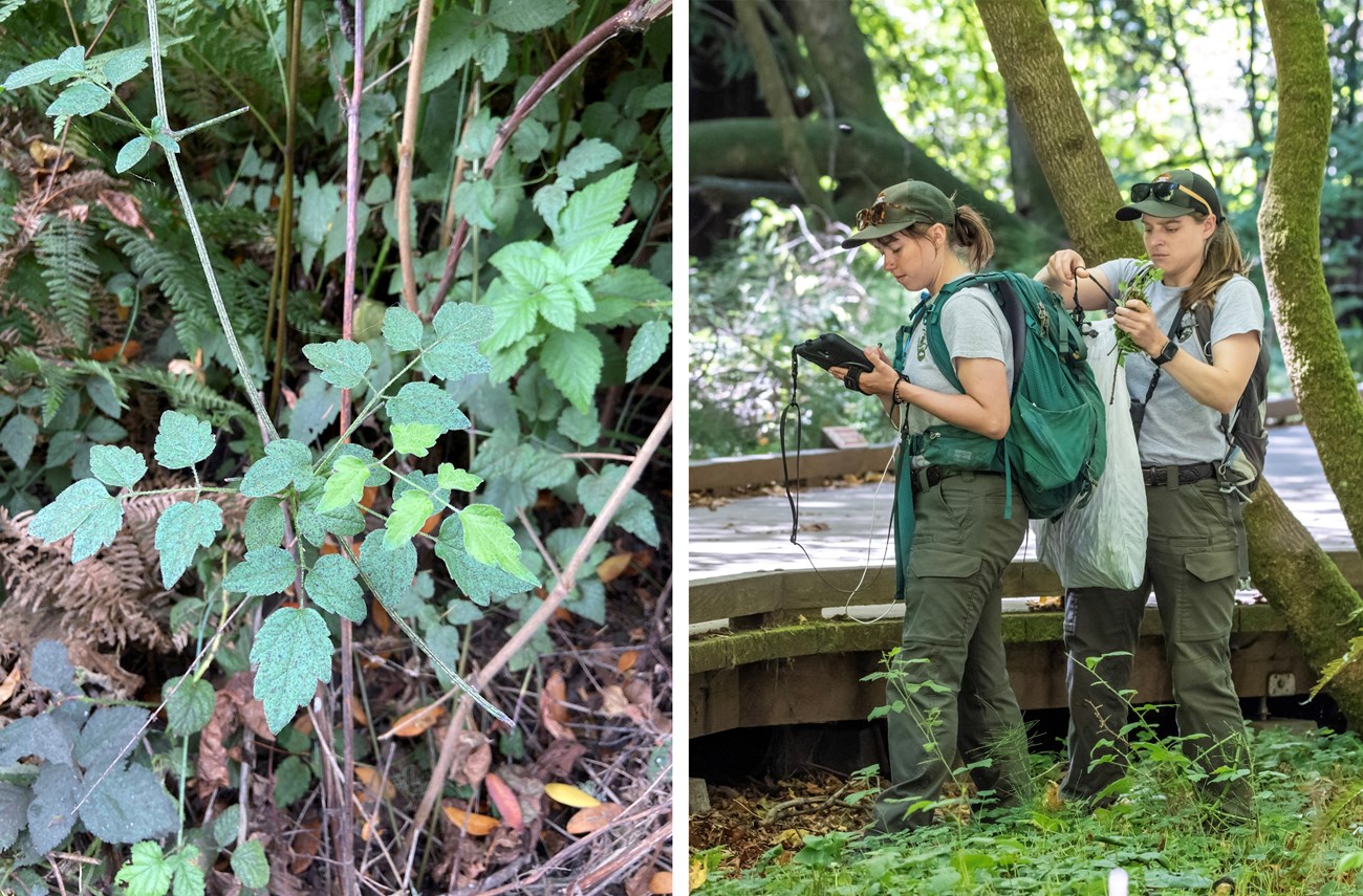
Right: The ISED team documents and treats an isolated Clematis.
Left: © dgkelch / Photo 94343787 / iNaturalist.org / 07-20-2020 / CC BY-NC
Right: NPS / Jessica Weinberg McClosky
Clematis vitalba is a climbing woody vine native to the UK, Mediterranean countries, and southwest Asia. As any vine, it loves to climb trees or layer the ground when none is in their proximity. Just like M. aquaticum, it was brought to North America as an ornamental.
C. vitalba is deciduous and spreads through seeding, capable of dropping over 100,000 seeds during its seeding season from September to January. The woody stems of C. vitalba can grow up to 100 feet and depending on age, it's vines can grow five to 30 feet per year. The oval-shaped and papery leaves drop in early winter, and the blooming season is from July to September, adorning the vine with white flowers having four thin, arching petals and long appendages. The seed head is a ball of fluff similar to what you might have seen in Dr. Seuss books!
C. vitalba grows rapidly and densely, growing five to seven times faster than ivy as well as growing multiple layers of ground cover preventing native growth. The invasive vine can even overcome trees enough for them to collapse. C. vitalba is likely to be found in wooded areas, but can be found pretty much anywhere as long as it is moist, including disturbed areas and along moving waters.
Because of their light, fluffy seed heads, it is easy for them to spread through wind and water as well as by humans and fragmenting stems. While fragmentation can cause spread, cutting the plant near the base will likely kill the vines. Planting conifers shade the understory, which prevent C. vitalba from covering the ground by limiting germination, but if already taken over, manual removal is method of control. C. vitalba can be found in Marin, San Francisco, and Santa Cruz counties. ISED has made numerous observations this season throughout Muir Woods.
Resources
Native Species Spotlight
Blueblossum ceanothus
(Ceanothus thyrsiflorus)
NPS / Alee Knoell
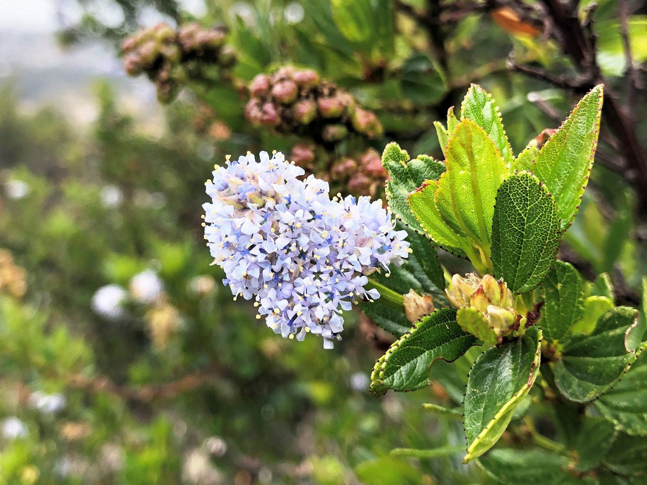
Stretching up the coast from south-central California to the Oregon border, Ceanothus thyrsiflorus can be found along rocky maritime slopes, northern coastal scrub, bluffs, and mixed evergreen forests, as well as in several PCM scrub and some Douglas-fir plots. It is a hardy evergreen shrub that grows anywhere from two to 30 feet tall, mat-like or erect. In part due to its relatively quick growth rate, C. thyrsiflorus is commonly used in landscaping for bank stabilization.
Blooming from mid-spring into early summer, C. thyrsiflorus is donned with tufts of small, fragrant, blue-to-purple flowers that attract an array of insects, notably pollinators such as bees and butterflies.
C. thyrsiflorus acts as a host plant for at least 14 butterfly and moth species*, including California tortoiseshell butterfly and elegant sheepmoth. Host plants are crucial for insect larvae to live and feed on. Additionally, birds and small mammals enjoy the seeds and pods as an important food source.
Among the myriad ecological benefits C. thyrsiflorus provides, there of course lies its ethnobotanical significance. Native American tribes, notably Pomo and Kashaya, traditionally used the blossoms for ceremonial dance wreaths. The plant is also used for soap, mixing fresh or dried flowers with water.
*C. thyrsiflorus is a confirmed host plant for 14 species and is a presumed but not confirmed host plant for 79 species, according to CalScape.
Resources
August ISED Survey Results
This month's ISED records may be viewed in an interactive map at the Calflora Observation Search website. Navigate to the Help Site for assistance using the Observation Search page.
