Last updated: December 1, 2025
Article
SECN Highlights February 2023


Photos courtesy of Katie Dagastino and Mallorie Davis.
Welcome to the Network!
Katie Dagastino is the new Hydrologic Technician
Katie is the new Hydrologic Technician for the Aquatic Team. Her primary role at the Southeast Coast Network will be operating sondes and collecting nutrient samples for the water-quality monitoring protocol. She will also cross train to assist with wadeable streams and other protocols as needed. Katie comes from the Mojave Desert Inventory and Monitoring Network where she assisted with all water resource projects. Katie started with NPS in 2016 as a seasonal interpretive ranger at Oregon Caves National Monument and Preserve. She has worked in several parks and forests in a variety of programs including recreation, endangered species monitoring, water quality, and conservation, and wildland firefighting. Katie has a Bachelor of Arts in Earth Sciences with an emphasis in geology. In her free time, she enjoys hiking, backpacking, learning to mountain bike, singing, and spending as much time as she can in nature. Welcome to the network Katie!
Mallorie Davis is the new Biological Technician
Mallorie is the new Biological Technician for the Vegetation Monitoring Team. She is duty stationed at the network office in St. Marys, Georgia at Cumberland Island National Seashore. Her primary role will be working with the terrestrial vegetation monitoring project. Along with SECN Botanist Forbes Boyle, she will conduct field surveys on vegetation monitoring plots across network parks this summer and beyond. Mallorie holds a bachelor's degree in Wildlife Ecology and Management from Auburn University and was an educational leader and mentor to her peers, school groups, and families through the College of Forestry and Wildlife Sciences. Between her naturalist role at the local preserve, being a dendrology teaching assistant for her professor, and working as a sea turtle intern at Cumberland Island National Seashore, Mallorie has grown more passionate about learning and exploring new territories within this field. Welcome to the network Mallorie!

NPS photo / Ches Vervaeke
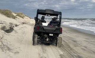
New Shoreline Monitoring Databases on IRMA
As another tool for the Southeast Coast Network's shoreline monitoring efforts, new updated geodatabases containing feature class files for 2018-2022 are now available on IRMA at DataStore - Southeast Coast Network Shoreline Change Monitoring Geodatabases 2018-2022 Shoreline Change Data (nps.gov). Geodatabases are available for Cape Hatteras National Seashore, Cape Lookout National Seashore, Canaveral National Seashore, Timucuan Ecological and Historic Preserve, Fort Matanzas National Monument, and Cumberland Island National Seashore. For more information on shoreline change monitoring or data availability, contact SECN Coastal Ecologist Ches Vervaeke, SECN Data Manager Wendy Wright, or SECN Physical Science Technician Abigail Gonzalez.

Photo courtesy of University of North Florida.
Looking for Ghost Structures
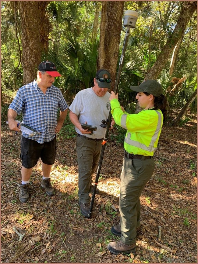
SECN Coastal Ecologist William "Ches" Vervaeke recently assisted Timucuan Ecological and Historic Preserve with a "ghost structures" project at Kingsley Plantation. The goal was to locate seven missing slave cabins and create "ghost structures" or short, elevated foundations that show the approximate footprint of the missing cabins. Historical records show 32 cabins were placed in a symmetrical arc formation and housed more than 200 slaves. Using GIS mapping software, the coordinates of the missing cabins were re-established. Ches assisted the team with locating these coordinates in the field using a Trimble R125 GPS unit and TSC5 controller. The corners of each structure were marked with flags and painted rebar. The ghost structures project is a coordinated effort between the park and the University of North Florida in Jacksonville.
Lecturing at the Jax Zoo
As part of SECN outreach activities, Ches recently lectured to a group of Advanced Inquiry Program (AIP) graduate students at Jacksonville Zoo and Gardens. Ches focused his presentation on the migration of mangroves at Timucuan Ecological and Historic Preserve and the impacts of climate change. The AIP is a one-of-a-kind master’s program available at the zoo and online from Miami University.
Paper Published
Ches recently co-authored a paper published on Wetland Elevation Dynamics, specifically, a regional synthesis of surface elevation change data from mangrove forests and coastal marshes in the Greater Everglades region of South Florida. Results from this study indicated some wetlands are keeping pace with sea-level rise while others are at risk of submergence and conversion to open water. Rates of surface elevation change were positively related to subsurface change but not vertical accretion. The paper also noted no significant relationships between rates of surface elevation change or rates of sea-level rise in the study areas. Site-specific examples showed hurricanes, plant productivity, hydrologic exchange, and proximity to sediment and nutrient inputs are critical but confounding drivers of surface elevation change dynamics in the Greater Everglades region. This paper documents the processes and trends currently being monitored by the Southeast Coast Network at coastal parks. The full paper is available at https://doi.org/10.1007/s12237-022-01141-2.

NPS photos / Forbes Boyle
Finding the Sweetgrass Spot
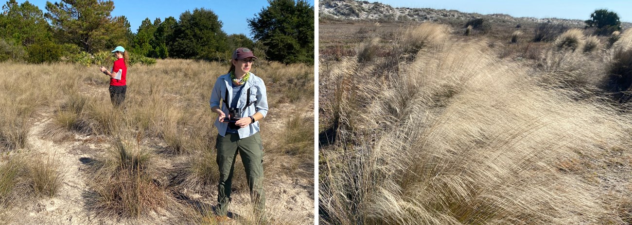
SECN Botanist Forbes Boyle assisted University of Georgia researchers with a sweetgrass (Muhlenbergia sericea) survey at Cumberland Island National Seashore in December. Led by Dr. Lizzie King and joined by PhD student Sara Meissner, the trio visited potential sweetgrass sites based on a 2016 vegetation map of the island and assessed the presence and condition of sweetgrass in those locations. The goal of this project is to understand the status, roles, and significance of sweetgrass and its habitats in Georgia. One key component of the project is developing a species distribution and habitat suitability map for sweetgrass to help determine the extent and size of existing populations for conservation and management as well as identify locations suitable for sweetgrass restoration. The data from this trip will be vital to building actionable knowledge to guide sweetgrass conservation and ecological restoration of this unique element of the coast’s biological and cultural heritage.

NPS photo / Brian Gregory
SECN Participates in RSS Workshop for Ocmulgee Mounds NHP
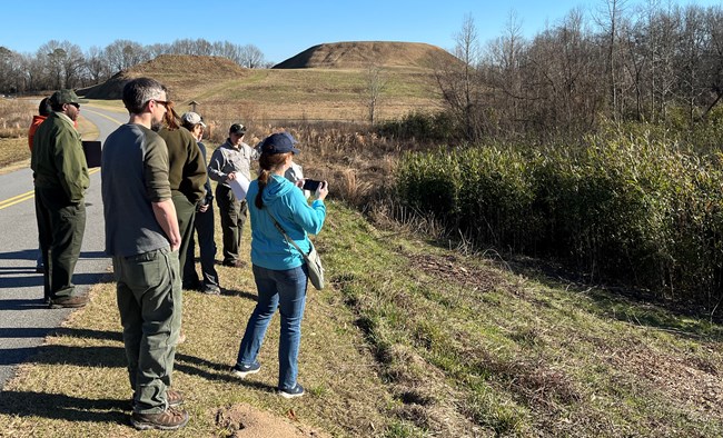
Staff from the Southeast Coast Network including Botanist Forbes Boyle, Physical Scientist Stephen Cooper, Wildlife Biologist Michael Parrish and Program Manager Brian Gregory, provided input on Ocmulgee Mounds National Historical Park's important natural resources during the recent Resource Stewardship Strategy meeting. Input was solicited from park staff and regional partners to develop a planning document that bridges the gap between the park's foundation document and everyday management of natural and cultural resources at the park. Charles Lawson and his team from the Denver Service Center guided the group through the process with OCMU Superintendent Carla Beasley and her staff providing hospitality and a park tour that included some of Ocmulgee Mounds National Historical Park's newly acquired lands. SECN staff will continue to assist with reviews of the final documents but also gained valuable insight into the day-to-day operations and concerns of a park where our main focus is on Vital Signs monitoring.

NPS photos / Michael C. Parrish
Tags
- mojave desert network
- oregon caves national monument
- cumberland island national seashore
- timucuan ecological and historic preserve
- kingsley plantation
- jacksonville zoo and gardens
- wetland elevation dynamics
- greater everglades region
- sweetgrass
- university of georgia
- university of north florida
- shoreline change monitoring
- rss
- resource stewardship and science
- denver service center
- ocmulgee mounds national historical park
- cape hatteras national seashore
- canaveral national seashore
- fort pulaski national monument
- fort frederica national monument
- fort matanzas national monument
- chattahoochee river national recreation area
- cape lookout national seashore
- fort sumter and fort moultrie national historic park
- horseshoe bend national military park
- kennesaw mountain national battlefield park
- moores creek national battlefield
- congaree national park
- vegetation community monitoring
- wadeable stream habitat surveys
- water-quality data monitoring
- estuarine water quality
- landbird community monitoring
- vocal anuran community monitoring
- automated recording devices
- ards
- mangroves
- secn network highlights
