Last updated: October 15, 2021
Article
School House Ridge North Cultural Landscape

NPS
Along with other landscapes in and around Harpers Ferry National Historical Park, the School House Ridge North property is important for its role in the Battle of Harpers Ferry in September of 1862, which resulted in the largest surrender of Federal troops during the Civil War. The School House Ridge North cultural landscape is also associated with agricultural history of the Shenandoah Valley between 1784 and 1868, indicative of the agragian landscape established here by European settlers. This landscape has been spared from the development of the Baltimore-Washington metropolitan region and retains integrity as a rural landscape, characterized by woodland and farmland.

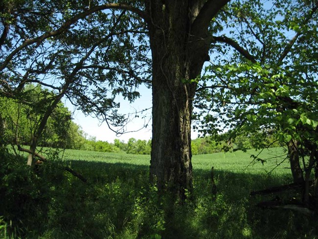
to west on School House Ridge North, looking north (2008).
NPS
Landscape History
The quiet hillside enclave of School House Ridge remained largely isolated from the energetic industrial influence of Bolivar and Harpers Ferry, due to the prominent geographical barrier of Bolivar Heights. Historically, the landscape was composed of agrarian pastures, croplands, and occasional orchards, interspersed with woodlands. This character persists today, with trees and a limited understory lining the edges of wide open fields to break up the broad, rolling vistas.
By the mid-1700s, permanent occupation of the Shenandoah Valley area had been limited and characterized by the villages and temporary hunting settlements of the Native American tribes that used the area as a trade throughway and a strategic route during combative confict. The Five Nations Iroquois League, Catawbas, and Delaware tribes traversed this area, and Tuscarora and Shawnee tribes erected temporary villages of bark huts here as they hunted deer and elk. The important river confluence of the Shenandoah and Potomac also became a destination for a wave of European settlers, who began locating to the Shenandoah Valley in the 1730s. Many arrived from the north, seeking relatively free and available properties for settlement and farming.
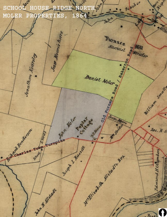
Several generations of the Moler family lived on the property and were buried in the Moler Cemetery. Prior to the Civil War, the Moler farm was cultivated by enslaved laborers. At the time of the war, Daniel Moler kept several horses, cows, and hogs and grew hay, straw, wheat, corn, and potatoes. The division of the property into ten separate fields indicates an extensive fencing system, and the resources and labor available to him to maintain the fence lines and fields. At that time, the household included Daniel, his wife Mary Jane, five daughters and four sons, and 13 enslaved people of various ages and sexes. Two sons fought against each other during the Civil War, one in the Southern Army and one in the Northern Army.

NPS

NPS / Harpers Ferry National Historical Park Archives
While it might seem peaceful today, the property is significant for its military history (1861-1865), specifically the role it played during the Battle of Harpers Ferry. This confrontation, which occurred between September 13 and 15, 1862, resulted in the largest surrender of Federal troops recorded during the entire Civil War. The School House Ridge Battlefield is the location of the Union's final surrender to Major General Jackson during the Battle of Harpers Ferry on the morning of September 15.
School House Ridge North is also significant for its agricultural history (1780-1868). Much of the historic agrarian landscape that was established in the region by early European settlers is still evident today, consisting of cleared and regularly used farmland that appears much as it did in the past. During the Civil War, the landscape around Harpers Ferry appears to have been covered at least in part by woodlands. In 1862, the Army extracted timber and fence rails for building hospitals and camp fires, further transforming the landscape.
While the Civil War had a substantial and destructive impact on the landscapes of the region and those who lived there, School House Ridge North and other parts of the Shenandoah Valley managed to recover fairly quickly after the war. While the Moler Farm did depend on the labor of enslaved people for production prior to the war, this was less of an established reliance than in other former slaveholding states. The tracts of School House Ridge North then changed hands several times, and a few additional farming structures were added to the property, notably by the Fritts and Ott families. This included the Fritts Barn that was constructed by John E. Fritts in 1926. Originally used as a dairy barn, it later housed cattle and remained in use until 2002. The barn was the first James Way barn built in West Virginia. The building style, characterized by metal stalls and troughs designed for individual cows and cement floors geared specifically towards effective drainage, was an innovative approach to sanitation and animal control. The barn burned in 2010 and no longer exists at the site.
Harpers Ferry National Monument was established in 1944, and in 1963 it was re-designated as Harpers Ferry National Historical Park. The School House Ridge North cultural landscape is located approximately two miles west of Harpers Ferry and five miles northeast of Charles Town, in Jefferson County, West Virginia. The property was acquired by the National Park Service as three tracts between 2003 and 2005, through a partnership with the Trust for Public Land and the Civil War Preservation Trust.
Landscape Description
The properties contained within the current School House Ridge North boundary were previously known as the Moler, Rau, Fritts, and Ott Farms, while a wooded area in the northwest corner is the former site of Jellystone Campground. Part of the landscape comprises the western half of the former Prospect Hill Farm, owned by the Moler family in the eighteenth and nineteenth centuries.
These historic properties define School House Ridge North, which is divided into three tracts:
- Tract 102-34 encompasses the Ott Farm and was acquired by the National Park Service from Blanche and Elmer Ott in 2005. This portion was formerly known as the Fritts Farm, named for the enterprising farmer John Fritts. In addition to modernizing features of the farm, he kept livestock on the areas of his poperty that were too steep to cultivate and rented out agricultural services like mowing and baling to neighboring farmers.
- Tract 102-31 comprises a portion of the old Prospect Hill Farm once owned by the Moler family. George Adam Moler came to America from Scotland with his Swiss-born father in 1730. He moved to Virginia from Lancaster, Pennsylvania in 1758 and recieved the land grant to this property in 1784. Several generations of the Moler family lived on the property and were buried in the Moler Cemetery. The tract was acquired from the Civil War Preservation Trust in 2003.
- Tract 102-33 includes the site of the old Jellystone Campground, which operated as a commercial resort and campground from from 1974 to 1978. During its brief period of operation, the for-profit complex contained facilities for visiting nearby caverns, two pools and a bathhouse, tennis courts, a miniature golf course, a lodge, and more than 300 campsites.

NPS
Quick Facts
-
Cultural Landscape Type: Historic Site / Vernacular
-
National Register Significance Level: National
-
National Register Significance Criteria: A
-
Period of Significance: 1784-1868
