Last updated: January 12, 2021
Article
Salmon River
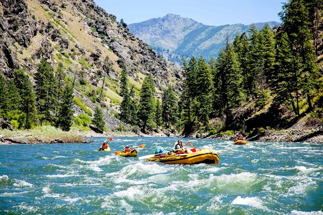
Each summer thousands of adventure-seekers do something that Lewis and Clark simply couldn’t – travel down the Salmon River.
When the Corps of Discovery reached the Continental Divide at Lemhi Pass, they were confronted with the reality of crossing the Bitterroot Range of the Rocky Mountains. Not surprisingly, they searched for other alternatives. Camping with Sacagawea’s people, the Shoshones, Captains Lewis and Clark questioned them as to the prospects for navigating through the mountains by river, beginning with the nearby Salmon River.
But Cameahwait and the other Shoshones ruled out the Salmon as a way to the Pacific because of its rapids and canyons, which eliminated travel either by boat or on horseback. A better, but still difficult, route was the one taken by the Nez Perce Indians over the Lolo Trail, whose eastern approach was reached via the Bitterroot Valley.
Yet, being determined to see the ruthless river for himself, William Clark hired a Shoshone guide known as Old Toby and they left the party on August 21, 1805. That first night camping near the Salmon, Clark was impressed with the size and beauty of the river. But two days later, he came to the conclusion the river was truly impassable.
The very whitewater, steep cliffs, and mountain views that made the Salmon River so impractical for Lewis and Clark’s dugouts now attract visitors for incomparable canoeing, kayaking, and rafting, along with fly fishing, mountain biking, hiking, and camping. It’s the centerpiece of the largest designated wilderness area in the United States, the Frank Church-River of No Return Wilderness Area.
The Salmon begins high in the mountains of the Sawtooth Range, traveling 425 miles before joining the Snake River northwest of White Bird, Idaho. The river has several tributaries including the Middle Fork, South Fork, East Fork and North Fork.