Last updated: October 18, 2024
Contact Us
Article
Ranchería Grande Exhibit Audio Description
Ranchería Grande - Orientation Exhibit Audio Description
-
Ranchería Grande - Orientation Exhibit Audio Description
Listen to the audio description of the Ranchería Grande - Orientation exhibit.
- Credit / Author:
- NPS Audio
- Date created:
- 10/18/2024
Ranchería Grande. 982 words.
This graphic panel is mounted on two black metal posts at the edge of the grassy parking area. Ahead of you the sandy dirt trail enters the woods turning off a dirt road which runs along the edge of the woods.
The large vertical panel is mounted on black metal posts. Text on the panel is both in English and in Spanish. Across the top of the panel is an arial view of the area with the loop trail marked with an orange dashed line. Most of the area is covered with green woods, although the trail passes through some open areas at the far end of the loop. Your current location is at the upper right of the map, where there is parking and restrooms. The line marking the trail goes to the left, where about one-third of the width of the panel along is a label that reads, "1. Main Swale. This road dates to Spanish colonial times but is possibly much older." A small insert has a photograph looking down the trail, which looks like a shallow channel or ditch with gently sloping sides.
Continuing to the left, the next label reads, "2. Signal Tree. The tree's unique form may indicate that it marked a trail."
Continuing to the left, about in the middle of the panel an alternate path loops upward and rejoins the main trail farther to the left. The label reads, "3. Alternate Swale. This path allowed travelers to go around a small valley when it was flooded." An insert has a photo showing a dirt trail.
Following the main trail to the left, it curves upward on the map, toward the north. The label on this section reads, "6. Sunken Road Swale. Continued use widened this swale, which now looks like a dirt road."
Continuing to the left, the trail passes though a cleared area before re-entering the woods. Here the label reads, "4. Hidden Swale. Note the evidence of water damage in this trail swale." An insert photo shows a wide path.
The trail ends in an open meadow at the left side of the panel where there is an icon for a picnic area. The label here reads, "5. Village Site. In use for over 12,000 years, this site had panoramic views and clear water."
An insert at lower left on the map reads, "Take a Hike – Follow the Camion Real Today. Length: 2.2 miles or 3.54 kilometers. Amenities: picnic table, composting toilet."
At bottom right on the map another insert shows a map with your current location near the middle. A wide oval shape is centered roughly over the point where the counties of Milam, Robertson, Brazos, and Lee meet. The caption reads, "Ranchería Grande originally spread across four of today's counties."
Below the map text at the left reads, " El Camino Real de los Tejas spans more than 2,500 miles (4,023 km) and 150 years of history. Spain used this road network to colonize present-day Texas and western Louisiana. The road followed Indigenous trails created long before Europeans arrived. Spaniards, Frenchmen, Native Americans, Mexicans, African Americans, and Anglo Americans traveled these routes. They all left stories to discover."
To the right more text reads, " Walk the Ranchería Grande along El Camino Real. Established along Native American trails, Ranchería Grande was a diverse settlement of 23 Indigenous nations when Spanish explorers first encountered it in the 18th century. This joint settlement pooled resources for subsistence and defense, while also serving as a refuge for Native peoples fleeing Spanish missions. The two-mile loop walk takes you through the rolling Post Oak Savannah hills of Central Texas."
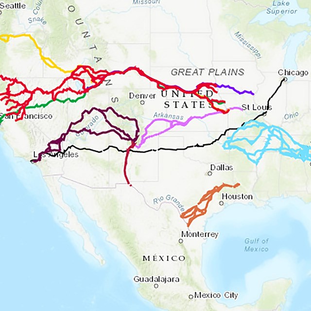
In the lower left corner of the panel is a map showing this part of El Camino Real, which stretched from Los Adaes in Louisiana all the way to Mexico City (shown on a smaller inset map). The stretch containing Ranchería Grande lies northeast of Austin. A caption reads, "Follow the Royal Road in Central Texas."
To the right of that is a photograph showing a trough-like part of the trail, called a swale. Text below reads, "View the Swales. Swales are shallow, linear depressions formed by human and animal traffic over many years of use. They are physical traces of El Camino Real, which followed Indigenous pathways across Texas."
On the right side is an old sketch showing a settlement comprised of small huts, many enclosed with green hedge-like boundaries. Text below reads, " Locating the Ranchería Grande. You are visiting a small portion of Ranchería Grande. For many years its location was unknown, but recent archeology shows that it covered parts of several modern counties. The village site (#5 on the map above) highlights life in this area."
At the bottom of the panel is a small section titled "Visit Nearby Sites." To the west are McKinney Falls State Park, with a photo of a broad river with low water falls, and Apache Pass, with a photo of a dirt road passing through a metal gate topped with two giant crossed arrows. To the east are Mission Tejas State Park, with a photo of a leave-strewn path through open woods, and Caddo Mounds State Park, with a photo of a fence surround a field with a grass-covered earth mound.
At bottom right is the Audio Description icon with text that reads, "Listen, Learn and Follow the Trail. Audio description available. Learn more and take the tour! Go.nps.gov/RancheriaGrande."
There is also a QR code to take you to that web site.
Across the top of the panel is a black bar. At the left end text reads " Ranchería Grande." At the right end is the logo and text for El Camino Real de los Tejas National Historic Trail. Other text reads, " Ranchería Grande Chapter, El Camino Real de los Tejas National Historic Trail Association, and National Park Service."
End of Description.


