Part of a series of articles titled Travel El Camino Real de Tierra Adentro National Historic Trail: Essays .
Article
Preservation and Protection of El Camino Real de Tierra Adentro
The congressional designation in 2000 of El Camino Real de Tierra Adentro as a National Historic Trail put the spotlight on a pivotal three-century chapter of the ethnic, cultural and economic development of the American Southwest. Encompassing its life as an American Indian, Spanish, Mexican and American trail, the distinction acknowledged El Camino Real as North America’s longest cultural route and a vital international crossroads of social experience and exchange.
The congressional action placed the “Royal Road to the Interior Land” among other National Historic Trails deemed significant to the history of the United States. To qualify, El Camino Real was required to have been established by a historic use with a far-reaching impact on American life, including American Indian culture.
Spanning 400 miles of New Mexico and West Texas, the trail had a multipurpose function and multicultural influences that undoubtedly shaped the physical and cultural landscapes of the Southwest and the lives of its peoples. Today, the road remains imprinted in various forms across the region’s diverse geographical terrain.
The designation also required that El Camino Real have the potential to serve as a place for public education, recreation and appreciation of its historic, cultural and natural resources. The purpose: to make El Camino Real’s resources more relevant and accessible to the public. The big vision: to recall El Camino Real’s history and revitalize its cultural identity in the contemporary landscape.
Preservation efforts would inspire modern-day adventurers to explore and connect to the compelling stories that unfold along the trail’s fabled path. Increased awareness would, in turn, preserve the more intangible products carried along El Camino Real, including culinary traditions, music, visual arts, literature, festivals and ceremonial rituals. Even the night sky, whose starlight guided many El Camino Real travelers, would be appreciated in new ways.
On January 19, 2001, the Secretary of the Interior assigned joint administration of El Camino Real to the National Park Service (NPS) and Bureau of Land Management (BLM) to assure the “preservation and enhancement of this national treasure.” The agencies have since worked together to identify, preserve, protect, enhance, interpret and increase awareness of El Camino Real and its historic remnants and artifacts. Listing sites on the National Register of Historic Places is one of the important tools used by the agencies to help recognize and preserve trail remnants.
Cultivating Collaboration and Awareness
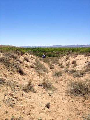
Administration of the trail recognizes El Camino Real as a bi-national trail that cuts through 1,200 miles of the Mexican interior. But as a National Historic Trail, it puts the focus on protecting the valuable historical and cultural assets featured along the 400-mile stretch of El Camino Real in New Mexico and West Texas. Moving across busy urban highways and quiet village streets to dusty backcountry roads, the path winds, falls and rises in various guises, from deep wagon ruts to subtle earthen depressions to nearly invisible traces of centuries of use. These connect vast and barren landscapes to small, isolated, largely rural communities highlighting simple vernacular building styles.
Historic buildings, churches, military forts, campsites and natural landmarks tell the stories of the lives that passed through U.S. sections of El Camino Real from 1598 to 1881. While many fragile archeological sites on the trail are not suitable for public visitation, other cultural resources associated with El Camino Real are being made accessible for public use. However, unrestrained population growth, as well as expanded commerce and energy development, threaten their protection.
Foremost among the threats are the development of wind and solar farms and the construction of transmission lines used to carry energy to faraway urban centers. Their impact affects the wide-open spaces that make the cultural landscapes associated with El Camino Real so special. Lack of public awareness of El Camino Real’s historical significance compounds the threats.
For the NPS and BLM, the work to preserve El Camino Real as a fundamental part of the American experience is a complex process that requires collaboration, creativity and common sense. Ownership of various trail segments ranges from federal, state, county and municipal entities to tribal and private hands. More than half of the U.S. portion of the trail is on private property.
In addition to working with government officials to provide access to public-land sections of the trail, the NPS and BLM rely on voluntary partnerships with property owners for stewardship of historic El Camino Real properties. The agencies partner with tribal officers and private individuals to preserve, and when appropriate, to interpret trail sites not in federal ownership. Federal and state agencies, as well as local communities, also work with energy proponents to minimize the visual impacts to the landscape through which the ancient trail passes. Another major partner is the Camino Real de Tierra Adentro Trail Association (CARTA), an international nonprofit that assists in preserving the historic corridor by developing volunteer opportunities and projects that help monitor and maintain site conditions.
Federal efforts to safeguard El Camino Real and its historic properties directly affect the lives of residents of the New Mexico and West Texas communities that populate the cultural corridor. Individual residents, government officials, local preservation boards and other community stakeholders are active participants in the preservation process. They work closely with federal representatives to conduct assessments, determine condition and devise solutions for maintaining the sites, and when appropriate, for preparing them for the best public use.
By far, the most effective tools in preserving El Camino Real’s trail remnants and associated historic buildings and ruins are public education and awareness. NPS and BLM are working to make the trail a more inviting, user-friendly public asset filled with opportunities for adventure, education and physical activity. Directional signage in both urban and rural areas encourages the public to retrace sections of El Camino Real by foot, by bike, and when appropriate, by car. Visitor centers, wayside exhibits and interpretive signage also enhance El Camino Real’s public path. On the local level, NPS and BLM are reaching out to schools in both New Mexico and West Texas to provide opportunities for students to learn about the significance of the trail, both in the classroom and by visiting trail-related sites.
With increased awareness of the importance of El Camino Real, the public is developing the stewardship needed to preserve and enhance the trail experience for generations to come. Many of the historic buildings, ruins and cultural landscapes that highlight a journey along the trail today showcase the success of these efforts thus far.
Preserving Historic Buildings
The National Historic Trail initiative strives to stay true to the history of El Camino Real as it developed through time. Central to this is the preservation and maintenance of historic buildings along its course. Knowledge of adobe architecture and other earth-building traditions of New Mexico and West Texas is a must for preservationists. This knowledge has been put into practice to preserve buildings at several El Camino Real sites during the past several years.
One of the oldest, best-preserved buildings central to El Camino Real history is the adobe Palace of the Governors in Santa Fe. Originally constructed in 1610 as the Casas Reales (Royal Houses), the administrative seat of the Spanish government, the earthen edifice has undergone various stylistic and structural incarnations since Santa Fe’s establishment that year as the New Mexico capital. Its plaza-side location set the Palace at the northern terminus of El Camino Real during nearly 300 years of the trail’s operation under the Spanish, Mexican and American governments. The centuries brought significant expansion of the Palace to suit military and governmental purposes, and new styles to keep in step with commercial and architectural trends, until a 1913 restoration returned the building to its Spanish colonial roots. Since then, preservation and maintenance efforts at the Palace, which now serves as part of the New Mexico State History Museum, have been guided by stringent historic structures guidelines.
Successful examples of community-based historic building preservation are found in three unique longstanding residential districts on the southern New Mexico stretch of El Camino Real. The area’s oldest permanent Hispano settlement, Doña Ana, was established by the Mexican government in 1843. The original path of El Camino Real is now overlain by a paved street in the village’s historic district, which reflects a traditional Spanish-Mexican village plan. The plan dictated Doña Ana’s construction as a linear village whose layout of shoulder-to-shoulder structures, heavy adobe walls and enclosed courtyards emphasized its defensive needs.
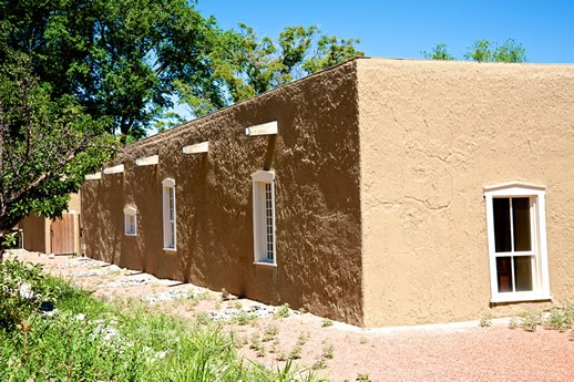
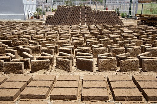
Today, 27 of those buildings and structures, in various states of repair and neglect, comprise the two-block hub of the Doña Ana Historic District. The community’s work to preserve their architectural history is best represented by the adobe Our Lady of Candelaria church, which blends Spanish, Mexican and New Mexican architecture and design. After being coated in concrete plaster, as opposed to traditional lime plaster, weighty water-logged church walls risked collapse. A meticulous 1990’s restoration, including the making of 17,000 replacement adobe bricks, left the church standing proud as southern New Mexico’s oldest church.
South of Doña Ana,in Las Cruces, the Mesquite Historic District continues to thrive as the city’s original townsite. The area was established following the Mexican-American War by former Doña Ana residents who moved south along El Camino Real to seize an offer of free and fertile Mesilla Valley lands. Now home to some 700 historic homes and other buildings, the district is only half its original size. But its eclectic, non-gentrified architectural mix reflects Las Cruces’s evolution from a vulnerable, far-flung village at the edge of the Chihuahua Desert, to a freighting, farming and mining center on the Chihuahua Trail, to a post-Railroad town that embraced modern architectural trends and ambiance while maintaining a traditional edge. Today, even while experimenting with modern looks and luxuries, the district’s home and business owners remain mindful of their roots, cultivating the best of the community’s local flavor, old and new.
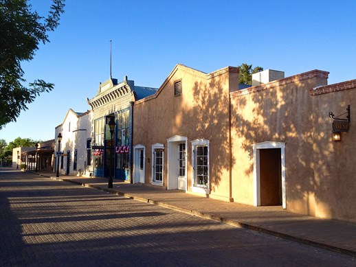
Old and new also come together seamlessly in the Mesilla Historic District, established in 1848 two miles south of Las Cruces in an area that was then part of Mexico. From the district’s central plaza and commercial core to its residential blocks and bordering farmlands, Mesilla’s traditional architecture and rural character have been thoughtfully preserved. Historic preservation regulations guide proposed alterations to historic buildings to retain the town’s modest scale and authenticity. One particularly outstanding example of adobe preservation and rehabilitation is the Taylor-Barela-Reynolds building, whose modern-day owners at once merged and expanded two historic adobe buildings—a mercantile and a merchant’s residence—into a larger residence that remains sympathetic to the structure’s original materials and intention. Today, the Taylor-Barela-Reynolds building is a historic preservation model for Mesilla and other communities along El Camino Real.
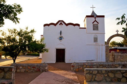
The West Texas portion of El Camino Real is home to other exceptional examples of successful building preservation. At San Elizario, where an imposing adobe Spanish military presidio was constructed in 1788 near today’s U.S.-Mexico border, the adobe Spanish colonial-style chapel is an architectural reflection of the community’s life and times. Constructed between 1877 and 1882 with thick adobe walls, massive buttresses and a flat viga (ceiling beam) roof, the chapel later adapted such European elements as the elegant rounded bell tower that distinguishes the building today. A pressed tin ceiling, neoclassical posts and stained glass windows followed. Today, residents’ diligent attention to the chapel’s maintenance and preservation ensures its continued graceful evolution.
Meanwhile, other buildings in the 27-acre San Elizario Historic District testify to the community’s development as a major military and commercial base on El Camino Real. The district highlights residential, commercial and civic buildings constructed between the 1830s and World War II. The most historically significant buildings feature adobe construction, linear floor plans, flat viga roofs, and classic elements of Spanish-Pueblo Revival and Territorial styles. While remodeling has rendered some buildings historically inauthentic, local preservation efforts have protected many important examples of adobe architecture, including the 1850’s jail house from which Billy the Kid once helped a friend escape.
The neighboring settlement of Socorro del Sur tells an earlier story of El Camino Real and the Spanish-Indian refugee community that moved there following New Mexico’s 1680 Pueblo Revolt. Constructed in 1843, today’s Socorro del Sur boasts massive adobe walls, hard-packed clay and gesso floors, and a lime-plaster exterior. Its unique design details—notably its monumental stair-stepped facade and dramatic interiors painted by Native artisans—represent the American Indian populations from northern New Mexico who fled with Spanish exiles to Socorro del Sur in the wake of the revolt. In the 1990s, when deterioration threatened to destroy the church, residents handcrafted 22,000 adobes to stabilize church walls, repaired the bell tower and conserved church interiors. The project is a shining example of how to do things right when preserving historic adobe buildings.
Numerous other examples of accessible historic neighborhoods and small villages along El Camino Real provide visitors with a sense of the richness of historic buildings associated with the trail. They include the village of La Ciénega, some 18 miles south of downtown Santa Fe, and Agua Fria, a traditional village that was adjacent to Santa Fe during El Camino Real’s years of activity, but is now within the city limits. Travelling south of La Cienega to central New Mexico, El Camino Real highlights include Bernalillo, Albuquerque’s Barelas neighborhood and Edith and Isleta boulevards, Tomé and Socorro. Many of these villages and neighborhoods can be experienced by travelling along New Mexico Highway 1, originally called El Camino Real Highway.
Protecting Historic Ruins and Landscapes
Like historic buildings, various historic ruins pose preservation challenges and opportunities along El Camino Real. Although the precontact Tiwa village of Kuaua Ruins predates El Camino Real by centuries, and lies west of the trail’s main route near Bernalillo, it provides a unique architectural narrative of Pueblo living at the time of European contact. Since its designation as a state historic site in the 1930s, Kuaua’s earthen remnants have tested the mettle and methods of historic preservationists who seek to protect the site’s cultural integrity and promote public education. After excavations between 1934 and 1940, most of the site was reburied for protection, though several room blocks and kivas were rebuilt on the village footprint. Today, as the rebuilt ruins settle back into the earth, preservationists face the dilemma of how to maintain the earthen form and outline that are central to the site’s educational mission.
South near Socorro, on the middle Rio Grande route of El Camino Real, the 1854 stone-and-adobe Fort Craig presents another trying preservation scenario. Once a sprawling, self-contained garrison, Fort Craig is now an open-air assortment of sun-bleached ruins and fallen buildings. In many cases, the crumbling masses are the result of earlier efforts to preserve the site using stabilized adobe and other incompatible preservation materials. While Fort Craig offers a scenic and stimulating visitor experience, protecting its structural integrity for future visitors remains an essential preservation goal.
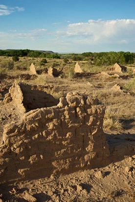
Still farther south along the Mesilla Valley path of El Camino Real, Fort Selden Historic Site is an example of the deterioration of an adobe structure after decades of exposure to the elements. Built in 1865, the large adobe garrison once housed 200 men and was comprised of 15 to 20 buildings. Despite a long history of cyclical site maintenance using natural mud plaster and replacement adobe bricks at the bases of some of the walls, Fort Selden is now a collection of crumbling adobe walls and earthen mounds. The preservation challenge is to develop new ideas and methods to protect the fragile fort from the natural processes of erosion in the future.
Natural and human forces also frequently work against preservation of important cultural landscapes on El Camino Real. A remnant of New Mexico’s volcanic past, the significant spiritual and geographic landmark of El Cerro de Tomé (Tomé Hill) has long been exposed to the elements as it rises 400 feet above the Rio Grande floodplain near Los Lunas. A popular pilgrimage and hiking site, the hill has petroglyphs that date from 3000 BC through the 17th century. Vandalism to the historic rock art jeopardizes the site while occasional over-visitation impacts the landscape. Thanks to the work of area residents, ongoing trail maintenance and efforts to deter vandals help protect the site’s natural resources and cultural integrity.
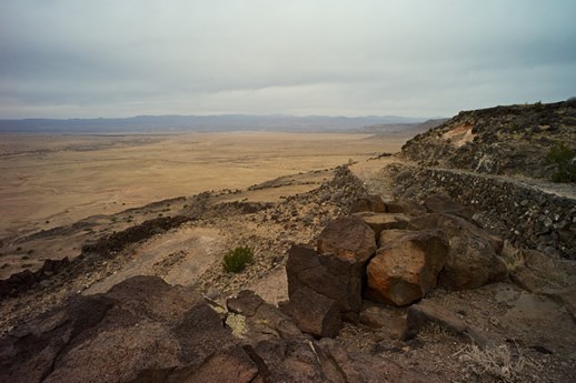
Protecting the landscape of La Bajada Mesa from both direct and indirect impacts is another aim of preservationists. While the remote locale of the 600-foot-tall mesa south of Santa Fe places it among the best preserved and historically significant sections of El Camino Real, damage to fragile trail pathways and sensitive archeological areas from vandals and all-terrain vehicles keeps preservationists on alert. Placement of power lines, cell towers and other forces of modern development further threaten the basalt escarpment and its history as a vital transportation corridor from the precontact period to 1932. For officials of state and federal lands where La Bajada stands, as well as others who work to protect the mesa and expand its public use, education is key. The lesson: despite La Bajada’s monumental presence, the escarpment is a delicate piece of El Camino Real history.
The lesson applies to all of El Camino Real’s historic and cultural resources. Indeed, equal to the federal charge to enhance and encourage use of El Camino Real as a National Historic Trail is the public responsibility to learn from these resources, which against all odds, have survived. Ultimately, our obligation is to preserve and protect the legacy of El Camino Real not just for ourselves, but for the generations to come.

Last updated: July 12, 2020
