Last updated: July 12, 2020
Article
Texas: San Elizario Historic District
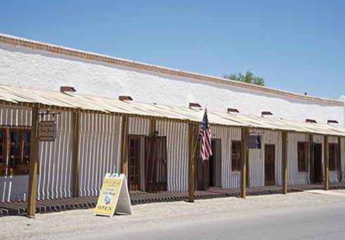
the town’s heyday in the late 18th and early 19th centuries. Photo © Jack Parsons
Wandering the tranquil, laid-back streets of the San Elizario Historic District in West Texas, one finds it hard to imagine the place as an action-packed crossroads of culture, commerce and military affairs. Yet in the 18th and 19th centuries, San Elizario’s adobe embrace held more than the charming air of history it exudes today.
Set on a section of El Camino Real de Tierra Adentro locally known as the Mission Trail at the point where the trail moves north from Mexico across the Rio Grande and into the United States, San Elizario remains a well-preserved portrait of more than 300 eventful years of frontier life.
Once a major commercial connector on El Camino Real, San Elizario now connects the contemporary reality of the lower El Paso Valley as an increasingly urban borderland to the community’s history as an agricultural heartland, a military presidio and a transportation corridor for both sides of the U.S.-Mexico border. While the town may feel sleepy to some visitors, its adobe architecture provides a stimulating reason for visitors to slow down, explore and experience a unique lesson in the history of the Southwest and the U.S.
San Elizario’s roots as a tactical military site on New Spain’s northern frontier are literally embedded in buildings throughout town, in the form of adobe bricks salvaged from an imposing presidio built in 1789 to protect area residents and El Camino Real caravans from Apache raiders. Located on the Rio Grande’s south bank, in the area of an abandoned 18th-century hacienda once owned and farmed by the Tiburcio family, the site was selected for the relocation of a Spanish military fort situated nearly 40 miles away in Guajoquilla, Mexico (present-day Chihuahua). In taking on that fort’s troops, the new presidio took on its name—San Elzeario (also San Elceario)—in tribute to the French patron saint of soldiers, San Elzear.
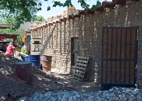
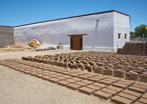
The self-contained garrison boasted twelve-foot-high walls, a chapel, officers’ quarters, soldier’s barracks, storerooms and more—all directly entered and exited via El Camino Real. The construction marked a shift in local building practices from the jacal technique of sealing vertical logs with adobe plaster to a widespread use of adobe bricks and vigas (ceiling beams), and more linear building plans. The presidio’s massive walls provided a sense of security and permanence, forming a central nucleus and a point of orientation for a settlement that quickly grew inside and around it.
By the early 19th century, farmers, merchants and other settlers had joined soldiers at San Elzeario. Among them were resident Apaches who participated in a military settlement program that offered security, food and other provisions in exchange for peace. The program drew hundreds of Apaches to San Elzeario by 1814, when the military’s focus shifted to the Mexican war for independence. The Mexican republic wrested Spanish lands into its control in 1821, and later rescinded rations and other protections for Apache residents. The presidio’s military population declined over the next few decades as the Apache threat waned, but the community’s civilian population continued to grow.
San Elzeario’s prominence as a point of trade began in the late 18th century, when a Chihuahua merchant won a contract as the presidio supplier, luring more trade caravans north along El Camino Real. Mexican independence prompted the opening of the Santa Fe Trail from Missouri to Santa Fe, adding another vital connection to El Camino Real, then known as the Chihuahua Trail. San Elzeario’s commercial growth gave the community greater reason and resources to exist beyond the presidio’s original military purpose.
Even as devastating floods in 1829 and 1852 ravaged the community, residents adapted to the Rio Grande floodplain’s changing course by rebuilding on higher ground. The 1829 flood placed San Elzeario on the Rio Grande’s north side. But the flood’s greatest impact was felt at the end of the Mexican-American War, when the 1848 Treaty of Guadalupe Hidalgo determined the newly cut Rio Grande channel as the boundary between Mexico and the U.S. As San Elzeario residents became Texas residents, San Elzeario became San Elizario.
Americanization spurred a burst of activity as the Chihuahua Stage Line, Butterfield Overland Mail, and other coach and mail lines merged into El Camino Real. Enterprising Americans from the East flocked to town, making San Elizario the largest city in the lower El Paso valley and the county seat. A county courthouse and U.S. post office joined the San Bernal plaza and the presidio chapel of Nuestra Señora del Pilar y de Gloriosa (Our Lady of Pilar and Glorious St. Joseph) at the center of community affairs. With the old presidio in a sorry state of disrepair by the late 19th century, residents salvaged its bricks to build new homes, stores and other symbols of San Elizario’s prosperity.
Prosperity also caused conflict among longtime Hispano residents and Anglo newcomers, who sought control over natural resources and influence in local politics. Tensions came to a head in 1877 with a battle over valuable salt deposits in the Guadalupe Mountains. The Salt War left nine people dead, including a prominent Anglo merchant and an Anglo judge. By the time the railroad reached El Paso in 1881, merchants and other residents were abandoning San Elizario for opportunities elsewhere. Railway exports caused a shift from sustainable to specialized agriculture, and San Elizario’s traditional farms found it hard to keep up. The final snub came from the Southern Pacific railway, which bypassed San Elizario as a site for a lower valley train depot and built a brand new town, scarcely three miles away.
Rather than moving forward into a modern urban railroad town, San Elizario remained rooted in the past, maintaining the historic integrity that gives the community its contemporary cachet. The plaza and chapel, though reconstructed through the years, represent the location of the original presidio. The path of El Camino Real that led into the presidio, today’s Glorieta Road, as well as a network of historic acequias (irrigation dishes), further define the district’s historic 27-acre core.
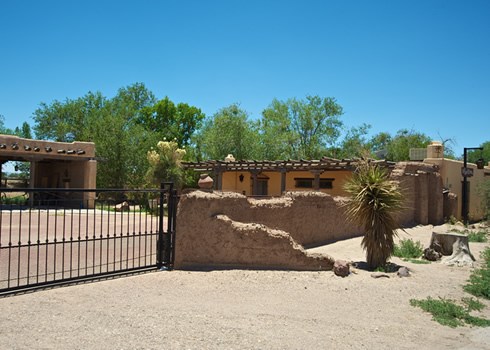
The district features a diverse melding of residential, commercial and civic buildings dating between the 1830s and World War II. The most historically significant buildings feature adobe construction, linear floor plans, flat viga roofs and architectural elements characteristic of the Spanish-Pueblo Revival and Territorial styles. Some later buildings demonstrate other Anglo-American influences and the use of prefabricated construction materials.
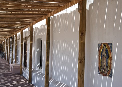
Among the most elegant Territorial-style examples is the mid-19th-century Casa Garcia, better known as the Los Portales Museum and Information Center, on the plaza’s south side. The home of Gregorio Garcia, a former El Paso County judge and Texas Ranger, the building is defined by a long front portal with waves of cottonwood vigas undulating across its impressive roof span. Previously used as a school, the building now hosts San Elizario visitors and highlights exhibits on the town’s history in the Spanish, Mexican and U.S. periods.
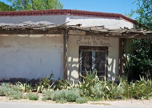
Casa Ronquillo sits outside the village center on the edge of the Acequia Madre (mother ditch). The former home of José Ignacio Ronquillo, a 19th-century San Elizario alcalde (mayor) and the first presidio commander in the Mexican period, Casa Ronquillo was among the largest in town, with multiple entries, twelve rooms, three wings and a large interior courtyard. After Ronquillo’s death, Charles Ellis, the Anglo merchant killed in the 1877 Salt War, purchased the home.
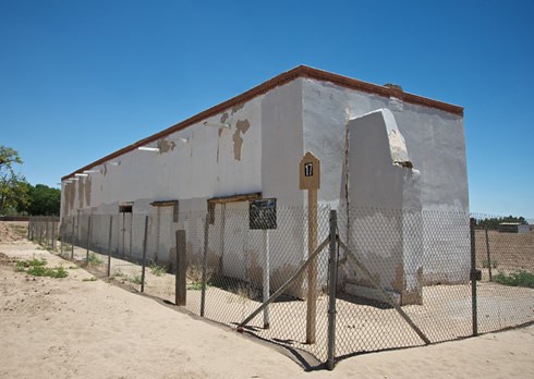
Main Street highlights San Elizario’s commercial heyday, with such buildings as Lalo’s Grocery, the Lujan Store and the Ochoa Store. Dating anywhere from the late-18th century to the mid-19th-century presidio period, the buildings may contain adobe remnants of the old fortress. The U-shaped Lalo’s Grocery may have housed Spanish or Mexican troops and formed a portion of the presidio wall.
Further down Main Street is the 1850’s jail house, whose exposed adobe brick walls and wood-plank door enclosed two steel-and-wrought-iron cage cells. Local legend has it that Billy the Kid helped his friend, Melquiadez Segura, escape from the jail in 1876.
While the sounds of El Camino Real caravans and creaky stagecoach wagons are no more, a private residence that once was a rest station for the Butterfield Overland Mail Line still stands southeast of the presidio. Although remodeled, the home retains its rectangular shape, thick walls and wagon-wide front gate.
Many San Elizario residences and buildings are only echoes of their former selves after years of remodeling. The cornerstones of the town’s cultural identity are being bolstered, however, by preservation efforts at historic buildings throughout town. As long as the presidio chapel bells continue to toll, and travelers trod the path of El Camino Real, San Elizario will remain a prominent symbol of the life and lore of the old Southwest.
The San Elizario Historic District is located in San Elizario, Texas (about 17 miles southeast of El Paso). For more information, visit the Los Portales Museum and Information Center website.
Explore more history by visiting the El Camino Real travel itinerary website.
