Last updated: September 9, 2021
Article
Oregon and California National Historic Trails Fall 2021 Newsletter
Read the latest project updates and completions from the National Trails Office of the National Park Service (NPS).
To print this newsletter, or save it as a pdf: CTRL + P or Right Click with your Mouse, and select "Print."
Photo/Paula Ogden-Muse
National Trails Welcomes New Staff
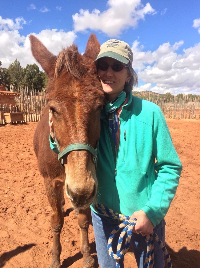
Paula Ogden-Muse has joined the National Trails Office (NTIR) as the Team Lead for Interpretation. She began her Department of Interior career as a wilderness ranger, interpreter, and then an education specialist at North Cascades National Park. She's also worked for the Upper Mississippi River National Wildlife and Fish Refuge in Wisconsin; Pipe Spring National Monument in Arizona; and, most recently, as the Chief of Interpretation for Fort Sumter and Fort Moultrie National Historical Park and Charles Pinckney National Historic Site in South Carolina. She's settling into Santa Fe with her husband, Jeff, a writer who also works in historical interpretation and environmental education. In their free time, you'll find them visiting local museums; walking urban paths and forested trails; and birding every chance they get.

Photo/Faith Welty
Faith Welty has joined NTIR as an Outdoor Recreation Planner in June 2021. Faith holds a Bachelor of Science in Landscape Architecture from Purdue University in West Lafayette, Indiana. Soon after graduation, she stepped into the role of a Landscape Architecture Fellow with the National Park Service’s Rivers, Trails, and Conservation Assistance Program (RTCA) based at the Center for Community and Environmental Design at Purdue University. In her free time, you will find her engaging with the outdoors and cultural arts (very excited to experience more in Santa Fe!). As part of her duties, she will support NTIR in providing planning assistance to local partners and associations along the historic trails ensuring preservation and recognition of our National Historic Trails.
Staff Updates
NTIR is pleased to announce a few changes within the office. Coreen Donnelly is the new lead for the Design & Development Team, which is coordinating the highway signing project in California. And Carole Wendler, who many have worked with as the lead for the Interpretation Team, is now the Deputy Superintendent, replacing John Canella. Congratulations to these staff members on their new positions!
Lillis Urban, who was leading NTIR's feasibility study process for the past year, has moved on. Jill Jensen, one of our cultural resources staff, will be temporarily promoted into the planning position and will be leading the feasibility study process for the next four months. NTIR is conducting feasibility studies for the potential Pike and Emancipation National Historic Trails (NHTs).
Work in the Time of Covid
NTIR staff have been teleworking full time from home since mid-March 2020, and will continue to do so until notified to return to our offices. Meanwhile, personnel are available during regular work hours through their usual email addresses and cell phone numbers. If you need a staffer’s cell number, call 505-988-6098 in Santa Fe or 801-741-1012 ext 119 to inquire.
NPS Exhibit
Elko Hot Hole Waysides
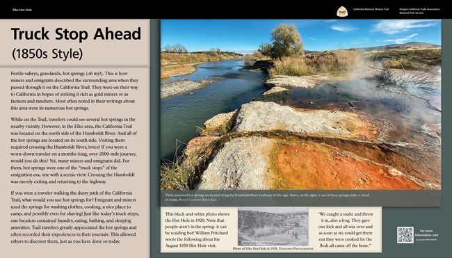
Two new waysides have been designed for installation at the Elko Hot Hole in Nevada. The panels interpret the geologic wonders as they were reported by trail travelers, and the site’s significance as a camp for providing hot water for bath, washing clothes, and cooking. The panels connect visitors with the California Trail Interpretive Center, located 20 minutes Southwest. The panels were funded in cooperation with the California Trail Heritage Alliance.
NPS Photo
American Solar Challenge
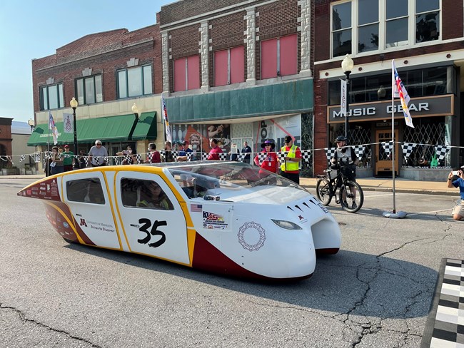
In 2018, the American Solar Challenge followed the Oregon NHT. In 2020 the event was cancelled, and in 2021 it was held on the Santa Fe Trail. But since the official starting line was in Independence, Missouri, all three trails were recognized. Big announcement: next year's race will return to the Oregon Trail!
NPS Image
National Historic Trails Wayside/Sign Inventory Application
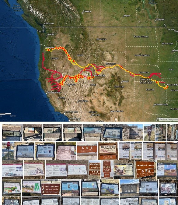
The mobile application (app) is used to track assets along the trail such as interpretive waysides, museum exhibits, and NHT road or pedestrian signs. The app utilizes a user-friendly interface, similar to a fillable PDF, and eliminates the use of complex and sometimes costly GPS devices. The instructional video for the app can now be viewed on YouTube. Below is the link to the video.
There are now 243 California NHT and 150 Oregon NHT (272 Total) waysides/signs that have been recorded by National Trails staff, OCTA members, and Santa Fe Trail Association members (where the trails overlap).
Thank you for the efforts of OCTA members Kevin Lee in recording 92 waysides/signs, Lila Aamodt recording 75 waysides/signs, Charles Weikart and Beth Skinner recording 18, and Jean Coupal-Smith for recording 11 wayside/signs. Waysides/Signs have been recorded in Missouri, Kansas, Utah, Nevada, Idaho, and Oregon. If you are interested in joining this effort, please contact Travis Boley and Dave Welch concerning your interest and CC National Trails GIS Specialist Brian Deaton on the email.
OCTA Mapping Workshop
September 9-11, 2021
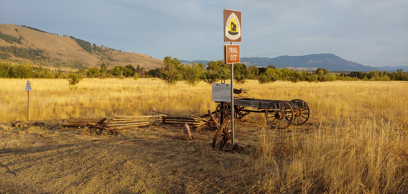
The Resource Information Management Team, National Trails GIS Program is excited about presenting and contributing to the workshop regarding OCTA’s mapping efforts, incorporating newer technology/software, ensuring data and software compatibility, and how these efforts identify/preserve the trail and enable the public to experience the NHTs.
NPS Photo
Auto Tour Route (ATR) Guide Updates
Oregon ATR
- The Oregon NHT Auto Tour Route guide for Oregon is in final layout. The printing date will be released soon!
California ATR
- In early July, a staff member visited sites on the Truckee Route, guided by Oregon and California Trails Association (OCTA) researcher David Fullerton, and also met with Bill Holmes and John Winner at Johnson’s Ranch in preparation for development of the California Auto Tour Route guide—the last in the series. NTIR has been consulting with Bill Holmes regarding a possible partnership certification agreement with the owner of Johnson’s Ranch. We’re waiting to learn from Bill if the owner would agree to seasonal tours of the property guided by local historical society members. Some level of public access is required for certification to be approved.
- NTIR staffers from the Cultural Resources and Interpretive teams are planning a mid-September drive along the Walker River-Sonora auto tour route in California Guide. This trip is subject to change pending Covid restrictions and wildfire closures. Plans to visit other routes for this purpose had to be postponed until spring due to wildfires.
NPS Photo
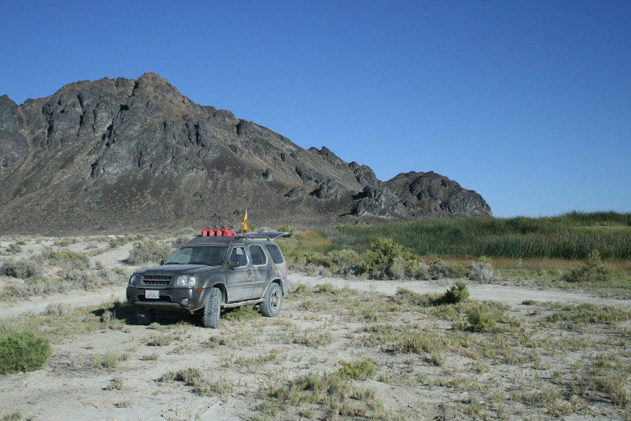
Team members are also planning to join Ken Johnston’s OCTA/Emigrant Trails West tour through the Black Rock Desert in late September/early October. This trip, too, is subject to change pending Covid restrictions and wildfire closures.
NPS Photo
Oregon Trail in the Blue Mountains
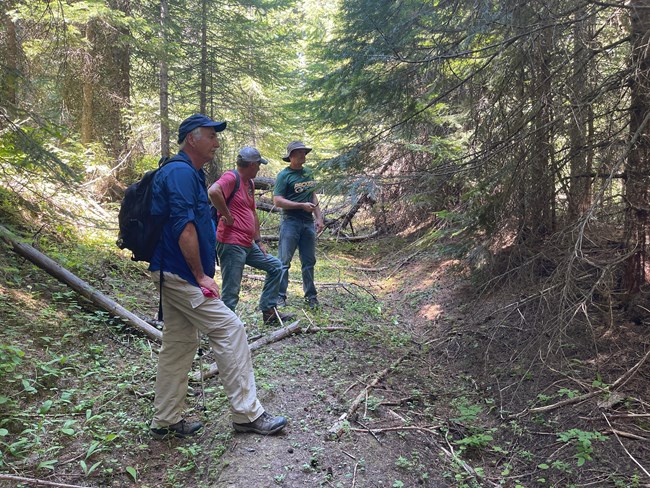
A select team of Pacific Northwest Chapter OCTA members, led by Dave Welch, gathered in the Blue Mountains in late June to examine state and private lands in the vicinity of Emigrant Springs State Heritage Area for possible trail trace. The primary objective of the investigation was to determine if Oregon Trail swale crossed property belonging to the First Presbyterian Church of Pendleton. NTIR supported the team members’ travel, and the church provided meeting space and lodging in its camp bunkhouses for those team members who wished to stay there. Temperatures during the fieldwork topped 100 degrees. NTIR is grateful to all of the hardworking team members who worked under those extreme conditions!
Updates on External Projects
NTIR is participating in early conversations with representatives from the proposed Grain Belt Transmission Line to consider any potential impacts to the California and Oregon NHT alignments and surrounding viewsheds. The current planned transmission line will be located in Kansas and Missouri; the transmission line intersects the shared California and Oregon NHT alignments southwest of Marysville, Kansas, and intersects the California NHT alignment southwest of Hiawatha, Kansas.
A large renewable energy project has been proposed on Bureau of Land Management Land in southern Idaho. The Lava Ridge Wind Project would include approximately 400 wind turbines at a maximum height of up to 740 feet tall.
The designated alignment of the Oregon National Historic Trail (NHT) crosses approximately 9- 10 miles south of the proposed Lava Ridge Wind Project. There are several high potential sites along and near this portion of the NHT, including Rock Creek Crossing, Caldron Linn, Stricker Store/Rock Creek Station, Milner Ruts (Cedar Emigrant Camp), and Shoshone Falls. Caldron Linn (NR# 72000442) was listed in the National Register of Historic Places in 1972 and the Stricker Store (NR# 79000810) was listed in 1979. Caldron Linn is located approximately eleven miles from the proposed wind project and the Stricker Store is located approximately 16 miles away.
Although we are still awaiting visual simulations, but we do not anticipate adverse visual impacts to Cauldron Linn, the Stricker property, or the Milner Ruts.
The Notice of Intent To Prepare an Environmental Impact Statement for the Proposed Lava Ridge Wind Project in Jerome, Lincoln, and Minidoka Counties, Idaho, was published on August 20, 2021. All comments must be received by September 20, 2021.
NTIR reviewed and commented on an analysis of visual impacts to the Oregon NHT across Oregon that are anticipated to result from the Boardman to Hemingway transmission line. The Bureau of Land Management has received our remarks and provided some initial follow-up.
Signing Updates
Sign planning for Fiscal Year (FY) 2021 is coming to a close. For the Oregon and California Trails, 2 sign plans have been completed.
Some notable signing highlights:
- California Trail: Signing in partnership with the Forest Service (USFS) along a portion of the Sonora Trail in Mono County, CA was completed.This is a 16 mile hiking trail.
- Oregon Trail: The Oregon Trail was signed this year in conjunction with the California and Pony Express Trails. The sign plan for the entire state of Wyoming along Wyoming Department of Transportation (WYDOT) roadways was completed.
Virtual Trail Stories & Experiences
Have you been following the trails on social media? You may have noticed an increase in articles, virtual visits, and virtual kids' activities. People can't travel to experience the trails in person, so the national trails' staff has been working to bring the trails to your house. You can check out recent and past articles, become a junior ranger, take virtual visits to learn more about trail sites, and more - click the links below!
Death Came A-Knockin’: Freak Accidents on the Westering Trails
Everyone who’s ever played the Oregon Trail game know that emigrants stood a good chance of dying from disease or drowning at a river crossing before ever reaching the Willamette Valley. Of course, there were other common ways to die on the way to Oregon, Utah, or California. These were the possibilities people knew and worried about as they loaded up their wagons and started their oxen westward. But there were other ways to end one’s trip early. Unexpected ways. Freak accidents. Read more...
Connect with the Trails
-
 Oregon Trail Website
Learn more on the Oregon Trail NPS website.
-
 California Trail Website
Learn more on the California Trail NPS website.
-
 Find us on Social Media
Learn more about the trails on social media!
