Last updated: December 13, 2023
Article
New Landmarks Reveal Stories Millions of Years in the Making, Below and Above Ground

NPS photos
The National Park Service is pleased to introduce the nation’s newest National Natural Landmarks:
- Glenwood Caverns and Iron Mountain Hot Springs, Colorado
- John Boyd Thacher State Park, New York

Glenwood Caverns
The exciting underground processes that formed Glenwood Caverns and Holly Cave millions of years ago are still in place at Iron Mountain Hot Springs, giving us a window into the past. Below the surface of Iron Mountain are beautifully decorated caves formed by unique processes that host rare and diverse ecosystems and whose features constitute a geomorphic timeline that is revealed by the downcutting of the Colorado River, telling a story millions of years in the making.
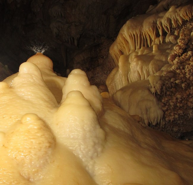
To understand what makes this site outstanding, we go underground. Glenwood Caverns, historically known as Fairy Cave, is near the top of Iron Mountain at an elevation of 7,100 feet and has been age-dated to between 1.34 and 1.69 million years old. It's the third longest cave in Colorado, with over three miles of mapped passageways, and has the second largest cave room in the state. Glenwood Caverns also contains an abundant variety of speleothems (cave formations) making it one of the most decorated caves in the state.

Glenwood Caverns
Holly Cave is lower down Iron Mountain at an elevation of nearly 6,000 feet. This cave consists of a network of 700 feet of maze-like passages with a vertical extent of 26 feet. While not as heavily decorated as Glenwood Caverns, Holly Cave’s similarity and its location farther down the mountain, suggests that it is a younger, relict conduit left high and dry by the continued downcutting of the Colorado River.
Iron Mountain Hot Springs are on the canyon floor and tell the third piece of the story. The hot springs are the site’s youngest features, resurging at the current level of the Colorado River, at around 5,700 feet of elevation. These hot mineral springs are home to a diverse suite of extremophiles (microorganisms that live in extreme conditions), including 25 unique types of living bacteria.
Collectively, Glenwood Caverns, Holly Cave, and Iron Mountain Hot Springs provide a unique record of the underground processes that reflect the evolution of the groundwater system in the Glenwood Springs area. Around 2.5 million years ago (mya), the bottom of Glenwood Canyon and the Colorado River were just above Glenwood Caverns. At that time the springs would have appeared at the surface just above the caves. Since then, the Colorado River has down cut around 1,300 feet and the springs have migrated to their present location. The caves were formed by both carbonic and sulfuric acids, with water that ascended from a deep-seated source. This is the only known cave system in the Southern Rocky Mountains where this combination of natural processes occurs.
2,000 miles to the east and several hundred million years back in time (go way down that geo timescale), we find the other newly minted NNL site.

NPS
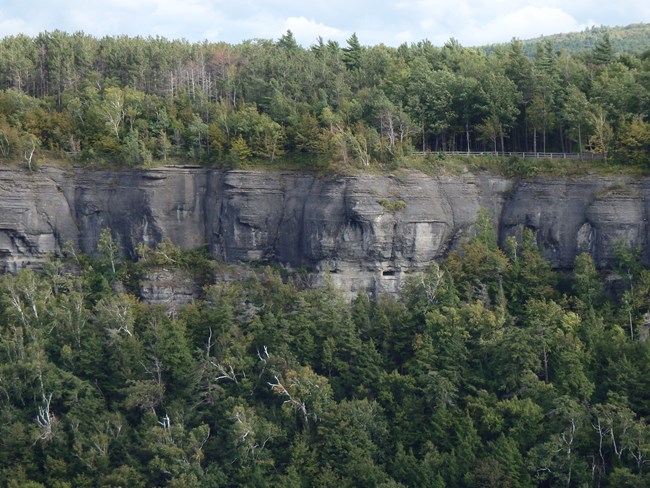
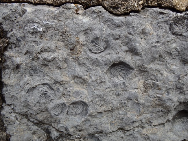
The cuesta’s cliff face exposes a very distinctive stratigraphic (layered rock) section that showcases 14 different formations covering 63 million years, from the Late Ordovician (450 mya) to the Middle Devonian (388 mya). The most interesting section at John Boyd Thacher State Park are the layers in the cliff face that date to the Silurian and Devonian Periods. These periods are collectively referred to as the Middle Paleozoic Era (444-359 mya) and represent an interval of Earth history characterized by high sea levels with expansion of marine invertebrates, reef communities, and fish. This era also marks the emergence of plants and insects on land, and near the end of the Devonian Period, the appearance of four-legged animals. This geologic interval is critical to understand because the Appalachian Mountains and their surroundings, in fact most of eastern North America, is largely composed of rocks of this age.

NPS
These millions of years of geologic history are set within beautiful northern hardwoods of the Eastern Deciduous Forest, some of which have not been logged for at least 100 years. The geology gave rise to the great diversity of conditions and environments that comprise this rich forest ecosystem with 21 distinct ecological communities, many of which host rare plant and animal species. The park also contains 40 caves, 17 springs and excellent examples of clint and grike limestone pavement; clints are flat, pavement-like limestone areas and grikes are the open cracks or fissures that isolate the individual clints. These natural formations give the appearance of cracked pavement, or in the case of Thacher State Park where the grikes are up to two feet in width and many tens of feet in length, natural gutters, or canals.
These new designations provide an amazing opportunity to learn about and celebrate the great diversity of the Nation’s natural heritage. Below are links for additional resources to continue learning about the types of natural features so illustratively represented at the Nation’s newest NNL sites.
Solution Caves - Caves and Karst (U.S. National Park Service) (nps.gov)
Geologic Time Scale - Geology (U.S. National Park Service) (nps.gov)
Fossils and Paleontology (U.S. National Park Service) (nps.gov)
NNL Prehistoric Life Coloring Pages (U.S. National Park Service) (nps.gov)
Solution Caves - Caves and Karst (U.S. National Park Service) (nps.gov)
Geologic Time Scale - Geology (U.S. National Park Service) (nps.gov)
Fossils and Paleontology (U.S. National Park Service) (nps.gov)
NNL Prehistoric Life Coloring Pages (U.S. National Park Service) (nps.gov)
