Part of a series of articles titled Five-Needle Pine Monitoring on Wyoming Bureau of Land Management Forests in the Greater Yellowstone Ecosystem.
Article
Methods for Five-Needle Pine Monitoring on Wyoming Bureau of Land Management Forests in the Greater Yellowstone Ecosystem

NPS/Shanahan
This is the third and final article in the article series, “Five-Needle Pine Monitoring on Wyoming Bureau of Land Management Forests in the Greater Yellowstone Ecosystem.” It describes the methods used to measure white pine blister rust infection status, mortality, and recruitment in five-needle pines (whitebark pine (Pinus albicaulis) and limber pine (Pinus flexilis)) on Bureau of Land Management (BLM) forests in Wyoming.
Methods for monitoring five-needle pines on Wyoming BLM forests follow the Interagency Whitebark Pine Monitoring Protocol for the Greater Yellowstone Ecosystem (GYWPMWG 2011), with one important exception: in Wyoming BLM forests, five-needle pines are also monitored using rapid assessment transects. These “rapid” transects differ slightly in methodology from permanent transects because trees and transect boundaries are not permanently marked, and fewer data are collected at each tree to expedite the survey. Otherwise, the same detailed methods apply as described in “Methods for the Interagency Whitebark Pine Monitoring Program in the Greater Yellowstone Ecosystem,” which is part of the “Whitebark Pine Monitoring in the Greater Yellowstone Ecosystem” article series on NPS.gov. Detailed methods, including example data forms, are also available from a summary of five-needle pine monitoring between 2013 and 2017 on Wyoming BLM forests (Shanahan et al. 2022).
Sampling Design

NPS
We appraised five-needle pine health on Wyoming BLM lands by combining a permanent transect approach, which follows the Interagency Whitebark Pine Monitoring Protocol for the Greater Yellowstone Ecosystem, with a rapid assessment method specifically designed for this Wyoming BLM effort (Shanahan et al. 2022). The interagency whitebark pine monitoring protocol assesses long-term trends in whitebark pine health by surveying permanent belt transects (10 meters by 50 meters) and tagged trees within designated stands of whitebark pine in the Greater Yellowstone Ecosystem. These delineated stands tend to support high densities of whitebark pine. Given the sparsity of five-needle pines often encountered on Wyoming BLM lands, the rapid assessment method allows for more samples, which helps to more accurately evaluate blister rust infection levels and overall five-needle pine health.
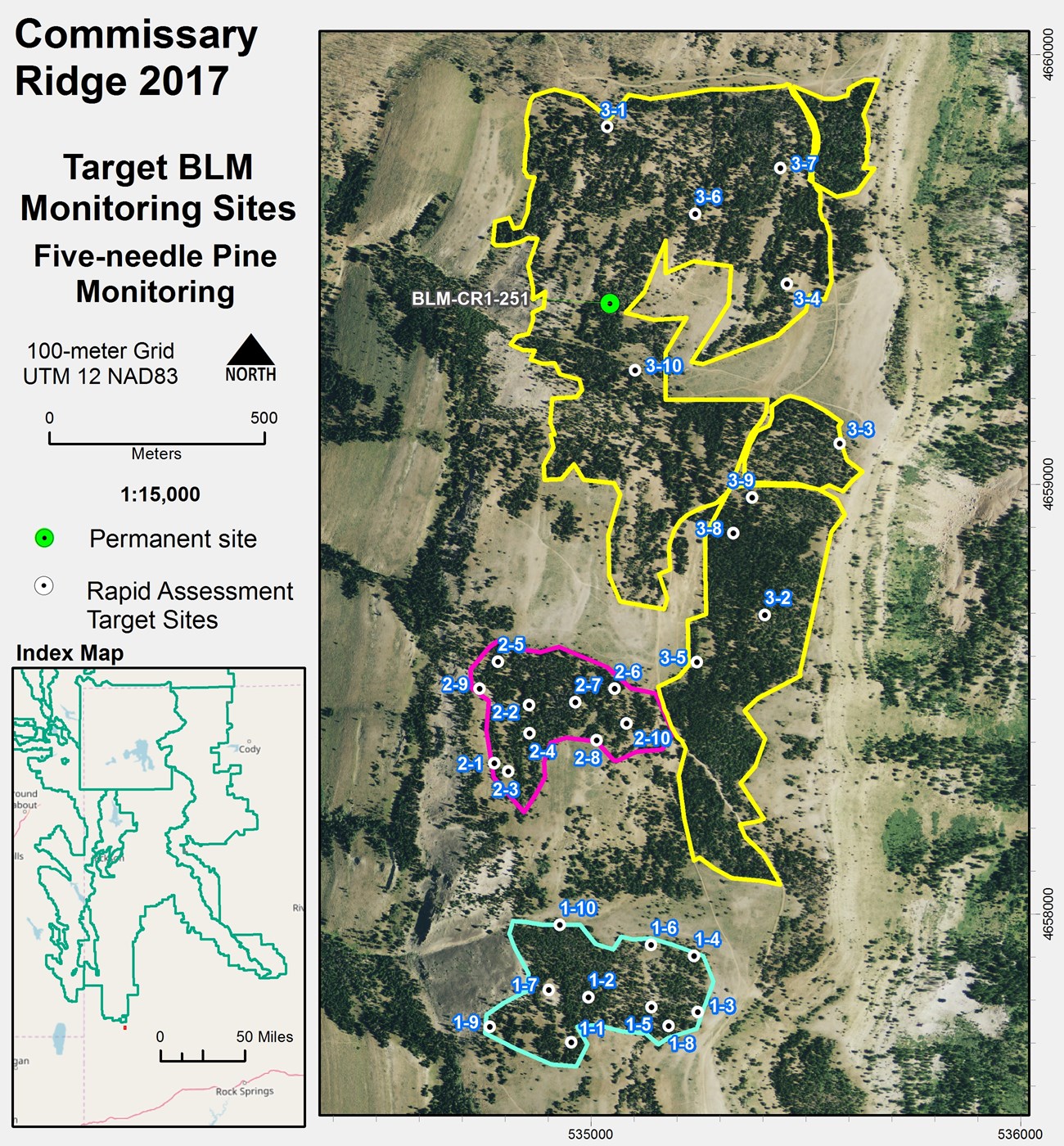
The sampling design for both types of surveys (permanent and rapid) was a stratified two-stage cluster sample. Each geographic area identified by Wyoming BLM was considered a geographic stratum. The first-stage sampling unit was a map unit (primary sampling unit; map units ≥2.5 ha; e.g., Commissary Ridge 1), and the secondary sampling unit was a point within a map unit (Figure 1).
The number of map units varied by geographic stratum. Secondary sampling units (10 meter by 50 meter belt transects) were selected using the Generalized Random Tessellation Stratified design (GRTS). The GRTS design is a spatially balanced sampling methodology that distributes coverage across the entire area of interest using a stochastic approach (Brown et al. 2015). The observation unit (the object on which a measurement was taken) was each qualifying, five-needle pine tree within the secondary sampling unit.
Transect Establishment and Visit Schedule
Permanent Transects
Eight permanent transects were established in 2013 and 2014 following the 2011 interagency whitebark pine monitoring protocol. Within these transects, a total of 146 live, individual trees >1.4 m tall were permanently marked with tags to monitor long-term changes in blister rust infection and survival rates. These eight permanent transects are divided into four panels of two transects each, which are revisited on a rotating schedule every four years (Figure 2).

NPS
Rapid Transects
Rapid assessment transects follow the same establishment methods and criteria used for permanent transects (following the monitoring protocol for whitebark pine), but neither the transect nor the trees within the 10 meter by 50 meter boundary of the transect are permanently marked. In addition, fewer data are collected on individual trees to expedite the survey for each rapid assessment transect, reducing the time spent per transect and allowing for increased sample size.
Rapid assessment transects are surveyed in conjunction with the associated permanent transect within each geographic stratum. Up to five rapid assessment transects are slated for measurement within each map unit throughout the Wyoming BLM area of interest. These rapid assessment transects are drawn from a selection of 10 possible GRTS-derived randomly ordered center points.
A handheld GPS unit is used to locate the rapid assessment coordinates. Points are visited according to their randomly assigned order, so that for random points 1 through 10, 1 is visited first, 2 is visited second, and so on. If a given random point does not qualify for a rapid assessment evaluation (no live, five-needle pines >1.4 m tall) the next random point in the selection is visited and assessed for inclusion. If a site is suitable for sampling (i.e., had at least one live, five-needle pine tree >1.4 m tall) a 10 meter by 50 meter area is surveyed. Once a maximum of five qualifying transects are successfully surveyed or all 10 random points are exhausted for inclusion, sampling in the map unit is completed. Because the transects are not permanently monumented, a GRTS selection of 10 new random points is generated for each map unit for subsequent revisits.
Collecting Blister Rust, Mortality, and Recruitment Data
Detailed methods for collecting mortality, recruitment, and white pine blister rust infection data on permanent 10 meter by 50 meter five-needle pine transects, as well as their associated 1/300 acre recruitment subplots, are identical to and can be accessed from “Methods for the Interagency Whitebark Pine Monitoring Program in the Greater Yellowstone Ecosystem.” Here we provide an overview.
Data for all four monitoring objectives follow the same collection methods at both permanent and rapid transects, with two exceptions: for rapid transects, trees and transect boundaries are not permanently marked, and fewer data are collected (Table 1).
| Metric | Permanent Transect | Rapid Transect |
| Date of survey | x | x |
| Elevation | x | x |
| Transect coordinates (UTMs; beginning, center, end) | x | center only |
| Transect orientation (azimuth) | x | x |
| Habitat type | x | x |
| Cover type | x | x |
| Tree species (Pinus albicaulis, Pinus flexilis, or Unknown) | x | x |
| Clump number | x | x |
| Clump letter | x | – |
| Diameter breast height category | x | x |
| Height class | x | x |
| Tree status (live, recently dead, dead) | x | x |
| Count of blister rust cankers with blister rust aecia spores in canopy in upper 1/3rd, middle 1/3rd, lower 1/3rd | x | – |
| Count of blister rust cankers with blister rust indicators in canopy in upper 1/3rd, middle 1/3rd, lower 1/3rd | x | – |
| Count of blister rust cankers with blister rust aecia spores in bole in upper 1/3rd, middle 1/3rd, lower 1/3rd | x | – |
| Count of blister rust cankers with blister rust indicators in bole in upper 1/3rd, middle 1/3rd, lower 1/3rd | x | – |
| Tally of indicators (rodent chewing, flagging, swelling, roughened bark, oozing sap) | x | – |
| Presence of blister rust aecia spores on bole | – | x |
| Presence of blister rust aecia spores on branches | – | x |
| Presence of at least three secondary indicators on bole | – | x |
| Presence of at least three secondary indicators on branches | – | x |
| Upper live canopy volume (%) | x | x |
| Pitch tube category | x | x |
| Presence of mountain pine beetle galleries (recently dead or dead trees only) | x | x |
| Presence of mountain pine beetle frass | x | x |
| Presence of cones | x | x |
| Tree health code | x | x |
| Total trees in plots ≤1.4 m tall with blister rust | x | x |
| Total trees in plots ≤1.4 m tall without blister rust | x | x |
| Total trees in plots ≤1.4 m tall with unknown blister rust status | x | x |
| Presence of mistletoe | x | x |

NPS/Shanahan
Documenting White Pine Blister Rust Infection
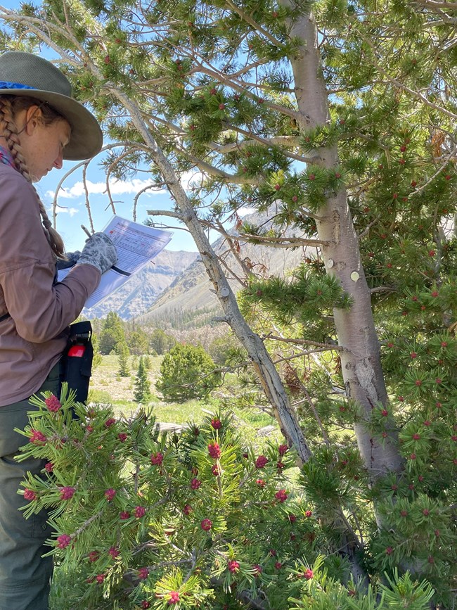
The presence or absence of blister rust infection is recorded for all live trees within each transect. A tree is considered infected if either aecia or cankers are present. To document the severity of infection, the location of blister rust canker is recorded as occurring in the canopy (branches) or on the bole (trunk) of an infected tree.
Documenting Mortality
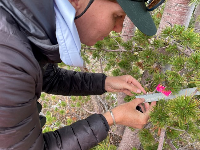
All trees >1.4 m tall are recorded as alive or dead. For live trees, we record evidence of blister rust infection, dwarf mistletoe infection, mountain pine beetle attack (pitch tubes, frass), impact from fire, or other mortality influencing factors, such as windfall or avalanche. For dead trees we record any J-shaped galleries under the bark from mountain pine beetle activity.

NPS/Shanahan
Documenting Recruitment
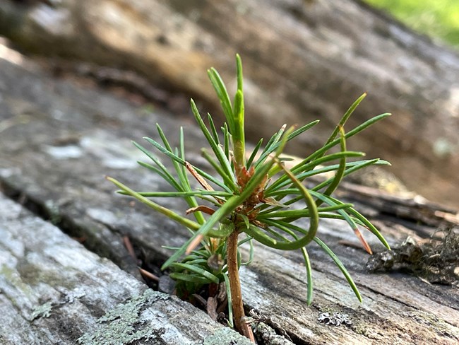
We record data for three indices of five-needle pine recruitment for each transect:
-
the number of trees less than or equal to 1.4 meters (≤1.4 m) tall
-
the number of trees that grow to more than 1.4 meters (>1.4 m) tall
-
the number of live tagged trees, regardless of height, that show signs of reproductive activity
We also record cone-production as an indication of current and potential future tree recruitment.
On permanently established transects only, additional information about factors affecting recruitment, such as the abundance and composition of non-five-needle pine understory tree species, and ground cover, is collected in three circular 1/300 acre subplots centered at the beginning, middle, and ending points of each belt transect. The beginning and ending circular subplots partially overlap the belt transect, while the center recruitment subplot falls entirely within the belt transect. Detailed methods for recruitment plot setup and metrics are available in “Methods for the Interagency Whitebark Pine Monitoring Program in the Greater Yellowstone Ecosystem.”
Brown, J. A., B. L. Robertson, and T. McDonald. 2015. Spatially balanced sampling: application to environmental surveys. Procedia Environmental Sciences 27:6–9.
Greater Yellowstone Whitebark Pine Monitoring Working Group (GYWPMWG). 2011. Interagency whitebark pine monitoring protocol for the Greater Yellowstone Ecosystem, Version 1.1. Greater Yellowstone Coordinating Committee, Bozeman, Montana.
Shanahan, E., K. M. Irvine, K. Legg, S. Wilmoth, R. Daley, and J. Jackson. 2022. Monitoring five-needle pine on Bureau of Land Management lands in Wyoming: Summary report for 2013, 2014, 2016, 2017—republished. Natural Resource Report NPS/GRYN/NRR—2022/2412. National Park Service, Fort Collins, Colorado. https://doi.org/10.36967/nrr-2293294
Last updated: August 19, 2024
