Last updated: September 5, 2024
Article
Calumet Unit Cultural Landscapes
Development of the Calumet Unit
Calumet developed on a similar trajectory to Quincy in regard to the timing of its founding and development. The Calumet and Hecla Mining Company (C&H) officially formed in 1871, as the result of two neighboring companies merging. The unit is located 12 miles to the northeast of Quincy and includes an industrial core, the adjacent civic and commercial district of the Village of Calumet, and several housing locations.
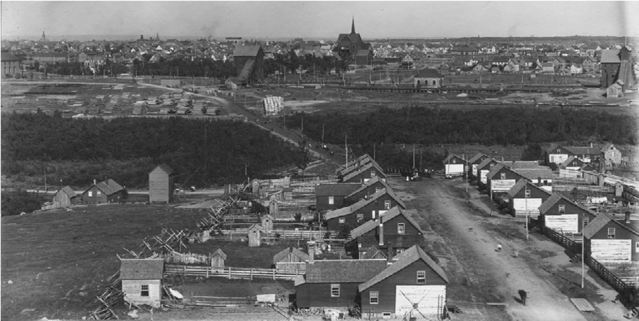
In 1864, Edwin Hulbert, a surveyor, identified the Calumet Conglomerate lode and began securing title to the land. Under his management, the company initially used the open-pit approach that greatly disturbed the landscape. The mining companies merged under the new management of Alexander Agassiz and transitioned to deep shaft mining, which required large amounts of lumber to support the mine ceilings. The prevalent wood use created the conditions for a series of fires and several shafts were closed, particularly between 1887 to 1889. The edge of the forest continued to recede farther from the main industrial corridor along Mine Street to provide more space and raw materials for development.
By the late 1800s, Calumet's character as an industrial landscape was solidified through the extensive clearcutting, along with the addition of railroad and tram tracks, trestles, machinery, and stockpiles of materials. Overhead power lines ran the length of the plant after the implementation of large electrical generating facilities in 1891. From 1891 to 1893, C&H upgraded shaft houses above the mines to include taller shaft-rockhouses. Shaft-rockhouses combined the operations of shafthouses and rockhouses, which enabled the initial rock crushing at the site instead of requiring extra transportation to a separate rockhouse and crushing facility.

NPS / Keweenaw National Historical Park, Jack Foster Collection
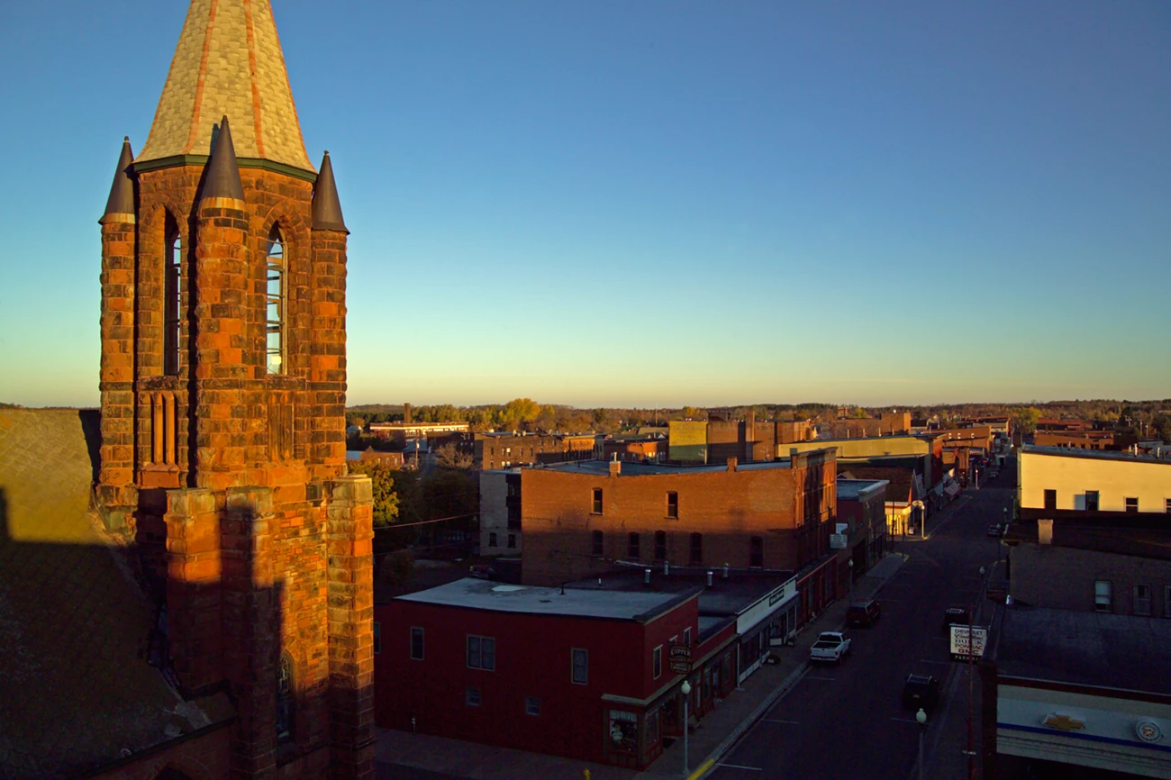
The industrial core was organized around the southwest-to-northeast geology of the copper lodes. Some company housing neighborhoods follow this orientation, while other surrounding commercial and housing districts to the north and west follow the south-north pattern. Hulbert platted the Village of Red Jacket (later the Village of Calumet) using an ordinal grid, which determined property lines and street locations. Early construction in both the industrial and commercial cores consisted of wood-framed structures and transitioned to brick and stone by the 1880s.
The prosperity of the company soon resulted in additional housing locations, which tended to each contain uniform architecture and materials. The emphasis on planning in Calumet yielded a common space that connected the village and industrial core. While at first “the commons” provided a place to grow and harvest hay for livestock and horses, later use of the Commons consisted primarily of leisure and recreation, including a fenced baseball field. Generally, the company succeeded in anticipating future housing and industrial needs and “overbuilding.”
Other villages associated with different mining companies were connected by an interurban streetcar between 1901 and 1932. The system connected Mohawk in the north to Houghton in the south.
In 1917, Warren Manning, a landscape architect, created a masterplan for Agassiz Park, formerly Calumet Commons. The plan included tree- and flower-lined paths radiating from a Paul Wayland Bartlett sculpture honoring C&H President Alexander Agassiz for nearly four decades of leadership. The park opened in 1923.

NPS / Keweenaw National Historical Park, Foster Collection
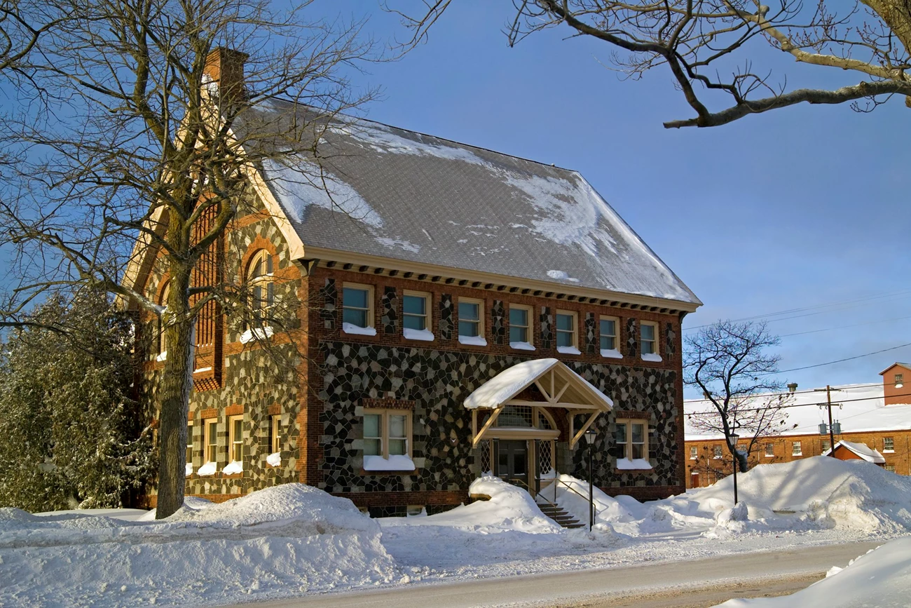
C&H also built other community facilities such as bathhouses, schools, hospitals, office buildings, a Colosseum, and libraries. The library was designed to be used by the whole community, not just mining company employees. It soon included open stacks, an elegant reading room (with a separate children’s library), and — until 1911 when a purpose-built bathhouse was constructed — bathing rooms in the basement. Both the library and bathhouse landscape demonstrated a refined character through ornamental fences, mowed lawns and a few trees.

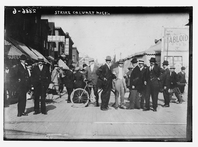
Bain News Service, Library of Congress
After the period of community development from 1890 to 1915, C&H growth slowed, and the company faced market challenges. As with Quincy, the workers' strike from 1913 to 1914 affected operations. The National Guard camped in Calumet Commons and by the company management offices nearby to maintain order. As at Quincy and other striking copper mines, workers at C&H demanded safer working conditions, higher compensation, opportunities for advancement, and basic housing amenities.
By this period, C&H was implementing too few upgrades to existing housing, and some workers lived without indoor plumbing and electricity in a climate with harsh winters. Workers left the area for opportunities elsewhere. Activity within the industrial core decreased, and residents of Calumet sought to bring new industry to the economy, including tourism. The Civilian Conservation Corps and Works Progress Administration projects, as part of the New Deal, brought some improvements to the existing infrastructure and fledgling tourism industry, primarily in Keweenaw County to the north.
Universal Oil Products (UOP) purchased C&H Mining Company in 1968. A strike followed soon after, and then finally the closure of the C&H mining company. In the early 1970s, UOP conceived of a history-oriented theme park, Coppertown USA. The plan did not come to fruition, but public interest in the site’s history grew, even as many mining-related structures were dismantled and sent to other active mining districts. Research and documentation supported the listing of two significant districts and properties on the National Register of Historic Places, and in 1989 both Quincy and Calumet were designated National Historic Landmarks (NHL). Together, the two NHL districts anchor Keweenaw National Historical Park, which was established in 1992.
Quick Facts
-
Cultural Landscape Type: Historic Site
-
National Register Significance Level: National
-
National Register Significance Criteria: A
-
Period of Significance: 1864-1930
-
National Historic Landmark District


