Last updated: May 8, 2025
Article
Vegetation Monitoring at Barataria Preserve: 2021 Brief

NPS/GULN
Project Background
The Gulf Coast region features landscapes that are, or once were, at the interface of land and water, creating diverse and dynamic habitats for plants. The region’s abundant plant life enhances our outdoor experiences and provides vital ecosystem and wildlife services.Yet even on NPS protected lands, these key botanical resources are threatened by human activities and environmental change. Monitoring plant communities is therefore essential to understanding park health and making informed management decisions, so that resources may be enjoyed, unimpaired, by future generations.
Throughout the NPS, plant communities and other key natural resources are tracked and assessed scientifically by 32 Inventory and Monitoring (I&M) networks, through their vital signs monitoring programs. For parks in the Gulf Coast I&M Network, the goals of vegetation monitoring include documenting the status and change in(1) richness of native and non-native species; (2) percent cover and frequency of key species or growth forms (e.g., graminoids or shrubs); and (3) the health and regeneration of forests. The network follows a peer-reviewed protocol that is largely consistent with other I&M networks in the eastern US, with plot resampling at 4-year intervals.
For Barataria Preserve of Jean Lafitte National Historical Park and Preserve, network and park staff made an initial selection of plots spanning both terrestrial and submerged portions of the park in 2014. The sampling frame was later narrowed to bottomland deciduous forests at 0.35 meters [m] above sea level [a.s.l.] or higher, and bald cypress swamp forests from the park’s U.S. National Vegetation Classification Map (USNVC; Hop et al. 2017). This new sampling frame included some of the sparser cypress forests with a flotant understory but excluded marshes and most marsh woodlands.
Within the revised sampling frame, 12 400-m² (20 m x 20m) plot locations were randomly selected, and in 2020-2022, these plots were established and first sampled in the field. Field methods included permanently marking plots, creating species lists, tagging and measuring trees, and estimating percent cover within 1- and 10-m² quadrats. For more details on methods and the full results, see the 2021 Report (//irma.nps.gov/DataStore/Reference/Profile/2293834).
Summary of Fieldwork
The first round of vegetation monitoring at the Preserve was completed over five park visits: 3 trips in January-March 2020 and 2021 (locating and marking plots), and 2 trips in May 2021 (intensive sampling). Participants included Jane Carlson, protocol lead and project botanist, 2 network staff, park and network interns and park ecologist Julie Whitbeck. All plots were sampled once except BP06 (repeat sample for quality control) and BP11 (unsampled, logistical problems). Sampling lasted an average of 3.5 hours per plot (range 2.5-6). More information about monitoring vegetation in the Gulf Coast Network can be found at https://www.nps.gov/im/guln/terrestrial-vegetation.htm.
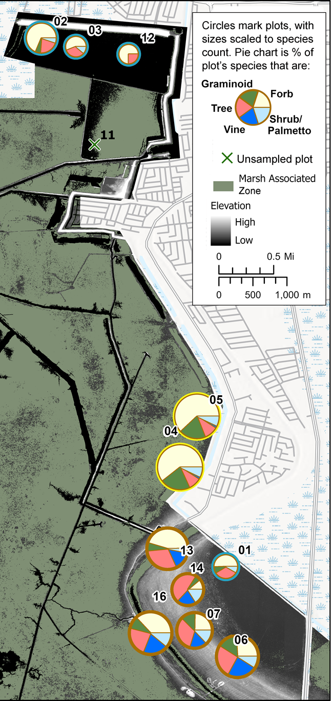
The 12 plots at Barataria Preserve fell into three broad vegetation classes: bottomland deciduous forest, bald cypress swamp, and sparse cypress with flotant (Figure 1).

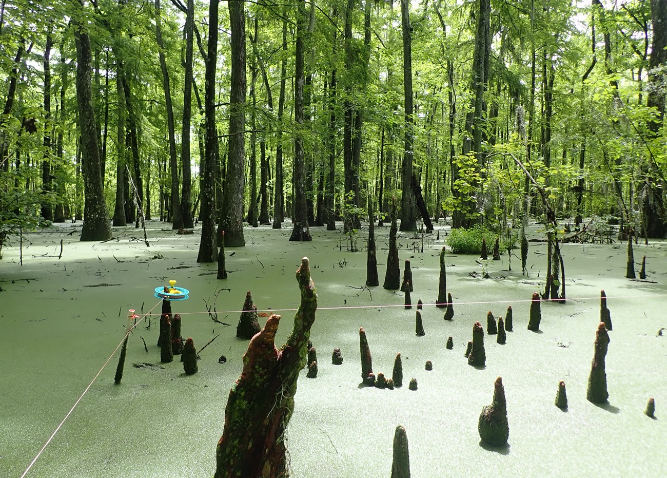
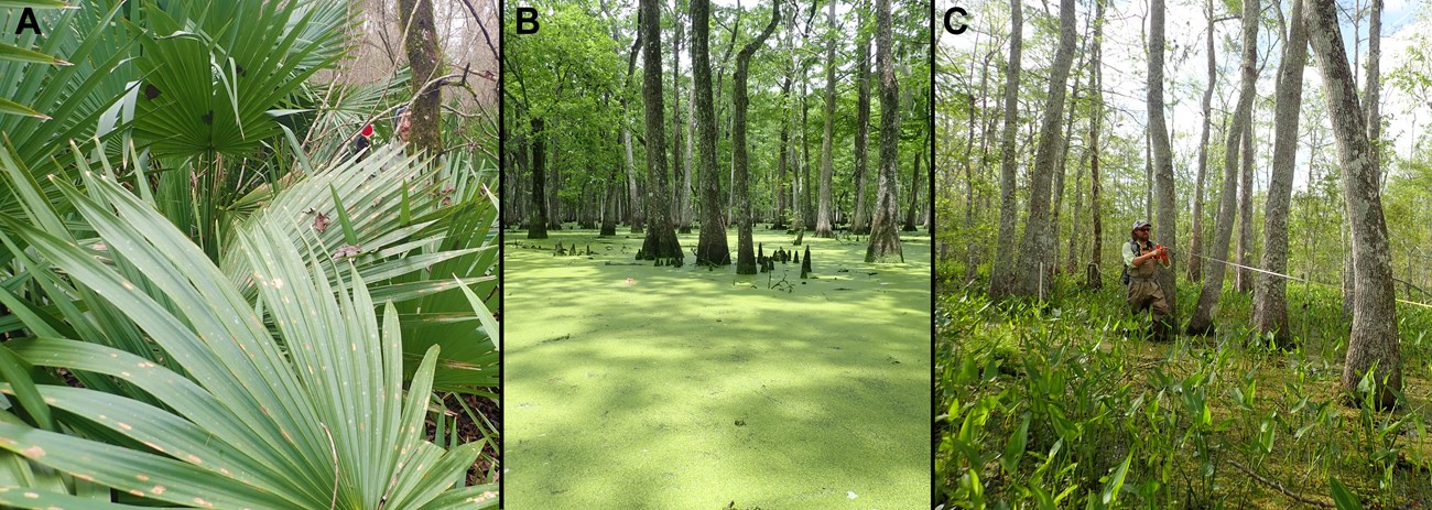
Bottomland deciduous forest was represented by five plots, which spanned a wide range of flood frequencies and associated plants (Table 1). Four of the bottomland plots were in or near the live oak levee forest zone (plot elevations 0.8-1.1 m a.s.l.), flooding infrequently or seasonally. Yet one of these four overlapped a pond, introducing several aquatic plant species. The fifth bottomland plot was lower still, at 0.5 m a.s.l., and it also had aquatic plants. All five had dense stands of 2+ m tall dwarf palmetto (Sabal minor) with relatively low tree densities. Even so, our 5-plot sample of bottomland forest was fairly rich in species (Table 1, Figure 2), collectively containing 46 herb/vine species, 17 tree species and 5 shrub/palmetto species across five plots. Tree condition in this class was relatively poor, with 27% of trees showing structural or foliage damage. Further, three of five plots had no saplings in microplots, suggesting future regeneration shortfalls. The bald cypress swamp class had four plots, which were all fairly similar in their species composition, permanent inundation (water depth 0.5-1.0 m), and nearby levees that impeded the natural flood regime. Species richness was low, with understories composed mainly of floating duckweeds (Lemna spp.) and sparser invasive floating aquatics. There were only 17 herb/vine, 5 tree and 2 shrub/palmetto species in total. Tree density was relatively high, and 15% of trees showed damage. All swamp plots showed a regeneration deficit, in that seedlings and saplings were absent from microplots.The third class, sparse cypress with flotant marsh, was represented by three plots that were a blend of the targeted cypress-tupelo-maple floodplain forest and the cypress marsh woodlands that grade into the park’s abundant marshes. Plots in this class had permanent inundation, variable tree densities and a rich herbaceous flotant layer (45 herb/vine, 4 tree and 4 shrub/palmetto species). Only two of the sparse cypress plots were sampled in 2021 and both had relatively undamaged trees and numerous seedlings and saplings.
Table 1. Plots sampled in 2021, including species counts for natives, non-natives and by growth form, as well as dominant trees and stem densities.
|
Site ID |
Major Vegetation Class |
Native Species |
Non-native Species |
Tree Species |
Herb and Vine Species |
Common Trees |
Total Live Tree Stems |
|
BP06 |
Bottomland Deciduous Forest |
30 |
4 |
9 |
14 |
Liquidambar styraciflua, Quercus nigra, Ulmus americana |
10 |
|
BP07 |
Bottomland Deciduous Forest |
24 |
0 |
8 |
9 |
Ulmus americana, Acer rubrum, Celtis laevigata |
9 |
|
BP13 |
Bottomland Deciduous Forest |
31 |
2 |
10 |
17 |
Ulmus americana, Fraxinus profunda, Acer rubrum |
18 |
|
BP14 |
Bottomland Deciduous Forest |
18 |
1 |
10 |
3 |
Acer rubrum, Celtis laevigata, Liquidambar styraciflua |
13 |
|
BP16 |
Bottomland Deciduous Forest |
35 |
3 |
11 |
16 |
Liquidambar styraciflua, Celtis laevigata, Quercus nigra |
9 |
|
BP01 |
Bald Cypress Swamp |
12 |
0 |
4 |
7 |
Nyssa aquatica, Taxodium distichum |
17 |
|
BP02 |
Bald Cypress Swamp |
14 |
5 |
4 |
14 |
Nyssa aquatica, Taxodium distichum |
30 |
|
BP03 |
Bald Cypress Swamp |
8 |
1 |
3 |
5 |
Nyssa aquatica, Taxodium distichum |
31 |
|
BP12 |
Bald Cypress Swamp |
7 |
1 |
2 |
6 |
Nyssa aquatica, Taxodium distichum |
35 |
|
BP04 |
Sparse Cypress with Flotant Marsh |
39 |
4 |
4 |
35 |
Taxodium distichum, Nyssa aquatica, Acer rubrum |
16 |
|
BP05 |
Sparse Cypress with Flotant Marsh |
38 |
4 |
4 |
34 |
Taxodium distichum, Nyssa aquatica, Acer rubrum |
36 |
|
BP11 |
Sparse Cypress with Flotant Marsh |
- |
- |
- |
- |
- |
- |

A total of 112 species were recorded across the 11 sampled plots, with only one species present in all plots: Spanish moss (Tilliandsia usneoides). The next most common species (6 -10 plots) were red maple, Chinese tallow (Triadica sebifera), duckweeds, water tupelo (Nyssa aquatica), bald cypress (Taxodium distichum), dwarf palmetto and pennywort (Hydrocotyle verticillata). Other than Chinese tallow,important invasives were common salvinia (Salvinia minima), alligator weed (Alternanthera philoxeroides) and water hyacinth (Eichhornia crassipes). Out of all species recorded, only 10 (9%) were non-native.
Additional Materials
For each round of sampling in a park, the network prepares two documents: this brief and a more lengthy report. The 2021 Trip Report document includes (1) USNVC map interpretation; (2) species list and richness summaries by plot and vegetation class; (3) figures of percent cover and relative frequency for common understory species; (4) tree and regeneration metrics by plot and vegetation class; (5) supporting information about park status and condition, including land use history, soils, and other vegetation-related projects on the park.
For more information on park plants and this project, visit:
- Vegetation project repository, linking to all online materials: https://irma.nps.gov/DataStore/Reference/Profile/2247864
- The park’s 2017 Vegetation Mapping Project by Hop et al.: https://irma.nps.gov/DataStore/Reference/Profile/2244440
