Part of a series of articles titled Park Paleontology News - Vol. 16, No. 1, Spring 2024.
Article
Fostering Paleontological Stewardship Through Geologic Mapping in Florissant Fossil Beds National Monument

Article by Paityn Schlosser and Ashley Martinovich
Florissant Fossil Beds National Monument
for Park Paleontology Newsletter, Spring 2024
NPS photo.
Introduction
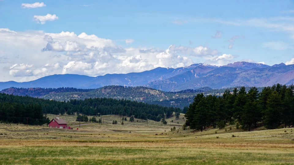
Sheltered within one of the many basins of Colorado’s Front Range, Florissant Fossil Beds National Monument (FLFO) stands as a testament to the on-going exploration and research fostered by the National Park Service. In the 19th century, early scientific surveys and pioneers of the American West explored Florissant’s untamed frontier and fossil-rich hills. As word spread about Florissant’s paleontological wonders, tourism flourished, drawing both scientists and visitors alike to observe the petrified redwood stumps and preserved plant and insect impressions. In the early 20th century, following the development of private tourist attractions and the establishment of the Midland Railway station, Florissant captivated thousands of visitors who would help themselves to hunks of petrified stumps and personally excavate the hills (National Park Service, 2024). The irreplaceable natural resources nestled in the Florissant valley were protected when Florissant Fossil Beds National Monument was established on August 20,1969, following decades of advocacy.
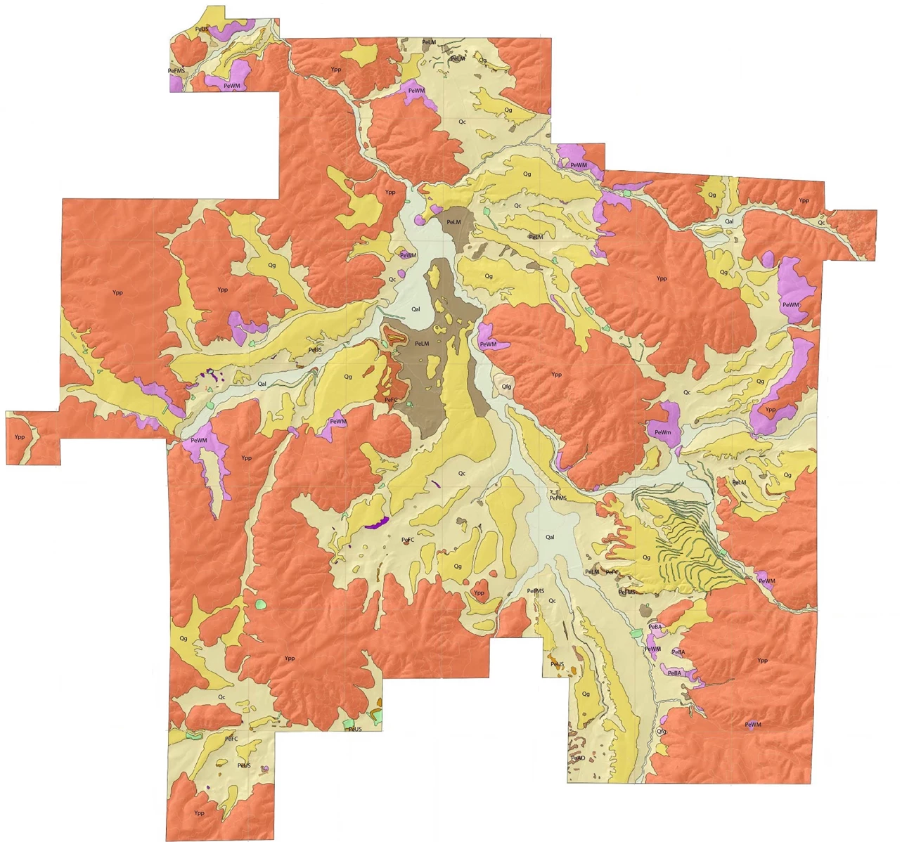
As part of the effort to continue preserving and protecting FLFO’s resources, a series of geospatial information system (GIS) internships were established in partnership with Southern Utah University’s Intergovernmental Internship Cooperative in 2022. The goal of the internship program was to enhance the monument’s geologic map through efficient and accurate geospatial data collection, thus improving the stewardship of sensitive paleontological resources. This is where the most recent mapping endeavors of Adeline Rich, Paityn Schlosser, and Ashley Martinovich began.
NPS photo.
History of Geologic Mapping in Florissant Fossil Beds National Monument
To understand the significance of recent mapping efforts in Florissant, we must also acknowledge previous geologic mapping history in the area which began as early as 1877.
The first descriptive study of Florissant’s geology and paleo Lake Florissant’s paleogeographic setting was conducted in 1877, by Arthur Lakes and Samuel H. Scudder (Meyer, 2008). Following the production of Lakes’s watercolor map, entitled “Map of Sedimentary Lacustrine Basin at Florissant near South Park, supposed to be Upper Miocene”, Florissant became noted for its fossil-bearing lake beds. The region was then studied by Whitman Cross and displayed in the Pikes Peak geological folio (Cross, 1894).
A century later, the Florissant region experienced a resurgence of geologic investigations. Offering a novel perspective to the region’s geology and paleontology, Reinhard Wobus and Rudy Epis authored a geologic map of the Florissant 15-Minute Quadrangle (USGS Map I-1044) in 1978. Later, Ralph Root explored FLFO in 1982 and differentiated the Florissant Formation into several informal subgroups, providing a clearer depositional history.
The most recent geologic survey of Florissant before the work described in this article was conducted in 1992, under the direction of Dr. Emmett Evanoff and a cohort of vertebrate paleontologists from the University of Colorado Boulder. Evanoff formulated new stratigraphic interpretations of the region and described five informal units of the Florissant Formation found within the monument (Evanoff, 2001). While the map produced significantly improved the spatial understanding of Florissant’s geology, technical advancements within the last three decades have revolutionized geospatial data collection. To support FLFO’s paleontological and geological research, it is imperative that the spatial accuracy of geologic units and contacts are verified and updated using new technology.
NPS photo.
GIS Geologic Mapping Internship Experience
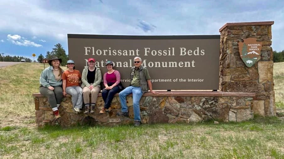
The GIS Geologic Mapping internship position, a collaboration of the National Park Service and Southern Utah University’s Intergovernmental Internship Cooperative, aimed to support the monument’s scientific research goals while offering hands-on experience for early career professionals. Mapping the fossil beds offered more than a chance to apply skills garnered through academia; it offered networking opportunities and mentorship, and prepared the recent graduates for successful careers in the geosciences. At the monument, Dr. Herbert Meyer, park paleontologist, acted as a mentor for Addie, Paityn, and Ashley, as well as 71 other interns during his 29-year service before retiring in 2023.
In May 2022, Adeline Rich began the monumental task of mapping. Over the course of several months, Rich independently mapped the geology exposed in the central portion of the park. As she tackled the central section of the monument on her own, she improved the accuracy of geospatial contacts by approximately 500 feet (150 meters).
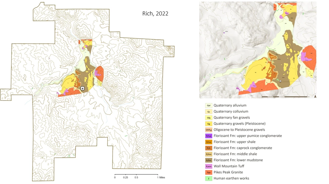
When the second term of the internship began in May of 2023, Ashley and Paityn began where Rich’s work ended. In April, Dr. Meyer was set for retirement; instead, he postponed his retirement and provided mentorship to Paityn and Ashley. To establish familiarity with the geologic units, they were joined by Tim Connors, a geologist with the National Park Service Intermountain Region, and visited sections of stratigraphy and outcrops not often observed by visitors. With each stump, hill, and outcrop, Dr. Meyer always had an anecdote which enriched the interns’ connection to the monument.
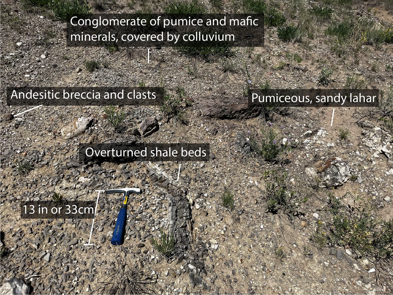
Despite the monument’s rich history of geologic mapping, queries remained. Dr. Meyer introduced the duo to the southern portion of the monument, where dark andesitic mounds eroded from the hillside, littered with overturned shale beds and clasts of pumice. This area was mapped by Evanoff in 1992 as the upper pumice conglomerate and upper shale beds. When faced with the dilemma of developing a new unit or expanding the description of existing units to include these hills, the trio turned to Dr. Evanoff. In June, Evanoff joined in the discourse about what implications a new lithologic unit may have on the understanding of Florissant’s geologic history. The andesitic flows, breccias, and inclusions were mapped and tentatively termed the “andesitic diamictite”.
NPS photo.
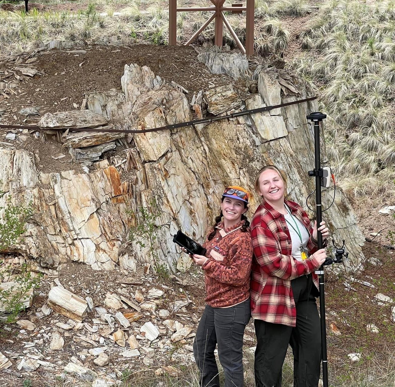
As the summer progressed, Paityn and Ashley began to venture into areas of the monument seldom visited, including the unmapped parcel of 280 acres to the west, which was added to the monument in 2019. Often the first employees on site in the early morning hours, the duo would don their hiking gear, equipped with a GNSS receiver and mobile GIS software, and headed into the hills. A typical day consisted of driving to pull-offs or trailheads to start their trek. Schlosser, utilizing her geologic mapping skills, would identify stratigraphy and contacts, and determine where the contact should be mapped. Martinovich, the GIS expert of the pair, would assign appropriate metadata to the collected geospatial information, and use satellites to track their location as they traversed. Hiking dozens of miles each week in the backcountry as they traced geologic contacts, they encountered wildlife, roaming livestock, and remnants of homesteads.
Facing ever-changing weather conditions and constant conductivity issues, there were doubts about the duo’s ability to complete the mapping project by September. However, like all scientists eager to contribute to the pursuit of knowledge, they persisted. Days of tracing contacts were rewarded with breaks under the pines, or a treat from the nearby mercantile. Paityn and Ashley reveled in every moment they spent in Florissant’s backcountry. Their internship was filled with ups and downs, both topographically and emotionally, but their appreciation of the hills, for their mentors, and for each other made it worth every step. In a short five months, the pair traveled down valleys and across peaks, mapping the entirety of the monument’s 6,272 acres.
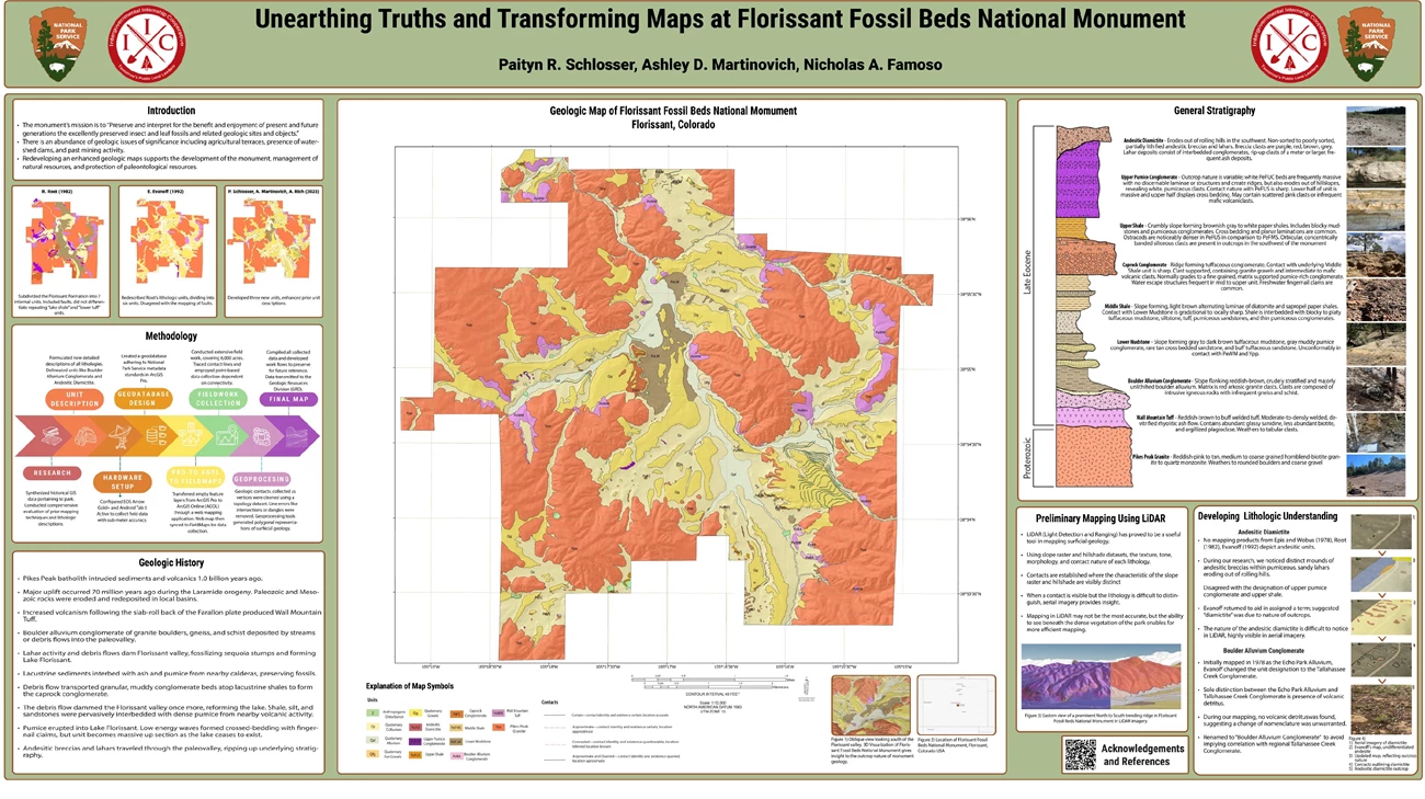
Following the end of their field season, Paityn and Ashley were given the opportunity to travel to Pittsburgh, Pennsylvania to present at the 2023 Geological Society of America (GSA) conference. Supported by the Friends of the Florissant Fossil Beds, a nonprofit dedicated to supporting FLFO, the mappers remotely collaborated on a poster titled “Unearthing Truths and Transforming Maps at Florissant Fossil Beds National Monument”. Their poster was the culmination of many months of hard work, and highlighted the progress of geologic mapping that has occurred for centuries. Without the support of the Friends of the Fossil Beds, attending the conference and elevating research in Florissant would not have been possible. The results of this mapping project reflect the nature of scientific collaboration and would not have been possible without the hard work of Dr. Emmett Evanoff, Adeline Rich, and all the geologists that came before them.
NPS image.
Acknowledgements
Paityn and Ashley would like to express gratitude to National Park Service Staff, including Penny Wagner, Dr. Herb Meyer, Dr. Nicholas Famoso, and Tim Connors, for their guidance, feedback, and support. Thanks to Hillary McLean for her guidance and friendship during the Summer 2023 internship and beyond. Acknowledgements are given to Dr. Emmett Evanoff for laying the foundation of modern geologic mapping in FLFO, and to Adeline Rich for her map contributions made in Summer 2022.
Sources
-
Cross, W., 1894, Pikes Peak Folio: Washington, D.C., U.S Government Printing Office, U.S Geological Survey Atlas
-
Evanoff, E., Gregory-Wodzicki, K.M. & Johnson, K.R. (eds.). Fossil flora and stratigraphy of the Florissant Formation, Colorado. October 1, 2001.
-
National Park Service. (2024, February 14). Park Archives: Florissant Fossil Beds National Monument. Npshistory.com.
-
Veatch, S. W., & Meyer, H. W. (2008). History of paleontology at the Florissant Fossil Beds, Colorado. Paleontology of the Upper Eocene Florissant Formation, Colorado.
Related Links
-
Florissant Fossil Beds National Monument (FLFO), Colorado—[FLFO Geodiversity Atlas] [FLFO Park Home] [FLFO npshistory.com]
Last updated: April 4, 2024

