Last updated: September 3, 2024
Article
Fletcher's Cove Cultural Landscape

Quinn Evans for NPS
Overview
Fletcher’s Cove is a distinctive destination and a testament to the layered history of human interaction with the Potomac River. It is located approximately 3.5 miles north of the canal terminus in Georgetown, Washington, DC and twelve miles below the Fall Line, a narrow zone defined by rapids and waterfalls that separates the Piedmont Plateau and Atlantic Coastal Plains.
The cultural landscape, now part of the Chesapeake and Ohio Canal National Historical Park, represents a period of significance extending from 1793 to 1966. This period begins with construction of the toll house, which was the first documented structure built in the Fletcher’s Cove area. Between 1826 and 1938, construction of the Chesapeake & Ohio Canal transformed the area, and a community developed that was centered on trade, milling, and transportation. The transfer of Fletcher’s Cove to federal stewardship in 1939 shifted its use to mainly recreational activities, with the intent of preserving significant historical resources like the Abner Cloud House, Fletcher’s Boathouse, and canal resources.

Quinn Evans for NPS
Landscape History
Indigenous History
Humans interacted with this landscape long before construction of the canal. Before 1600, Indigenous groups such as the Nacotchtanks, also known as Necostins or Anacostins (Algonquins), and the Accokeeks frequented the Fletcher’s Cove area, using the Maddox Branch for travel and resource gathering. Archeological evidence indicates early inhabitants hunted small fauna and fished along the Potomac River. The site saw use from the Early Archaic period (9500–7500 BCE) through the Late Woodland period (900–1650 CE), with artifacts suggesting activities such as food preparation and toolmaking.
European colonization in the 17th century brought disease, displacement, and cultural decimation, so there are few remaining physical traces of the rich Indigenous history of this landscape. Although the Nacotchtanks and Accokeeks do not survive as modern tribes, the Piscataway Conoy Tribe of southern Maryland and the Piscataway Indian Nation and Tayac Territory are among their living descendants. The Piscataways trace their history in the region as far back as ten thousand years ago as a confederacy, which extended between the western shore of the Chesapeake Bay to the Potomac River and included land in present-day Washington, DC and Maryland.
Settlement and Little Falls Skirting Canal
From 1600 to 1825, the Fletcher’s Cove area underwent significant transformations in land and water use. John Ballendine attempted to construct a canal near Little Falls in 1765 to facilitate navigation, with its lower terminus at present-day Fletcher’s Cove. While that project failed, George Washington founded the Potomac Company in 1785 which initiated the construction of the Little Falls Skirting Canal in the 1790s. This canal, crucial for bypassing the Potomac River’s rapids, featured wooden lift locks at Fletcher’s Cove. Most of the canal infrastructure here was built by between 60-100 enslaved persons, conscripted from nearby plantations.

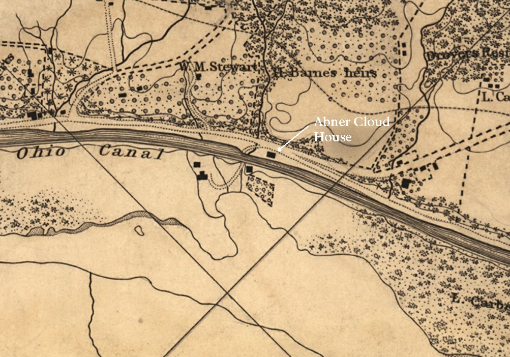
A. Boschke, “Topographical Map of the District of Columbia,” 1861. Library of Congress. Annotation added by NPS.
In 1812, the Potomac Company constructed new stone locks to replace the deteriorating wooden ones. They also relocated the canal terminus and enhanced navigation efficiency. The period saw the development of key structures like the Abner Cloud House, and Johns' Mill, which generated a small residential and commercial community around Fletcher’s Cove. Despite these advancements, the Potomac Company’s canal system struggled with sediment accumulation, necessitating frequent maintenance, and leading to its eventual bankruptcy by 1819.
A New Canal and an Evolving Landscape
Beginning in 1828, the Fletcher's Cove landscape was impacted by the construction and operation of the Chesapeake and Ohio Canal (C&O Canal). Initially conceived to enhance trade between Pennsylvania's Ohio River headwaters and the Chesapeake Bay, the C&O Canal replaced earlier canal systems with a continuous route along the Potomac River, stretching from Georgetown in DC, to Cumberland, Maryland. Completed by 1850, the canal's construction reshaped the landscape of Fletcher’s Cove. It led to repurposing the Little Falls Skirting Canal and to the establishment of adjacent mills like Edes’ Mill, which was later converted into an ice factory around 1882.
Census records and maps from the era show evidence of how the canal facilitated the growth of a working-class community along Canal Road. Fletcher’s Boathouse was founded in the 1880s and catered primarily to fishing enthusiasts, thereby bolstering recreational use along this part of the Potomac River.
The decline of commercial canal traffic by 1924 marked a shift in Fletcher’s Cove towards predominantly recreational and residential uses. The closure of the C&O Canal to commercial navigation following flood damage in 1924 accelerated this transition, prompting the federal government to acquire the canal in 1938 under the auspices of the National Park Service. This acquisition laid the foundation for its preservation and transformation into a recreational resource.
Joseph Fletcher’s family was key in establishing the boathouse business, passing it down from generation to generation from the 1880s until 1950. It played a pivotal role in shaping the area’s recreational identity. Fletcher’s Cove thus evolved from an industrial and transportation hub during the canal era to a focal point for boating and leisure activities, reflecting broader shifts in urban development and land use along the Potomac River corridor.

Thomas C. Vint, Outline Report of Architectural Work on the Restoration of the Chesapeake and Ohio Canal for Recreational Use (Georgetown, DC, to Seneca, MD). NPS
National Park Service and the Recreational Landscape
From 1939 to 1966, Fletcher’s Cove underwent significant changes under the stewardship of the NPS, transitioning from a mixed-use area to a predominantly recreational hub. During this period, the NPS aimed its efforts at preserving historic canal features and enhancing recreational amenities. By the 1950s, residential structures along Canal Road NW, including those in the vicinity of Fletcher’s Cove, were gradually removed amid concerns over public health and to clear space for recreational purposes. Fletcher’s Boathouse was established during this era, operated by Julius Fletcher after 1950 under an agreement with the NPS.By the early 1960s, Fletcher’s Cove had transformed into a dedicated recreational area. New infrastructure like a concrete-block refreshment stand and a redesigned boathouse replaced older structures, reflecting NPS efforts to enhance visitor amenities. Land use modifications included the filling of a sluiceway with fill from the Potomac Interceptor Sewer construction, as well as altering the isthmus between the cove and the canal.
Through these changes, Fletcher’s Cove solidified its role as a haven for fishing, boating, and other leisure activities. This development underscored the NPS’s commitment to balancing preservation of natural and historic resources with expanding recreational opportunities along the Potomac River corridor.
1966 to Today: Continuing Recreation and Preservation
Since 1967, Fletcher’s Cove has evolved under the stewardship of the NPS, focusing on recreation, sustainability, accessibility, and historic preservation. The canal was designated as the C&O Canal National Historical Park in 1971. By 1971, distinct functional zones were established within the recreational landscape around the boathouse, including grassy picnic islands and dedicated parking areas southeast of the boathouse/refreshment stand, marking a shift towards organized leisure activities.
Fletcher's Cove, 1960s-Today


Left image
Aerial photograph of project area, 1963
Credit: NPS
Right image
Google Aerial, 2023
Credit: Google Earth

Thomas Skadow
Existing Conditions
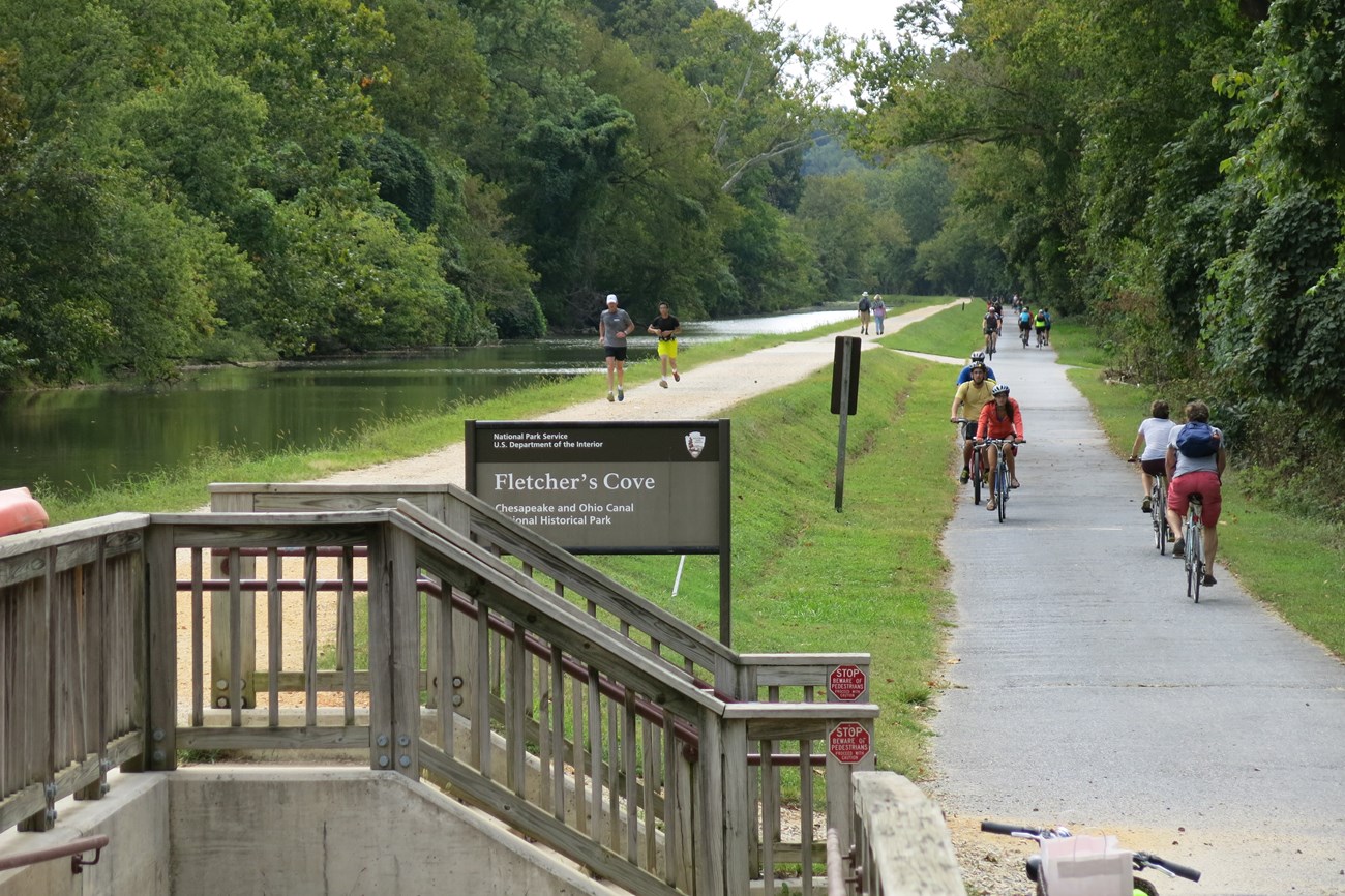
Today, Fletcher’s Cove offers multiple opportunities for recreational, educational, and interpretive uses. The arrival sequence from Canal Road down Fletcher’s Road and through the culvert comprises contracting and expanding views as visitors move down through the historic landscape and emerge at the shores of Fletcher’s Cove. Views from the pedestrian access point at the Capital Crescent Trail are also mostly uninterrupted and the parklike vegetation allows pedestrians to see their destination from that vantage point before descending and making their way toward the boathouse, cove, or picnic area.
Fletcher’s Cove provides a multitude of recreational activities like walking, biking, running, boating, fishing, and picnicking. The Towpath Trail and Capital Crescent Trail are popular routes for commuters, joggers, cyclists, and sightseers. The Fletcher’s Boathouse is open seasonally and rents kayaks, canoes, rowboats, stand-up paddle boards, and bicycles to its members and the public. While the modes of transportation have changed in some cases, transportation of goods remains an active use on site via Canal Road.
Recreational use of the site began in the late nineteenth and early twentieth centuries as the function of the landscape evolved. The forces that shaped its development - industrial, transportation, residential, agricultural, and fishing - were no longer central to its use. Evidence of these earlier periods is reflected in the landscape, including the history of recreational use that continues to the present.
Plan Your Visit
Fletcher's CoveQuick Facts
-
Cultural Landscape Type: Historic Vernacular Landscape
-
National Register Significance Level: National
-
National Register Significance Criteria:
-
A (National): in the areas of commerce, conservation, and transportation
-
C (National): in the area of engineering
-
D (Local): in the area of archeology
-
-
Period of Significance: 1793 - 1966


